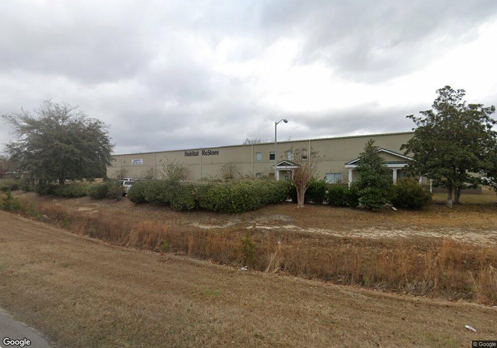
165 Co-Op Rd Myrtle Beach, SC 29588
--
Bed
--
Bath
24,462
Sq Ft
1.55
Acres
About This Home
This home is located at 165 Co-Op Rd, Myrtle Beach, SC 29588. 165 Co-Op Rd is a home located in Horry County with nearby schools including Socastee Elementary School, Forestbrook Middle School, and Socastee High School.
Ownership History
Date
Name
Owned For
Owner Type
Purchase Details
Closed on
Aug 3, 2021
Sold by
Harrison & Payne Llc
Bought by
Habitat For Humanity Of Horry County Inc
Home Financials for this Owner
Home Financials are based on the most recent Mortgage that was taken out on this home.
Original Mortgage
$1,593,750
Outstanding Balance
$1,449,212
Interest Rate
2.9%
Mortgage Type
New Conventional
Purchase Details
Closed on
Nov 8, 2016
Sold by
Habitat For Humanity
Bought by
Furlong Laura
Home Financials for this Owner
Home Financials are based on the most recent Mortgage that was taken out on this home.
Original Mortgage
$89,000
Interest Rate
3.54%
Create a Home Valuation Report for This Property
The Home Valuation Report is an in-depth analysis detailing your home's value as well as a comparison with similar homes in the area
Home Values in the Area
Average Home Value in this Area
Purchase History
| Date | Buyer | Sale Price | Title Company |
|---|---|---|---|
| Habitat For Humanity Of Horry County Inc | $1,875,000 | -- | |
| Furlong Laura | -- | -- |
Source: Public Records
Mortgage History
| Date | Status | Borrower | Loan Amount |
|---|---|---|---|
| Open | Habitat For Humanity Of Horry County Inc | $1,593,750 | |
| Previous Owner | Furlong Laura | $89,000 | |
| Previous Owner | Furlong Laura | -- |
Source: Public Records
Tax History Compared to Growth
Tax History
| Year | Tax Paid | Tax Assessment Tax Assessment Total Assessment is a certain percentage of the fair market value that is determined by local assessors to be the total taxable value of land and additions on the property. | Land | Improvement |
|---|---|---|---|---|
| 2024 | $525 | $151,381 | $36,460 | $114,921 |
| 2023 | $525 | $89,342 | $27,953 | $61,389 |
| 2021 | $25,231 | $116,150 | $28,358 | $87,792 |
| 2020 | $18,585 | $116,150 | $28,358 | $87,792 |
| 2019 | $18,585 | $116,150 | $28,358 | $87,792 |
| 2018 | $0 | $77,689 | $24,307 | $53,382 |
| 2017 | $16,780 | $77,689 | $24,307 | $53,382 |
| 2016 | -- | $77,689 | $24,307 | $53,382 |
| 2015 | $16,920 | $77,689 | $24,307 | $53,382 |
| 2014 | $16,361 | $77,689 | $24,307 | $53,382 |
Source: Public Records
Map
Nearby Homes
- 118 Sly Fox Trail
- 201 Delano Way
- 237 Delano Way
- 304 Silver Fox Trail
- 6357 Highway 707
- 5730 Highway 707 Unit Lot 32
- 5730 Highway 707 Unit 17
- 5730 Highway 707 Unit Lot 58
- 260 Fox Catcher Dr
- 223 Hampton Park Cir
- 279 Hampton Park Cir
- 104 Willow Ridge Rd
- 333 Ashwood Ln Unit MB
- 130 Ashton Cir
- 107 Willow Ridge Rd
- 5800 Creekside Dr
- 5865 Creekside Dr
- 449 Levanto Rd
- 2 Sioux Trail
- 71 Plantation Rd
- 165 Co op Rd
- Lot 1 707 Connector
- 4 Co-Op Rd
- 4 Co-Op Rd Unit Lot 4
- 126 Co op Rd
- 166 Co op Rd
- 125 Co-Op Rd
- 133 707 Connector
- TBD Co-Op Rd
- TBD Co-Op Rd Unit Connector Profession
- LOT 4 Co-Op Rd Unit Connector Business P
- LOT 4 Co-Op Rd Unit CONNECTOR PROFESSION
- LOT 4 Co-Op Rd
- 6151 Highway 707
- 6189, 6163,6175 S Carolina 707
- TBD 5.1 Acres Highway 544
- 6010 Highway 707 Unit Hwy 707 Connector
- 6010 Highway 707
- 6189 Highway 707
- 6189 Highway 707 Unit Signalized intersect