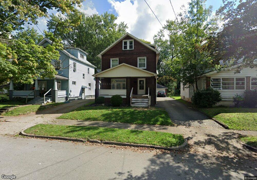
165 Courtland Ave Campbell, OH 44405
Estimated Value: $78,000 - $94,000
3
Beds
1
Bath
1,472
Sq Ft
$57/Sq Ft
Est. Value
About This Home
This home is located at 165 Courtland Ave, Campbell, OH 44405 and is currently estimated at $84,560, approximately $57 per square foot. 165 Courtland Ave is a home located in Mahoning County with nearby schools including Campbell Elementary School, Memorial High School, and Northeast Ohio Impact Academy.
Ownership History
Date
Name
Owned For
Owner Type
Purchase Details
Closed on
Jul 18, 2006
Sold by
Filo Leslie A
Bought by
Gonzalez Andino Alfredo and Melendez Carmen Y
Current Estimated Value
Home Financials for this Owner
Home Financials are based on the most recent Mortgage that was taken out on this home.
Original Mortgage
$40,000
Outstanding Balance
$23,969
Interest Rate
6.82%
Mortgage Type
Purchase Money Mortgage
Estimated Equity
$60,591
Purchase Details
Closed on
Dec 6, 1989
Bought by
Kempers Eugene and Kempers Jean C
Create a Home Valuation Report for This Property
The Home Valuation Report is an in-depth analysis detailing your home's value as well as a comparison with similar homes in the area
Home Values in the Area
Average Home Value in this Area
Purchase History
| Date | Buyer | Sale Price | Title Company |
|---|---|---|---|
| Gonzalez Andino Alfredo | $50,000 | None Available | |
| Kempers Eugene | $15,000 | -- |
Source: Public Records
Mortgage History
| Date | Status | Borrower | Loan Amount |
|---|---|---|---|
| Open | Gonzalez Andino Alfredo | $40,000 |
Source: Public Records
Tax History Compared to Growth
Tax History
| Year | Tax Paid | Tax Assessment Tax Assessment Total Assessment is a certain percentage of the fair market value that is determined by local assessors to be the total taxable value of land and additions on the property. | Land | Improvement |
|---|---|---|---|---|
| 2024 | $781 | $14,520 | $1,100 | $13,420 |
| 2023 | $771 | $14,520 | $1,100 | $13,420 |
| 2022 | $644 | $10,140 | $1,000 | $9,140 |
| 2021 | $604 | $10,140 | $1,000 | $9,140 |
| 2020 | $614 | $10,140 | $1,000 | $9,140 |
| 2019 | $651 | $9,560 | $940 | $8,620 |
| 2018 | $667 | $9,560 | $940 | $8,620 |
| 2017 | $664 | $9,560 | $940 | $8,620 |
| 2016 | $827 | $12,640 | $1,100 | $11,540 |
| 2015 | $811 | $12,640 | $1,100 | $11,540 |
| 2014 | $808 | $12,640 | $1,100 | $11,540 |
| 2013 | $793 | $12,640 | $1,100 | $11,540 |
Source: Public Records
Map
Nearby Homes
- 494 Camden Ave
- 200 Hamrock Dr
- 0 Mccartney Rd Unit 5030673
- 71 Fairview St
- 250 Harold Ln
- 38 Palmer Ave
- 369 6th St
- 430 Mccartney Rd
- 296 Sanderson Ave
- 338 Blossom Ave
- 565 12th St
- 533 12th St
- 371 S Jackson St
- 301 Park Dr
- 325 S Jackson St
- 311 Park Dr
- 331 Sanderson Ave
- 321 Park Dr
- 217 S Jackson St
- 461 Park Dr
- 169 Courtland Ave
- 161 Courtland Ave
- 157 Courtland Ave
- 153 Courtland Ave
- 150 Fairdale Ave
- 144 Fairdale Ave
- 147 Courtland Ave
- 152 Fairdale Ave
- 137 Gladstone St
- 140 Fairdale Ave
- 147 Gladstone St
- 145 Courtland Ave
- 151 Gladstone St
- 168 Courtland Ave
- 158 Courtland Ave
- 136 Fairdale Ave
- 123 Gladstone St
- 155 Gladstone St
- 141 Courtland Ave
- 154 Courtland Ave