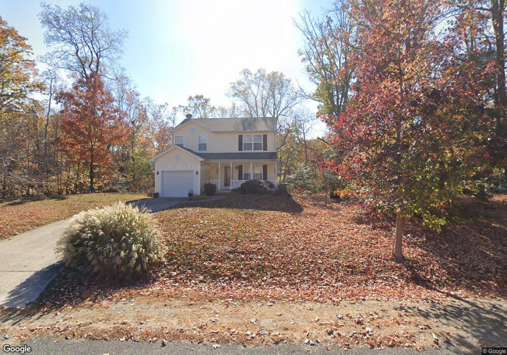
165 Federalist Way Montross, VA 22520
Estimated Value: $285,000 - $313,000
3
Beds
3
Baths
1,620
Sq Ft
$184/Sq Ft
Est. Value
About This Home
This home is located at 165 Federalist Way, Montross, VA 22520 and is currently estimated at $298,310, approximately $184 per square foot. 165 Federalist Way is a home located in Westmoreland County with nearby schools including Montross Middle School and Westmoreland High School.
Ownership History
Date
Name
Owned For
Owner Type
Purchase Details
Closed on
Oct 16, 2009
Sold by
Us Bank Na
Bought by
Delling Hart Terri R
Current Estimated Value
Home Financials for this Owner
Home Financials are based on the most recent Mortgage that was taken out on this home.
Original Mortgage
$81,480
Outstanding Balance
$53,368
Interest Rate
5.14%
Mortgage Type
New Conventional
Estimated Equity
$244,942
Purchase Details
Closed on
Jan 5, 2009
Sold by
Samuel I White P C and Harley Yolanda D
Bought by
Lasalle Bank National Assoc
Create a Home Valuation Report for This Property
The Home Valuation Report is an in-depth analysis detailing your home's value as well as a comparison with similar homes in the area
Home Values in the Area
Average Home Value in this Area
Purchase History
| Date | Buyer | Sale Price | Title Company |
|---|---|---|---|
| Delling Hart Terri R | $101,850 | -- | |
| Lasalle Bank National Assoc | $182,750 | -- |
Source: Public Records
Mortgage History
| Date | Status | Borrower | Loan Amount |
|---|---|---|---|
| Open | Lasalle Bank National Assoc | $81,480 |
Source: Public Records
Tax History Compared to Growth
Tax History
| Year | Tax Paid | Tax Assessment Tax Assessment Total Assessment is a certain percentage of the fair market value that is determined by local assessors to be the total taxable value of land and additions on the property. | Land | Improvement |
|---|---|---|---|---|
| 2024 | $1,678 | $246,700 | $26,800 | $219,900 |
| 2023 | $1,530 | $246,700 | $26,800 | $219,900 |
| 2022 | $1,530 | $246,700 | $26,800 | $219,900 |
| 2021 | $1,554 | $204,500 | $26,800 | $177,700 |
| 2020 | $1,554 | $204,500 | $26,800 | $177,700 |
| 2019 | $1,329 | $204,500 | $26,800 | $177,700 |
| 2018 | $1,247 | $204,500 | $26,800 | $177,700 |
| 2017 | -- | $204,500 | $26,800 | $177,700 |
| 2016 | $1,227 | $204,500 | $26,800 | $177,700 |
| 2015 | -- | $210,100 | $26,800 | $183,300 |
| 2014 | -- | $0 | $0 | $0 |
| 2013 | -- | $210,100 | $26,800 | $183,300 |
Source: Public Records
Map
Nearby Homes
- Lot 70 Federalist Way
- 59 Federalist Way
- 58 Federalist Way
- 114 Dragoon Dr
- 0 W Lee Way Unit VAWE2008908
- LOT 41 Traveller Cir
- Lot 68 Traveller Cir
- lot 38 and 39 Cavalry Dr
- LOT # 34 Cavalry Dr
- 299 Traveller Cir
- 49 Avian Ct
- 88 Carter Way
- 32 General Lee Ct
- LOT #43 S Independence Dr
- 253 Shirley Ln
- LOT #28 Queens Way
- Lot 23 Queens Way
- LOT #75 Kidd Ct
- Lot 27 Queens Way
- LOT 38 and 39 Grove Dr
- Lot 64 Federalist Way
- 107 Federalist Way
- 75 Federalist Way
- 89 Federalist Way
- LOT 60-62 Federalist Way
- LOT 65 Federalist Way
- LOT #65 Federalist Way
- LOT #60, 61 AND 62 Federalist Way
- 205 Federalist Way
- 148 Federalist Way
- Lot 37 Calvary Dr
- 176 Federalist Way
- Lot #38 Cavalry Dr
- 39 Cavalry Dr
- 186 Dragoon Dr
- Lot #39 Cavalry Dr
- 209 Federalist Way
- 193 Federalist Way
- 18 Matilda Ln
- 68 Matilda Ln