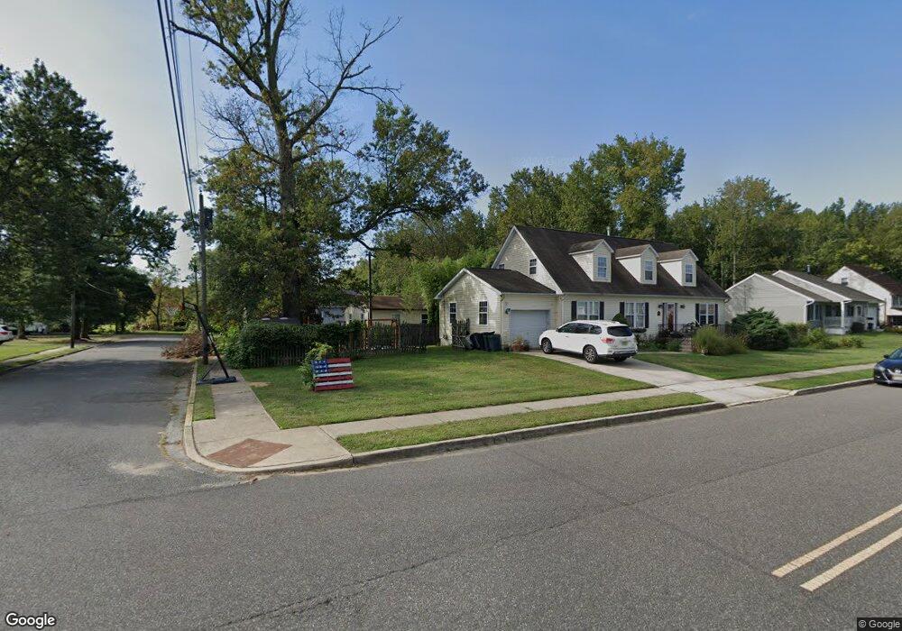
165 Forrest St Gibbstown, NJ 08027
Greenwich Township NeighborhoodEstimated Value: $271,000 - $298,000
--
Bed
--
Bath
1,383
Sq Ft
$206/Sq Ft
Est. Value
About This Home
This home is located at 165 Forrest St, Gibbstown, NJ 08027 and is currently estimated at $284,350, approximately $205 per square foot. 165 Forrest St is a home located in Gloucester County with nearby schools including Nehaunsey Middle School and Guardian Angels Regional School.
Ownership History
Date
Name
Owned For
Owner Type
Purchase Details
Closed on
May 12, 2022
Sold by
Lambert Michael S and Lambert Lisa A
Bought by
Digiambattista Thomas
Current Estimated Value
Purchase Details
Closed on
Jan 11, 2021
Sold by
Lambert Michael S and Lambert Lisa A
Bought by
Lambert Michael S and Lambert Lisa A
Home Financials for this Owner
Home Financials are based on the most recent Mortgage that was taken out on this home.
Original Mortgage
$105,800
Interest Rate
2.71%
Mortgage Type
New Conventional
Purchase Details
Closed on
Apr 22, 2002
Sold by
Guadagno Vendla R
Bought by
Lambert Michael S
Home Financials for this Owner
Home Financials are based on the most recent Mortgage that was taken out on this home.
Original Mortgage
$96,300
Interest Rate
6.79%
Mortgage Type
Purchase Money Mortgage
Purchase Details
Closed on
Sep 19, 2000
Sold by
Chase Manhattan Bank
Bought by
Lambert Michael S and Guadagno Vendla R
Home Financials for this Owner
Home Financials are based on the most recent Mortgage that was taken out on this home.
Original Mortgage
$94,350
Interest Rate
8%
Mortgage Type
FHA
Purchase Details
Closed on
Sep 24, 1999
Sold by
Banscher Howard and Banscher Howard A
Bought by
Chase Manhattan Bank and Chemical Bank
Purchase Details
Closed on
Jan 14, 1991
Sold by
Byrd Mildred
Bought by
Banscher Howard A
Create a Home Valuation Report for This Property
The Home Valuation Report is an in-depth analysis detailing your home's value as well as a comparison with similar homes in the area
Home Values in the Area
Average Home Value in this Area
Purchase History
| Date | Buyer | Sale Price | Title Company |
|---|---|---|---|
| Digiambattista Thomas | $194,000 | None Listed On Document | |
| Lambert Michael S | -- | Advantage Title | |
| Lambert Michael S | -- | -- | |
| Lambert Michael S | $75,000 | Surety Title Corporation | |
| Chase Manhattan Bank | -- | -- | |
| Banscher Howard A | $4,000 | -- | |
| Banscher Howard A | $4,000 | -- | |
| Banscher Howard | $4,000 | -- | |
| Banscher Howard A | $4,000 | -- |
Source: Public Records
Mortgage History
| Date | Status | Borrower | Loan Amount |
|---|---|---|---|
| Previous Owner | Lambert Michael S | $105,800 | |
| Previous Owner | Lambert Michael S | $96,300 | |
| Previous Owner | Lambert Michael S | $94,350 |
Source: Public Records
Tax History Compared to Growth
Tax History
| Year | Tax Paid | Tax Assessment Tax Assessment Total Assessment is a certain percentage of the fair market value that is determined by local assessors to be the total taxable value of land and additions on the property. | Land | Improvement |
|---|---|---|---|---|
| 2025 | $5,192 | $150,800 | $40,200 | $110,600 |
| 2024 | $4,919 | $150,800 | $40,200 | $110,600 |
| 2023 | $4,919 | $150,800 | $40,200 | $110,600 |
| 2022 | $4,922 | $150,800 | $40,200 | $110,600 |
| 2021 | $4,871 | $150,800 | $40,200 | $110,600 |
| 2020 | $4,939 | $150,800 | $40,200 | $110,600 |
| 2019 | $4,942 | $150,800 | $40,200 | $110,600 |
| 2018 | $4,801 | $150,800 | $40,200 | $110,600 |
| 2017 | $4,685 | $150,800 | $40,200 | $110,600 |
| 2016 | $4,634 | $150,800 | $40,200 | $110,600 |
| 2015 | $4,485 | $150,800 | $40,200 | $110,600 |
| 2014 | $4,292 | $148,600 | $40,200 | $108,400 |
Source: Public Records
Map
Nearby Homes
- 268 Memorial Ave
- 157 S Poplar St
- W Broad St
- 433 Jefferson St
- 431 Washington St
- 132 Tomlin Station Rd
- 0 S Democrat Rd Unit NJGL2065008
- 752 Duncan Ave
- 456 Freund Ave
- 0 Swedesboro Ave Unit NJGL2061592
- 330 Croce Ave
- 219 Vanneman Blvd
- 43 45 Repaupo Station Rd
- 0 Rd Unit NJGL2061600
- 344 W Washington St
- 335 W Buck St
- 126 Repaupo Station Rd
- 792 Paulsboro Rd
- L18 20 W Broad St
- 255 Elizabeth Ave
- 157 Forrest St
- 264 Memorial Ave
- 172 Forrest St
- 160 Forrest St
- 252 Memorial Ave
- 276 Memorial Ave
- 265 Memorial Ave
- 275 Memorial Ave
- 251 Memorial Ave
- 281 Memorial Ave
- 224 Memorial Ave
- 284 Memorial Ave
- 130 Forrest St
- 128 Adalisa Ave
- 225 Memorial Ave
- 301 Memorial Ave
- 120 Forrest St
- 117 Forrest St
- 109 S Orchard St
- 84 Adalisa Ave