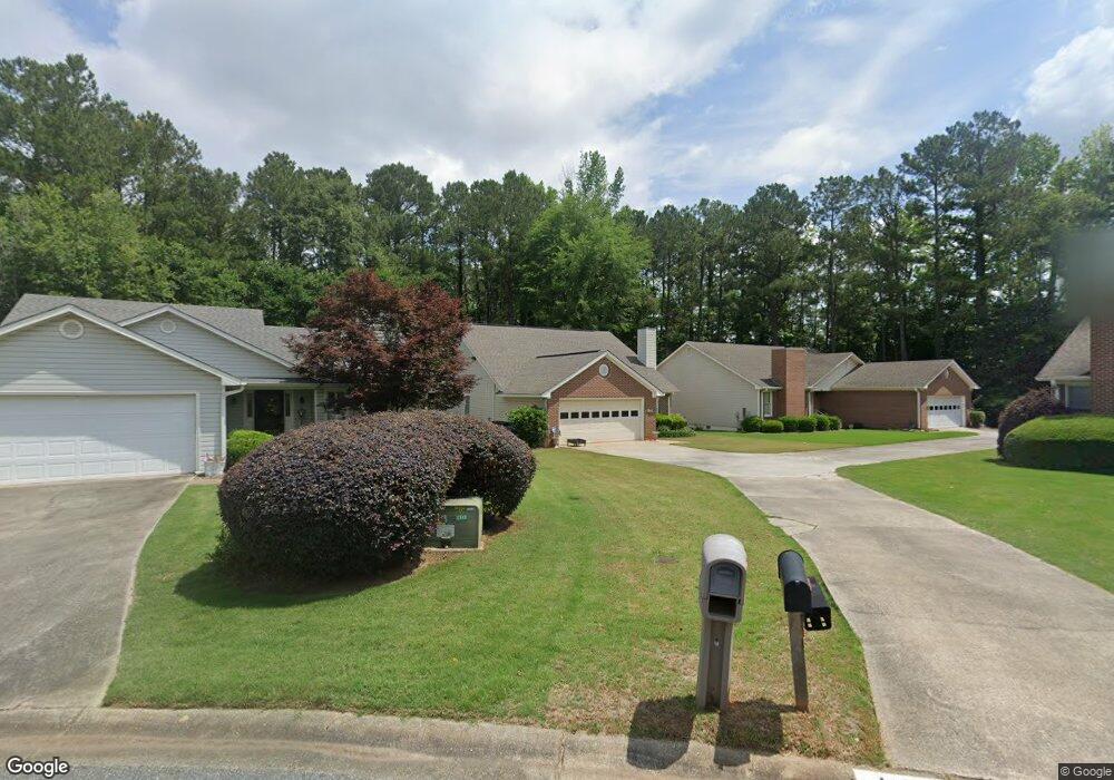
165 Foxford Ct Macon, GA 31210
Estimated Value: $180,877 - $209,000
3
Beds
3
Baths
1,667
Sq Ft
$116/Sq Ft
Est. Value
About This Home
This home is located at 165 Foxford Ct, Macon, GA 31210 and is currently estimated at $192,969, approximately $115 per square foot. 165 Foxford Ct is a home located in Bibb County with nearby schools including Springdale Elementary School, Howard Middle School, and Howard High School.
Ownership History
Date
Name
Owned For
Owner Type
Purchase Details
Closed on
Aug 27, 2020
Sold by
Barron Jim E
Bought by
Francis Robert G and Francis Valerie R
Current Estimated Value
Home Financials for this Owner
Home Financials are based on the most recent Mortgage that was taken out on this home.
Original Mortgage
$87,000
Outstanding Balance
$69,104
Interest Rate
2.9%
Mortgage Type
New Conventional
Estimated Equity
$123,865
Purchase Details
Closed on
Mar 14, 1990
Sold by
Pioneer Dev Corp Pt 1516/349
Bought by
Barron Jim E
Create a Home Valuation Report for This Property
The Home Valuation Report is an in-depth analysis detailing your home's value as well as a comparison with similar homes in the area
Purchase History
| Date | Buyer | Sale Price | Title Company |
|---|---|---|---|
| Francis Robert G | $129,000 | None Available | |
| Barron Jim E | $85,600 | -- |
Source: Public Records
Mortgage History
| Date | Status | Borrower | Loan Amount |
|---|---|---|---|
| Open | Francis Robert G | $87,000 |
Source: Public Records
Tax History
| Year | Tax Paid | Tax Assessment Tax Assessment Total Assessment is a certain percentage of the fair market value that is determined by local assessors to be the total taxable value of land and additions on the property. | Land | Improvement |
|---|---|---|---|---|
| 2025 | $1,213 | $56,376 | $8,000 | $48,376 |
| 2024 | $1,254 | $56,376 | $8,000 | $48,376 |
| 2023 | $797 | $56,376 | $8,000 | $48,376 |
| 2022 | $1,879 | $61,281 | $6,600 | $54,681 |
| 2021 | $1,695 | $51,600 | $6,240 | $45,360 |
| 2020 | $1,236 | $45,687 | $6,000 | $39,687 |
| 2019 | $1,059 | $40,925 | $6,000 | $34,925 |
| 2018 | $1,610 | $37,750 | $6,000 | $31,750 |
| 2017 | $1,054 | $42,313 | $8,000 | $34,313 |
| 2016 | $1,127 | $47,032 | $9,600 | $37,432 |
| 2015 | $1,600 | $47,032 | $9,600 | $37,432 |
| 2014 | $1,600 | $47,032 | $9,600 | $37,432 |
Source: Public Records
Map
Nearby Homes
- 108 Hillbrooke Ct
- 123 Saddle Run Ct
- 5341 Northside Dr
- 204 Carriage Way
- 1297 Wesleyan Dr
- 5369 Rivoli Dr
- 1643 Wesleyan Hills Dr
- 181 Rivoli Landing
- 807 Wera Place
- 175 Rivoli Landing
- 1064 Brookford Rd
- 137 Senora Place
- 5158 Bowman Rd
- 100 Palmer Dr
- 567 Billingswood Dr
- 5104 Pine Ridge Dr
- 169 Brookefield Dr
- 135 Chadwick Dr
- 643 Millrun Ct
- 405 Amberly Ct
- 167 Foxford Ct
- 163 Foxford Ct
- 161 Foxford Ct
- 166 Foxford Ct
- 164 Foxford Ct
- 159 Foxford Ct
- 142 Springfield Blvd
- 162 Foxford Ct
- 138 Springfield Blvd
- 148 Springfield Blvd
- 153 Wakefield Dr
- 157 Foxford Ct
- 155 Foxford Ct
- 160 Foxford Ct
- 156 Wakefield Dr
- 134 Springfield Blvd
- 152 Springfield Blvd
- 154 Wakefield Dr
- 149 Wakefield Dr
- 152 Wakefield Dr
Your Personal Tour Guide
Ask me questions while you tour the home.