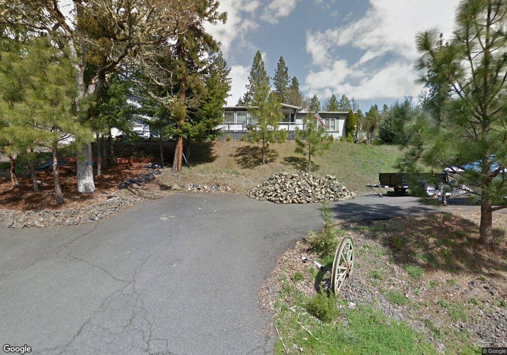
165 Jane Dr Shady Cove, OR 97539
Estimated Value: $792,000 - $879,000
3
Beds
4
Baths
3,603
Sq Ft
$235/Sq Ft
Est. Value
About This Home
This home is located at 165 Jane Dr, Shady Cove, OR 97539 and is currently estimated at $847,981, approximately $235 per square foot. 165 Jane Dr is a home located in Jackson County with nearby schools including Shady Cove School, Eagle Point Middle School, and White Mountain Middle School.
Ownership History
Date
Name
Owned For
Owner Type
Purchase Details
Closed on
Oct 19, 2018
Sold by
Tallman Phillip and Tallman Kathleen A
Bought by
Bellah Robert B and Robert Bellah Living Trust
Current Estimated Value
Purchase Details
Closed on
Oct 20, 2006
Sold by
Tallman Phillip and Tallman Kathleen A
Bought by
Bellah Robert B and Bellah Dennis Sandra
Home Financials for this Owner
Home Financials are based on the most recent Mortgage that was taken out on this home.
Original Mortgage
$250,000
Interest Rate
6.46%
Mortgage Type
Purchase Money Mortgage
Purchase Details
Closed on
Oct 19, 2006
Sold by
Bellah Robert B and Bellah Dennis Sandra
Bought by
Bellah Robert B and Robert Bellah Living Trust
Home Financials for this Owner
Home Financials are based on the most recent Mortgage that was taken out on this home.
Original Mortgage
$250,000
Interest Rate
6.46%
Mortgage Type
Purchase Money Mortgage
Create a Home Valuation Report for This Property
The Home Valuation Report is an in-depth analysis detailing your home's value as well as a comparison with similar homes in the area
Home Values in the Area
Average Home Value in this Area
Purchase History
| Date | Buyer | Sale Price | Title Company |
|---|---|---|---|
| Bellah Robert B | -- | Ticor Title | |
| Tallman Phillip | -- | Ticor Title | |
| Bellah Robert B | $750,000 | Lawyers Title Ins | |
| Bellah Robert B | -- | Accommodation |
Source: Public Records
Mortgage History
| Date | Status | Borrower | Loan Amount |
|---|---|---|---|
| Previous Owner | Bellah Robert B | $250,000 |
Source: Public Records
Tax History Compared to Growth
Tax History
| Year | Tax Paid | Tax Assessment Tax Assessment Total Assessment is a certain percentage of the fair market value that is determined by local assessors to be the total taxable value of land and additions on the property. | Land | Improvement |
|---|---|---|---|---|
| 2025 | $6,310 | $532,760 | $167,070 | $365,690 |
| 2024 | $6,310 | $517,250 | $162,200 | $355,050 |
| 2023 | $6,093 | $502,190 | $157,470 | $344,720 |
| 2022 | $5,931 | $502,190 | $157,470 | $344,720 |
| 2021 | $5,757 | $487,570 | $152,880 | $334,690 |
| 2020 | $6,199 | $473,370 | $148,420 | $324,950 |
| 2019 | $6,118 | $446,210 | $139,893 | $306,317 |
| 2018 | $5,604 | $398,560 | $89,360 | $309,200 |
| 2017 | $5,125 | $398,560 | $89,360 | $309,200 |
| 2016 | $4,957 | $375,690 | $84,230 | $291,460 |
| 2015 | $4,701 | $375,690 | $84,230 | $291,460 |
| 2014 | $4,665 | $354,130 | $79,390 | $274,740 |
Source: Public Records
Map
Nearby Homes
- 635 Sarma Dr
- 640 Sarma Dr
- 0 Pinetop Terrace Unit 220161538
- 1027 Chevney Way
- 551 Hudspeth Ln
- 124 Hudspeth Ln
- 30 Dion Ct Unit 3
- 110 Cora Dr
- 62 Erickson Ave Unit A-B
- 23159 Highway 62
- 1755 Old Ferry Rd
- 838 Ragsdale Rd
- 23619 Oregon 62
- 234 Williams Ln
- 975 Old Ferry Rd
- 778 Ragsdale Rd
- 22071 Highway 62 Unit 54
- 202 White Oak Way
- 205 Madrone Ln
- 580 Ragsdale Rd