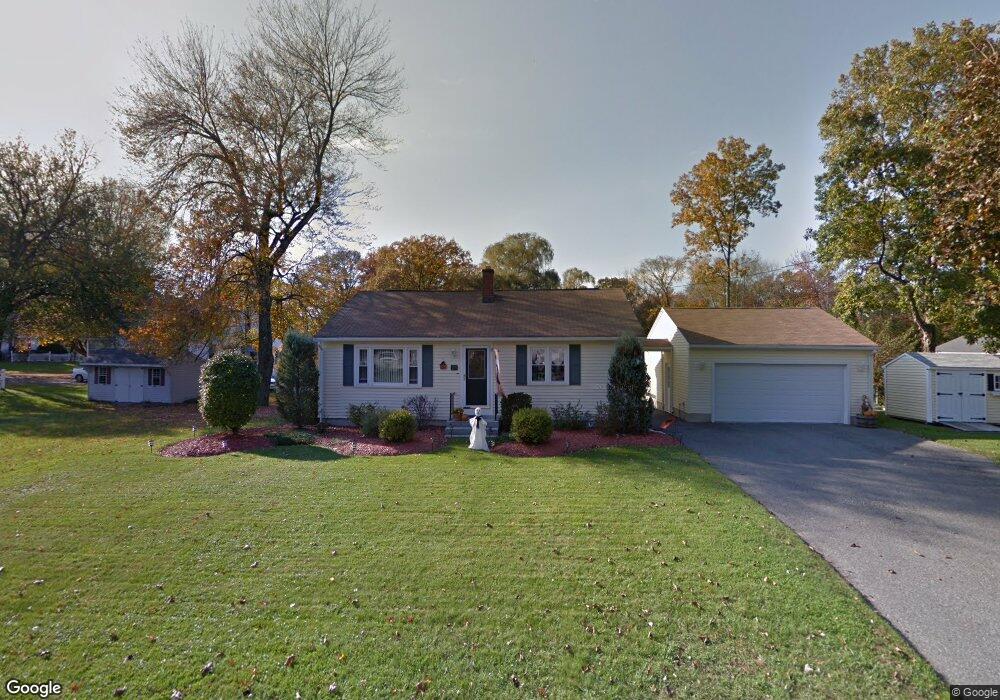
165 Lancaster Ave West Springfield, MA 01089
Estimated Value: $297,000 - $355,000
3
Beds
1
Bath
1,044
Sq Ft
$316/Sq Ft
Est. Value
About This Home
This home is located at 165 Lancaster Ave, West Springfield, MA 01089 and is currently estimated at $329,671, approximately $315 per square foot. 165 Lancaster Ave is a home located in Hampden County with nearby schools including St Thomas The Apostle School.
Ownership History
Date
Name
Owned For
Owner Type
Purchase Details
Closed on
Jan 12, 1998
Sold by
Booth Ian M and Booth Lisa A
Bought by
Santilli Mark L and Santilli Valerie A
Current Estimated Value
Home Financials for this Owner
Home Financials are based on the most recent Mortgage that was taken out on this home.
Original Mortgage
$105,866
Interest Rate
7.09%
Mortgage Type
Purchase Money Mortgage
Purchase Details
Closed on
Aug 1, 1990
Sold by
Anderson Kurt M
Bought by
Booth Ian M
Create a Home Valuation Report for This Property
The Home Valuation Report is an in-depth analysis detailing your home's value as well as a comparison with similar homes in the area
Home Values in the Area
Average Home Value in this Area
Purchase History
| Date | Buyer | Sale Price | Title Company |
|---|---|---|---|
| Santilli Mark L | $107,000 | -- | |
| Booth Ian M | $1,170,900 | -- |
Source: Public Records
Mortgage History
| Date | Status | Borrower | Loan Amount |
|---|---|---|---|
| Open | Booth Ian M | $136,500 | |
| Closed | Booth Ian M | $105,866 | |
| Previous Owner | Booth Ian M | $118,228 | |
| Previous Owner | Booth Ian M | $7,707 |
Source: Public Records
Tax History Compared to Growth
Tax History
| Year | Tax Paid | Tax Assessment Tax Assessment Total Assessment is a certain percentage of the fair market value that is determined by local assessors to be the total taxable value of land and additions on the property. | Land | Improvement |
|---|---|---|---|---|
| 2025 | $3,921 | $263,700 | $107,800 | $155,900 |
| 2024 | $3,911 | $264,100 | $107,800 | $156,300 |
| 2023 | $3,731 | $240,100 | $107,800 | $132,300 |
| 2022 | $3,369 | $213,800 | $97,800 | $116,000 |
| 2021 | $3,240 | $191,700 | $90,500 | $101,200 |
| 2020 | $3,248 | $191,200 | $90,500 | $100,700 |
| 2019 | $3,243 | $191,200 | $90,500 | $100,700 |
| 2018 | $3,260 | $191,200 | $90,500 | $100,700 |
| 2017 | $3,260 | $191,200 | $90,500 | $100,700 |
| 2016 | $3,209 | $188,900 | $86,900 | $102,000 |
| 2015 | $3,148 | $185,300 | $85,300 | $100,000 |
| 2014 | $764 | $185,300 | $85,300 | $100,000 |
Source: Public Records
Map
Nearby Homes
- 16 North St
- 65 Verdugo St
- 142 Morton St
- 19 Cora St
- 42 Janet St
- 61 Clarence St
- 260 Wolcott Ave
- 180 Wolcott Ave
- 74 Maple Terrace
- 36 Maple Terrace
- 17 Laurence Dr
- 32 Lotus Ave
- 139 Upper Beverly Hills
- 81 Laurence Dr
- 43 Houston Rd
- 148 Craiwell Ave
- 43 Wishing Well Way
- 258 Poplar Ave
- 283 Forest Glen
- 31 Stone Path Ln
- 6 North St
- 179 Lancaster Ave
- 164 Lancaster Ave
- 36 Benedict St
- 178 Lancaster Ave
- 154 Lancaster Ave
- 186 Lancaster Ave
- 145 Lancaster Ave
- 20 Benedict St
- 15 North St
- 142 Lancaster Ave
- 197 Lancaster Ave
- 70 Benedict St
- 159 Brookline Ave
- 137 Lancaster Ave
- 33 Benedict St
- 200 Lancaster Ave
- 138 Lancaster Ave
- 76 Benedict St
- 182 Ely Ave