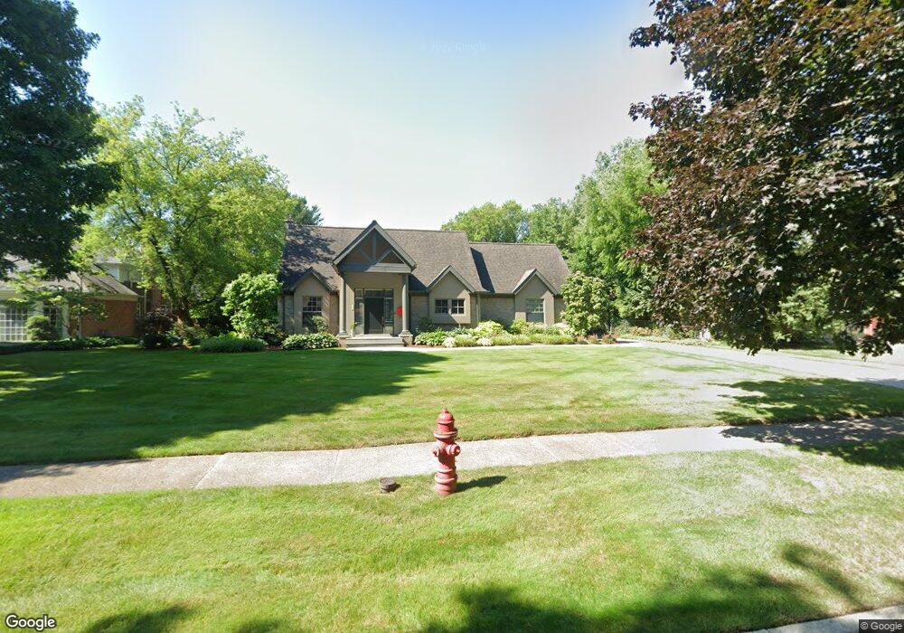
165 Lothrop Rd Grosse Pointe Farms, MI 48236
Estimated Value: $904,000 - $989,000
3
Beds
4
Baths
3,100
Sq Ft
$302/Sq Ft
Est. Value
About This Home
This home is located at 165 Lothrop Rd, Grosse Pointe Farms, MI 48236 and is currently estimated at $935,687, approximately $301 per square foot. 165 Lothrop Rd is a home located in Wayne County with nearby schools including Kerby Elementary School, Brownell Middle School, and Grosse Pointe South High School.
Ownership History
Date
Name
Owned For
Owner Type
Purchase Details
Closed on
Nov 30, 2011
Sold by
Scott David A and Scott Annessa
Bought by
Coello Michael
Current Estimated Value
Purchase Details
Closed on
Jun 25, 2004
Sold by
Scott David A and Scott Annessa
Bought by
Scott David A
Home Financials for this Owner
Home Financials are based on the most recent Mortgage that was taken out on this home.
Original Mortgage
$309,500
Interest Rate
6.35%
Mortgage Type
New Conventional
Purchase Details
Closed on
Aug 14, 2002
Sold by
David & Andrew Investmen
Bought by
Scott David A
Create a Home Valuation Report for This Property
The Home Valuation Report is an in-depth analysis detailing your home's value as well as a comparison with similar homes in the area
Home Values in the Area
Average Home Value in this Area
Purchase History
| Date | Buyer | Sale Price | Title Company |
|---|---|---|---|
| Coello Michael | $572,000 | Greco Title Agency Llc | |
| Scott David A | -- | Service First Title Agency L | |
| Scott David A | -- | -- |
Source: Public Records
Mortgage History
| Date | Status | Borrower | Loan Amount |
|---|---|---|---|
| Previous Owner | Scott David A | $309,500 |
Source: Public Records
Tax History Compared to Growth
Tax History
| Year | Tax Paid | Tax Assessment Tax Assessment Total Assessment is a certain percentage of the fair market value that is determined by local assessors to be the total taxable value of land and additions on the property. | Land | Improvement |
|---|---|---|---|---|
| 2025 | $7,503 | $422,600 | $0 | $0 |
| 2024 | $7,503 | $397,400 | $0 | $0 |
| 2023 | $6,873 | $383,800 | $0 | $0 |
| 2022 | $6,873 | $350,800 | $0 | $0 |
| 2021 | $12,612 | $341,400 | $0 | $0 |
| 2019 | $12,402 | $316,400 | $0 | $0 |
| 2018 | $6,347 | $305,000 | $0 | $0 |
| 2017 | $11,012 | $305,600 | $0 | $0 |
| 2016 | $11,543 | $290,400 | $0 | $0 |
| 2015 | $22,864 | $248,600 | $0 | $0 |
| 2013 | $22,150 | $221,500 | $0 | $0 |
| 2012 | $5,777 | $217,200 | $83,100 | $134,100 |
Source: Public Records
Map
Nearby Homes
- 216 Ridge Rd
- 130 Merriweather Rd
- 218 Merriweather Rd
- 189 Cloverly Rd
- 93 Merriweather Rd
- 194 Charlevoix Ave
- 259 Mount Vernon Ave
- 257 Ridge Rd
- 166 Lewiston Rd
- 273 Ridge Rd
- 302 Mount Vernon Ave
- 213 Muir Rd
- 276 Lewiston Rd
- 314 Mount Vernon Ave
- 317 Mount Vernon Ave
- 233 Mcmillan Rd
- 65 Mapleton Rd
- 159 Grosse Pointe Blvd
- 240 Mckinley Ave
- 201 Mcmillan Rd
- 165 Lothrop Rd Unit Grosse Pointe Farms
- 171 Lothrop Rd
- 155 Lothrop Rd
- 181 Lothrop Rd
- 170 Merriweather Rd
- 172 Merriweather Rd
- 176 Merriweather Rd
- 158 Merriweather Rd
- 164 Lothrop Rd
- 170 Lothrop Rd
- 152 Merriweather Rd
- 180 Merriweather Rd
- 178 Lothrop Rd
- 154 Lothrop Rd
- 191 Lothrop Rd
- 188 Merriweather Rd
- 184 Lothrop Rd
- 131 Lothrop Rd
- 134 Merriweather Rd
- 167 Merriweather Rd