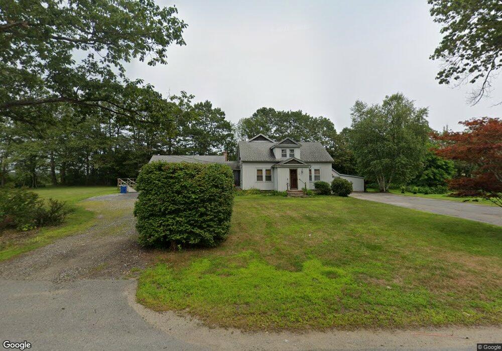
165 Maple Ave Rutland, MA 01543
Estimated Value: $551,000 - $636,000
3
Beds
4
Baths
3,047
Sq Ft
$190/Sq Ft
Est. Value
About This Home
This home is located at 165 Maple Ave, Rutland, MA 01543 and is currently estimated at $580,254, approximately $190 per square foot. 165 Maple Ave is a home located in Worcester County with nearby schools including Wachusett Regional High School.
Ownership History
Date
Name
Owned For
Owner Type
Purchase Details
Closed on
Nov 16, 2023
Sold by
Kolofsky Julianna A
Bought by
Kolofsky Julianna A and Kolofsky Dorene A
Current Estimated Value
Purchase Details
Closed on
Jun 25, 2020
Sold by
Kolofsky Mary A
Bought by
Kolofsky Dorene A
Create a Home Valuation Report for This Property
The Home Valuation Report is an in-depth analysis detailing your home's value as well as a comparison with similar homes in the area
Home Values in the Area
Average Home Value in this Area
Purchase History
| Date | Buyer | Sale Price | Title Company |
|---|---|---|---|
| Kolofsky Julianna A | -- | None Available | |
| Kolofsky Julianna A | -- | None Available | |
| Kolofsky Julianna A | -- | None Available | |
| Kolofsky Julianna A | -- | None Available | |
| Kolofsky Dorene A | -- | None Available | |
| Kolofsky Dorene A | -- | None Available |
Source: Public Records
Tax History Compared to Growth
Tax History
| Year | Tax Paid | Tax Assessment Tax Assessment Total Assessment is a certain percentage of the fair market value that is determined by local assessors to be the total taxable value of land and additions on the property. | Land | Improvement |
|---|---|---|---|---|
| 2025 | $5,977 | $419,700 | $99,700 | $320,000 |
| 2024 | $5,107 | $344,400 | $95,700 | $248,700 |
| 2023 | $4,779 | $348,300 | $90,400 | $257,900 |
| 2022 | $5,133 | $325,100 | $76,700 | $248,400 |
| 2021 | $4,633 | $277,400 | $76,700 | $200,700 |
| 2020 | $4,864 | $276,200 | $72,900 | $203,300 |
| 2019 | $4,768 | $266,500 | $69,500 | $197,000 |
| 2018 | $4,141 | $228,400 | $69,500 | $158,900 |
| 2017 | $4,184 | $228,400 | $69,500 | $158,900 |
| 2016 | $4,442 | $255,700 | $66,200 | $189,500 |
| 2015 | $4,022 | $227,900 | $66,200 | $161,700 |
| 2014 | $3,899 | $227,900 | $66,200 | $161,700 |
Source: Public Records
Map
Nearby Homes
- 176 Maple Ave Unit 1-38
- 176 Maple Ave Unit 3-25
- 176 Maple Ave Unit 2-26
- 189 Maple Ave
- 7 Prescott St
- 85 Maple Ave Unit A
- 21 Highland Park Rd
- 132 Fidelity Dr Unit 61
- 10 Fidelity Dr Unit 5
- 2 Forest Hill Dr
- 10 Beechwood Dr
- 14 Welch Ave Unit A
- 27 Lewis St
- 6 Lewis St
- 12 Lewis St
- 11 Lewis St
- 21 Lewis St
- 28 Forest Hill Dr
- 7 Emerald Rd
- 236 Turkey Hill Rd
- 176,5-25 Maple Ave Unit 5-25
- 176,4-34 Maple Ave Unit 4-34
- 95 Maple Ave
- 164 Maple Ave
- 162 Maple Ave
- 171 Maple Ave
- 176 Maple St Unit 208
- 176 Maple St Unit 2-22
- 176 Maple St Unit 1-1
- 156 Maple Ave
- 184 Kenwood Dr
- 175 Maple Ave
- 176,4-23 Maple Ave Unit 4-23
- 176,2-5 Maple Ave Unit 2-5
- 163 Maple Ave
- 163 Maple Ave Unit Ave
- 176 Maple Ave Unit 2-2
- 176 Maple Ave Unit 2-01
- 176 Maple Ave Unit 2-1
- 176 Maple Ave Unit 7-6