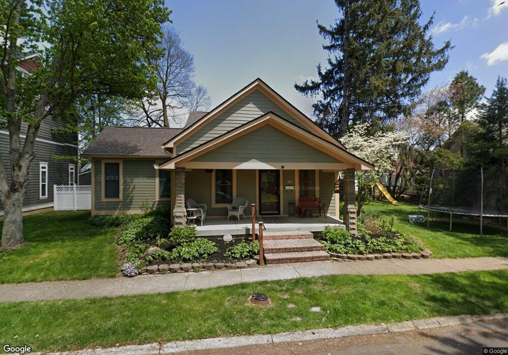
165 N Maple St Zionsville, IN 46077
Estimated Value: $669,000 - $874,000
4
Beds
3
Baths
2,827
Sq Ft
$274/Sq Ft
Est. Value
About This Home
This home is located at 165 N Maple St, Zionsville, IN 46077 and is currently estimated at $774,247, approximately $273 per square foot. 165 N Maple St is a home located in Boone County with nearby schools including Eagle Elementary School, Zionsville West Middle School, and Zionsville Community High School.
Ownership History
Date
Name
Owned For
Owner Type
Purchase Details
Closed on
May 7, 2009
Sold by
Hamilton David F
Bought by
Mikell David and Mikell Jeanine
Current Estimated Value
Home Financials for this Owner
Home Financials are based on the most recent Mortgage that was taken out on this home.
Original Mortgage
$271,600
Outstanding Balance
$171,418
Interest Rate
4.83%
Mortgage Type
New Conventional
Estimated Equity
$602,829
Create a Home Valuation Report for This Property
The Home Valuation Report is an in-depth analysis detailing your home's value as well as a comparison with similar homes in the area
Home Values in the Area
Average Home Value in this Area
Purchase History
| Date | Buyer | Sale Price | Title Company |
|---|---|---|---|
| Mikell David | -- | -- |
Source: Public Records
Mortgage History
| Date | Status | Borrower | Loan Amount |
|---|---|---|---|
| Open | Mikell David | $271,600 |
Source: Public Records
Tax History Compared to Growth
Tax History
| Year | Tax Paid | Tax Assessment Tax Assessment Total Assessment is a certain percentage of the fair market value that is determined by local assessors to be the total taxable value of land and additions on the property. | Land | Improvement |
|---|---|---|---|---|
| 2024 | $7,310 | $645,700 | $94,400 | $551,300 |
| 2023 | $6,653 | $604,000 | $94,400 | $509,600 |
| 2022 | $6,236 | $551,100 | $94,400 | $456,700 |
| 2021 | $5,926 | $492,800 | $94,400 | $398,400 |
| 2020 | $5,630 | $477,400 | $94,400 | $383,000 |
| 2019 | $5,217 | $458,400 | $94,400 | $364,000 |
| 2018 | $4,090 | $362,300 | $94,400 | $267,900 |
| 2017 | $3,890 | $346,600 | $94,400 | $252,200 |
| 2016 | $3,652 | $325,200 | $94,400 | $230,800 |
| 2014 | $3,297 | $293,800 | $94,400 | $199,400 |
| 2013 | $3,311 | $293,500 | $94,400 | $199,100 |
Source: Public Records
Map
Nearby Homes
- 170 E Ash St
- 340 W Poplar St
- 255 N Fourth St
- 635 W Poplar St
- 350 S 6th St
- 820 W Poplar St
- 895 W Poplar St
- 35 Spring Dr
- 650 Mulberry St
- 6330 Mayfield Ln
- 961 Starkey Rd
- 361 Fairfax Way
- 1 Woodard Bluff
- 1450 Whistle Way
- 1461 Whistle Way
- 19 Calumet Ct
- 5713 Upper Garden Way
- 9175 Highpointe Ln
- 9280 Highpointe Ln
- 11915 Kelso Dr Unit 2