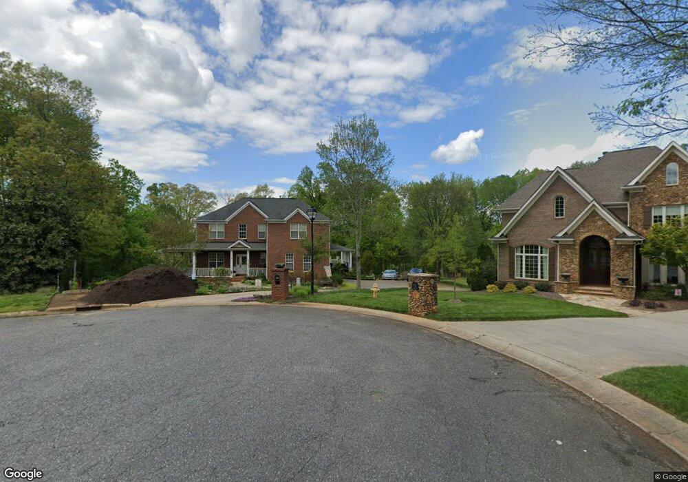
165 Patrick Ln Mount Holly, NC 28120
Estimated Value: $707,130 - $809,000
5
Beds
4
Baths
3,146
Sq Ft
$233/Sq Ft
Est. Value
About This Home
This home is located at 165 Patrick Ln, Mount Holly, NC 28120 and is currently estimated at $734,533, approximately $233 per square foot. 165 Patrick Ln is a home located in Gaston County with nearby schools including Rankin Elementary School, Mount Holly Middle School, and Stuart W. Cramer High School.
Ownership History
Date
Name
Owned For
Owner Type
Purchase Details
Closed on
Mar 31, 2014
Sold by
Stafford Derrick Scott and Stafford Jennifer Hicks
Bought by
Dake Kenneth M and Dake Heather D
Current Estimated Value
Home Financials for this Owner
Home Financials are based on the most recent Mortgage that was taken out on this home.
Original Mortgage
$267,200
Outstanding Balance
$203,580
Interest Rate
4.4%
Mortgage Type
New Conventional
Estimated Equity
$530,953
Create a Home Valuation Report for This Property
The Home Valuation Report is an in-depth analysis detailing your home's value as well as a comparison with similar homes in the area
Home Values in the Area
Average Home Value in this Area
Purchase History
| Date | Buyer | Sale Price | Title Company |
|---|---|---|---|
| Dake Kenneth M | $334,000 | None Available |
Source: Public Records
Mortgage History
| Date | Status | Borrower | Loan Amount |
|---|---|---|---|
| Open | Dake Kenneth M | $267,200 |
Source: Public Records
Tax History Compared to Growth
Tax History
| Year | Tax Paid | Tax Assessment Tax Assessment Total Assessment is a certain percentage of the fair market value that is determined by local assessors to be the total taxable value of land and additions on the property. | Land | Improvement |
|---|---|---|---|---|
| 2025 | $6,439 | $641,330 | $78,520 | $562,810 |
| 2024 | $6,439 | $641,330 | $78,520 | $562,810 |
| 2023 | $6,510 | $641,330 | $78,520 | $562,810 |
| 2022 | $5,402 | $417,160 | $74,870 | $342,290 |
| 2021 | $5,486 | $417,160 | $74,870 | $342,290 |
| 2019 | $5,527 | $417,160 | $74,870 | $342,290 |
| 2018 | $4,561 | $325,751 | $59,196 | $266,555 |
| 2017 | $4,561 | $325,751 | $59,196 | $266,555 |
| 2016 | $2,834 | $325,751 | $0 | $0 |
| 2014 | $2,847 | $327,209 | $70,315 | $256,894 |
Source: Public Records
Map
Nearby Homes
- 101 Madison Dr
- 3631 Azalea Ridge Dr
- 504 N Hawthorne St
- 201 1st St
- 703 Rankin Ave
- 101 Loya St
- 413 W Glendale Ave
- 221 Deerfield Dr
- 227 W Glendale Ave
- 1015 Hoover Ave
- 1045 Hoover Ave
- 105 S Tanninger Rd
- 128 Birchwood Ct
- 1024 Old Mountain View Rd
- 113 S Mulberry Ct
- 00 Bell St
- 120 Abernathy St
- 112 Julia St
- 5235 Clearwater Lake Rd
- 217 Highland St
- 162 Patrick Ln
- 159 Patrick Ln
- 147 Patrick Ln
- 146 Patrick Ln
- 133 Patrick Ln
- 608 W Central Ave
- 606 W Central Ave
- 435 W Central Ave
- 121 Patrick Ln
- 116 Patrick Ln
- 105 Patrick Ln
- 431 W Central Ave
- 100 Woodhill Dr
- 108 Waverly St
- 107 Waverly St
- 177 Woodhill Dr
- 105 Waverly St
- 104 Waverly St
- 609 W Charlotte Ave
- 110 Hilltop St