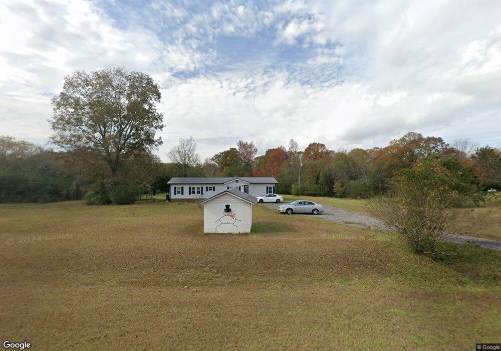
165 Robertson Rd Lagrange, GA 30241
Estimated Value: $190,000 - $228,000
3
Beds
1
Bath
1,387
Sq Ft
$152/Sq Ft
Est. Value
About This Home
This home is located at 165 Robertson Rd, Lagrange, GA 30241 and is currently estimated at $210,183, approximately $151 per square foot. 165 Robertson Rd is a home located in Troup County with nearby schools including Rosemont Elementary School, Whitesville Road Elementary School, and Berta Weathersbee Elementary School.
Ownership History
Date
Name
Owned For
Owner Type
Purchase Details
Closed on
Dec 18, 2024
Sold by
Johnson Dana P
Bought by
Bartlett Gina and Bartlett Jay
Current Estimated Value
Purchase Details
Closed on
May 28, 2002
Sold by
Tony Darnell Noles
Bought by
Prophett Family Limited Ptn
Purchase Details
Closed on
Dec 21, 1999
Sold by
Ethyl Ann Shumake Noles
Bought by
Tony Darnell Noles
Purchase Details
Closed on
Feb 9, 1989
Bought by
Ethyl Ann Shumake Noles
Purchase Details
Closed on
Jan 1, 1965
Create a Home Valuation Report for This Property
The Home Valuation Report is an in-depth analysis detailing your home's value as well as a comparison with similar homes in the area
Purchase History
| Date | Buyer | Sale Price | Title Company |
|---|---|---|---|
| Bartlett Gina | $170,000 | -- | |
| Prophett Family Limited Ptn | $200,000 | -- | |
| Tony Darnell Noles | -- | -- | |
| Ethyl Ann Shumake Noles | -- | -- | |
| -- | -- | -- |
Source: Public Records
Tax History
| Year | Tax Paid | Tax Assessment Tax Assessment Total Assessment is a certain percentage of the fair market value that is determined by local assessors to be the total taxable value of land and additions on the property. | Land | Improvement |
|---|---|---|---|---|
| 2025 | $1,933 | $70,888 | $8,480 | $62,408 |
| 2024 | $1,670 | $61,248 | $8,480 | $52,768 |
| 2023 | $1,461 | $53,568 | $8,480 | $45,088 |
| 2022 | $1,410 | $50,528 | $8,480 | $42,048 |
| 2021 | $1,433 | $47,520 | $27,680 | $19,840 |
| 2020 | $1,433 | $47,520 | $27,680 | $19,840 |
| 2019 | $1,425 | $47,240 | $27,680 | $19,560 |
| 2018 | $1,372 | $45,488 | $27,680 | $17,808 |
| 2017 | $1,372 | $45,488 | $27,680 | $17,808 |
| 2016 | $1,354 | $44,907 | $27,700 | $17,207 |
| 2015 | $1,357 | $44,907 | $27,700 | $17,207 |
| 2014 | $1,332 | $44,002 | $27,700 | $16,302 |
| 2013 | -- | $45,116 | $27,700 | $17,416 |
Source: Public Records
Map
Nearby Homes
- 137 Robertson Rd
- 130 Hamilton Lake Dr
- 950 John Lovelace Rd
- 830 John Lovelace Rd
- 2851 & 2891 Hamilton Rd
- 0 Briley Rd Unit 10582531
- 0 Briley Rd Unit 214353
- 11.59+/- AC Hunt Rd
- 111 Prestwick Dr
- 123 Wexford Dr
- 209 Grace Ct
- 246 S Smith Rd
- 501 Lago Ct
- 557 Lago Ct
- 312 Lana Ln
- 405 Lakeview Way
- 414 Lakeview Way
- 329 Linman Dr
- 86 John Lovelace Rd
- 107 Beaver Creek Way Unit 249
- 163 Robertson Rd
- 155 Robertson Rd
- 164 Robertson Rd
- 153 Robertson Rd
- 138 Robertson Rd
- 175 Robertson Rd
- 183 Robertson Rd Unit LOT 12
- 197 Robertson Rd Unit LOT 8
- 199 Robertson Rd Unit LOT 7
- 199 Robertson Rd Unit LOT 8
- 195 Robertson Rd Unit LOT 9
- 143 Robertson Rd
- 141 Robertson Rd
- 174 Robertson Rd
- 694 Lower Big Springs Rd Unit LOT 5
- 804 Lower Big Springs Rd
- 0 Lower Big Springs Road and Robertson Rd
- 187 Robertson Rd Unit LOT 11
- 836 Lower Big Springs Rd
- 401 Lower Big Springs Rd
Your Personal Tour Guide
Ask me questions while you tour the home.