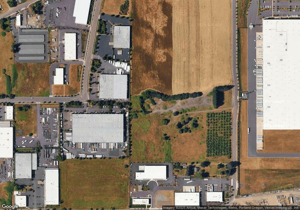
Estimated Value: $1,015,000
5
Beds
2
Baths
3,578
Sq Ft
$284/Sq Ft
Est. Value
About This Home
This home is located at 165 S Walnut St, Canby, OR 97013 and is currently priced at $1,015,000, approximately $283 per square foot. 165 S Walnut St is a home with nearby schools including Josefa L. Sambrano Elementary School, Cecile Trost Elementary School, and Carus School.
Ownership History
Date
Name
Owned For
Owner Type
Purchase Details
Closed on
Jul 14, 2022
Sold by
Tc/Eil Barker Llc
Bought by
State Of Oregon
Current Estimated Value
Purchase Details
Closed on
Jun 16, 2020
Sold by
Larusso Concrete Inc
Bought by
C & L Lang Llc
Purchase Details
Closed on
Jan 8, 2007
Sold by
Larusso Concrete Co Inc
Bought by
Larusso Concrete Inc
Purchase Details
Closed on
Oct 24, 2006
Sold by
Parsons Philip A and Parsons Tammy M
Bought by
Larusso Concrete Co Inc
Purchase Details
Closed on
Dec 6, 1995
Sold by
Nolan Thomas J and Nolan Tamera L
Bought by
Parsons Philip A and Parsons Tammy M
Home Financials for this Owner
Home Financials are based on the most recent Mortgage that was taken out on this home.
Original Mortgage
$155,000
Interest Rate
7.05%
Mortgage Type
Commercial
Create a Home Valuation Report for This Property
The Home Valuation Report is an in-depth analysis detailing your home's value as well as a comparison with similar homes in the area
Home Values in the Area
Average Home Value in this Area
Purchase History
| Date | Buyer | Sale Price | Title Company |
|---|---|---|---|
| State Of Oregon | $36,400,530 | Chicago Title | |
| C & L Lang Llc | $846,000 | First American Title | |
| Larusso Concrete Inc | -- | None Available | |
| Larusso Concrete Co Inc | $615,000 | Fidelity Natl Title Co Of Or | |
| Parsons Philip A | $275,000 | Chicago Title Insurance Co |
Source: Public Records
Mortgage History
| Date | Status | Borrower | Loan Amount |
|---|---|---|---|
| Previous Owner | Parsons Philip A | $155,000 |
Source: Public Records
Tax History Compared to Growth
Tax History
| Year | Tax Paid | Tax Assessment Tax Assessment Total Assessment is a certain percentage of the fair market value that is determined by local assessors to be the total taxable value of land and additions on the property. | Land | Improvement |
|---|---|---|---|---|
| 2025 | -- | $3,789,929 | -- | -- |
| 2024 | -- | $693,937 | -- | -- |
| 2023 | $6,866 | $384,895 | $0 | $0 |
| 2022 | $6,467 | $373,685 | $0 | $0 |
| 2021 | $8,141 | $474,250 | $0 | $0 |
| 2020 | $7,995 | $460,437 | $0 | $0 |
| 2019 | $7,614 | $447,027 | $0 | $0 |
| 2018 | $7,444 | $434,007 | $0 | $0 |
| 2017 | $7,255 | $421,366 | $0 | $0 |
| 2016 | $7,013 | $409,093 | $0 | $0 |
| 2015 | $6,773 | $397,178 | $0 | $0 |
| 2014 | $6,577 | $385,610 | $0 | $0 |
Source: Public Records
Map
Nearby Homes
- 399 S Sequoia Pkwy
- 1558 NE 10th Place
- 1620 N Sweetgum St
- 1346 NE 16th Ave
- 1111 SE 3rd Ave Unit 74
- 835 SE 1st Ave Unit 64
- 835 SE 1st Ave Unit 14
- 835 SE 1st Ave Unit 12
- 835 SE 1st Ave Unit 17
- 575 S Ponderosa St
- 1552 NE 19th Loop
- 1422 NE 18th Place
- 582 S Maple St
- 1053 S Vine St
- 620 SE 2nd Ave
- 620 SE 2nd Ave Unit 11
- 550 SE 5th Ave
- 1460 SE 9th Ave
- 860 NE 14th Ave
- 1947 NE 21st Ave
- 211 S Walnut St
- 368 Sequoia Pkwy Unit 2
- 372 Sequoia Pkwy Unit 3
- 267 S Walnut St
- 1027 S Walnut Rd Unit Lot77
- 360 Sequoia Pkwy
- 380 Sequoia Pkwy
- 220 S Walnut St
- 2190 SE 1st Ave
- 2112 SE 1st Ave
- 2150 SE 1st Ave
- 2026 SE 1st Ave
- 2344 SE 1st Ave
- 1793 SE 1st Ave
- 2392 SE 1st Ave
- 23100 S Highway 99e
- 2486 SE 1st Ave
- 23399 S Mulino Rd
- 23106 S Highway 99e
- 2226 SE 1st Ave
