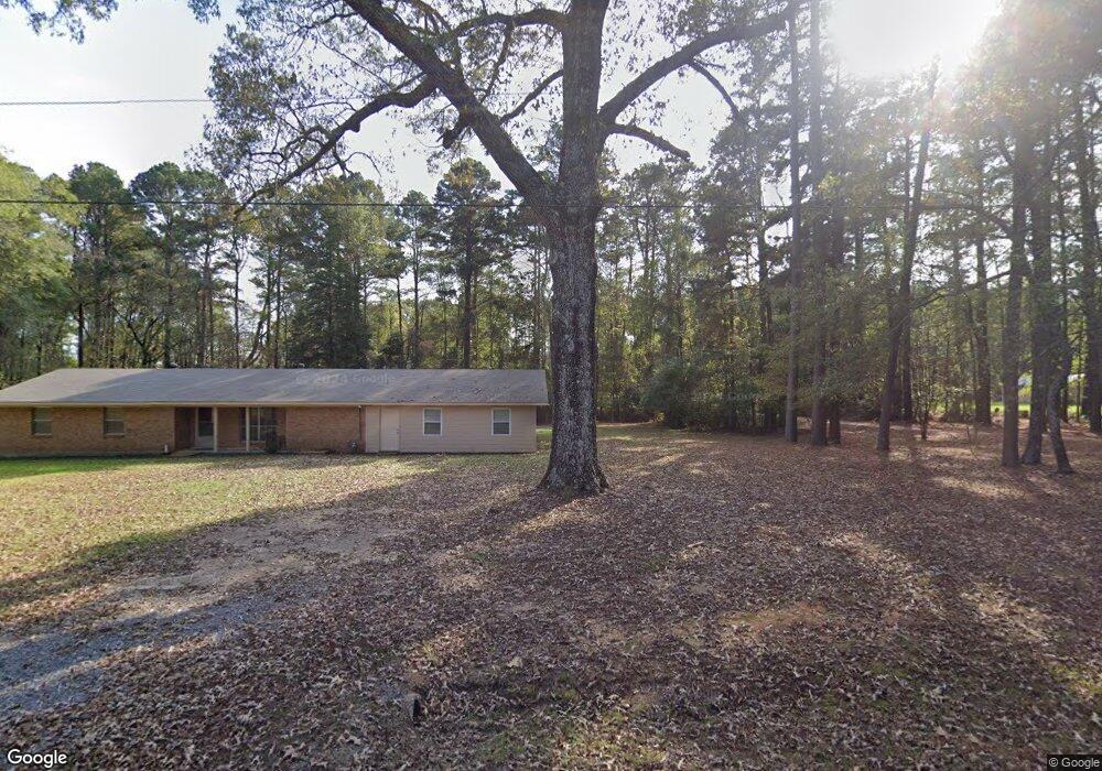
165 Thurman Rd Springhill, LA 71075
Estimated Value: $112,000 - $163,628
Studio
--
Bath
--
Sq Ft
191,664
Sq Ft Lot
About This Home
This home is located at 165 Thurman Rd, Springhill, LA 71075 and is currently estimated at $138,907. 165 Thurman Rd is a home with nearby schools including Browning Elementary School, Brown Upper Elementary School, and North Webster High School.
Ownership History
Date
Name
Owned For
Owner Type
Purchase Details
Closed on
Sep 10, 2021
Sold by
Cheryl Kay Garner Family Trust and Jpmorgan Chase Bank Na
Bought by
Revelle Terry Duane and Revelle Jennifer Lea
Current Estimated Value
Purchase Details
Closed on
Aug 5, 2016
Sold by
Pace Properties Llc
Bought by
Revelle Brandon Tyler
Home Financials for this Owner
Home Financials are based on the most recent Mortgage that was taken out on this home.
Original Mortgage
$120,099
Interest Rate
3.41%
Mortgage Type
New Conventional
Create a Home Valuation Report for This Property
The Home Valuation Report is an in-depth analysis detailing your home's value as well as a comparison with similar homes in the area
Home Values in the Area
Average Home Value in this Area
Purchase History
| Date | Buyer | Sale Price | Title Company |
|---|---|---|---|
| Revelle Terry Duane | $17,000 | Magnolia Title | |
| Revelle Brandon Tyler | $126,420 | None Available |
Source: Public Records
Mortgage History
| Date | Status | Borrower | Loan Amount |
|---|---|---|---|
| Previous Owner | Revelle Brandon Tyler | $120,099 |
Source: Public Records
Tax History
| Year | Tax Paid | Tax Assessment Tax Assessment Total Assessment is a certain percentage of the fair market value that is determined by local assessors to be the total taxable value of land and additions on the property. | Land | Improvement |
|---|---|---|---|---|
| 2025 | $545 | $11,870 | $610 | $11,260 |
| 2024 | $535 | $11,870 | $610 | $11,260 |
| 2023 | $365 | $10,790 | $550 | $10,240 |
| 2022 | $1,203 | $10,790 | $550 | $10,240 |
| 2021 | $1,203 | $10,790 | $550 | $10,240 |
| 2020 | $1,225 | $10,790 | $550 | $10,240 |
| 2019 | $1,205 | $10,790 | $550 | $10,240 |
| 2018 | $1,241 | $10,790 | $550 | $10,240 |
| 2017 | $1,233 | $10,790 | $550 | $10,240 |
| 2010 | $631 | $5,600 | $550 | $5,050 |
Source: Public Records
Map
Nearby Homes
- 894 Percy Burns Rd
- 165 Rosewood Rd
- 203 Airport Loop
- 214 Springhill Airport Rd
- 900 MacHen Dr
- 304 8th St SE
- 0 Spring Branch Rd
- 403 N Park Dr
- 407 S Park Dr
- 404 4th St SE
- 607 5th St NE
- 206 North St
- 0 June Anthony Dr
- 0 Elm St
- 0 SW 1st St Unit 21062350
- 204 3rd St NW
- 206 Oak Dr
- 2020 S Arkansas St
- 311 N Arkansas St
- 313 N Arkansas St
- 152 Thurman Rd
- 187 Thurman Rd
- 1014 Percy Burns Rd
- 1134 Percy Burns Rd
- 1035 Percy Burns Rd
- 1097 Percy Burns Rd
- 110 Dogwood Dr
- 1015 Percy Burns Rd
- 24028 Highway 157
- 24044 Highway 157
- 23990 Highway 157
- 995 Percy Burns Rd
- 107 Dogwood Dr
- 23968 Highway 157
- 1001 Percy Burns Rd
- 1154 Percy Burns Rd
- 960 Percy Burns Rd
- 23954 Highway 157
- 24096 Highway 157
- 106 Dogwood Dr
Your Personal Tour Guide
Ask me questions while you tour the home.