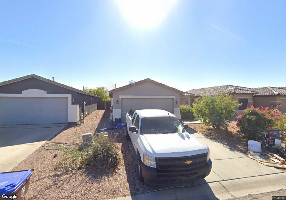
165 W Angus Rd San Tan Valley, AZ 85143
Estimated Value: $295,628 - $343,000
4
Beds
2
Baths
1,460
Sq Ft
$226/Sq Ft
Est. Value
About This Home
This home is located at 165 W Angus Rd, San Tan Valley, AZ 85143 and is currently estimated at $329,407, approximately $225 per square foot. 165 W Angus Rd is a home located in Pinal County with nearby schools including Circle Cross Ranch K8 School, Poston Butte High School, and Legacy Traditional-San Tan.
Ownership History
Date
Name
Owned For
Owner Type
Purchase Details
Closed on
Aug 25, 2008
Sold by
Avelo Mortgage Llc
Bought by
Evans Michael D and Evans Rachel L
Current Estimated Value
Home Financials for this Owner
Home Financials are based on the most recent Mortgage that was taken out on this home.
Original Mortgage
$91,326
Outstanding Balance
$60,715
Interest Rate
6.51%
Mortgage Type
New Conventional
Estimated Equity
$268,692
Purchase Details
Closed on
Dec 28, 2007
Sold by
Hoyum Dale N
Bought by
Avelo Mortgage Llc
Purchase Details
Closed on
Oct 26, 2004
Sold by
First American Title Insurance Co
Bought by
Hoyum Dale N
Home Financials for this Owner
Home Financials are based on the most recent Mortgage that was taken out on this home.
Original Mortgage
$125,700
Interest Rate
5.7%
Mortgage Type
VA
Create a Home Valuation Report for This Property
The Home Valuation Report is an in-depth analysis detailing your home's value as well as a comparison with similar homes in the area
Home Values in the Area
Average Home Value in this Area
Purchase History
| Date | Buyer | Sale Price | Title Company |
|---|---|---|---|
| Evans Michael D | $89,500 | Lsi Title Agency | |
| Avelo Mortgage Llc | $129,900 | Accommodation | |
| Hoyum Dale N | -- | First American Title Ins Co |
Source: Public Records
Mortgage History
| Date | Status | Borrower | Loan Amount |
|---|---|---|---|
| Open | Evans Michael D | $91,326 | |
| Previous Owner | Hoyum Dale N | $125,700 |
Source: Public Records
Tax History Compared to Growth
Tax History
| Year | Tax Paid | Tax Assessment Tax Assessment Total Assessment is a certain percentage of the fair market value that is determined by local assessors to be the total taxable value of land and additions on the property. | Land | Improvement |
|---|---|---|---|---|
| 2025 | $901 | $26,801 | -- | -- |
| 2024 | $888 | $30,238 | -- | -- |
| 2023 | $903 | $24,264 | $4,680 | $19,584 |
| 2022 | $888 | $16,544 | $2,925 | $13,619 |
| 2021 | $985 | $13,815 | $0 | $0 |
| 2020 | $886 | $13,154 | $0 | $0 |
| 2019 | $887 | $12,446 | $0 | $0 |
| 2018 | $849 | $10,398 | $0 | $0 |
| 2017 | $798 | $10,398 | $0 | $0 |
| 2016 | $810 | $10,339 | $1,250 | $9,089 |
| 2014 | $792 | $6,506 | $1,000 | $5,506 |
Source: Public Records
Map
Nearby Homes
- 35323 N Aubrac Cir
- 35480 N Danish Red Trail
- 35030 N Barzona Trail
- 35521 N Danish Red Trail
- 321 W Dexter Way
- 630 W Corriente Ct
- 695 W Holstein Trail
- 35462 N Sunset Trail
- 35468 N Sunset Trail
- 780 W Holstein Trail
- 35532 N Sunset Trail
- 291 E Las Puertas Ln
- 286 E Citrus Hollow Way
- 280 E Watermelon Ln
- 297 E Veterans Way
- 331 E Citrus Hollow Way
- 379 E Las Puertas Ln
- 210 E Bergamot Ln
- 812 W Gascon Rd
- 199 E Tangerine Path