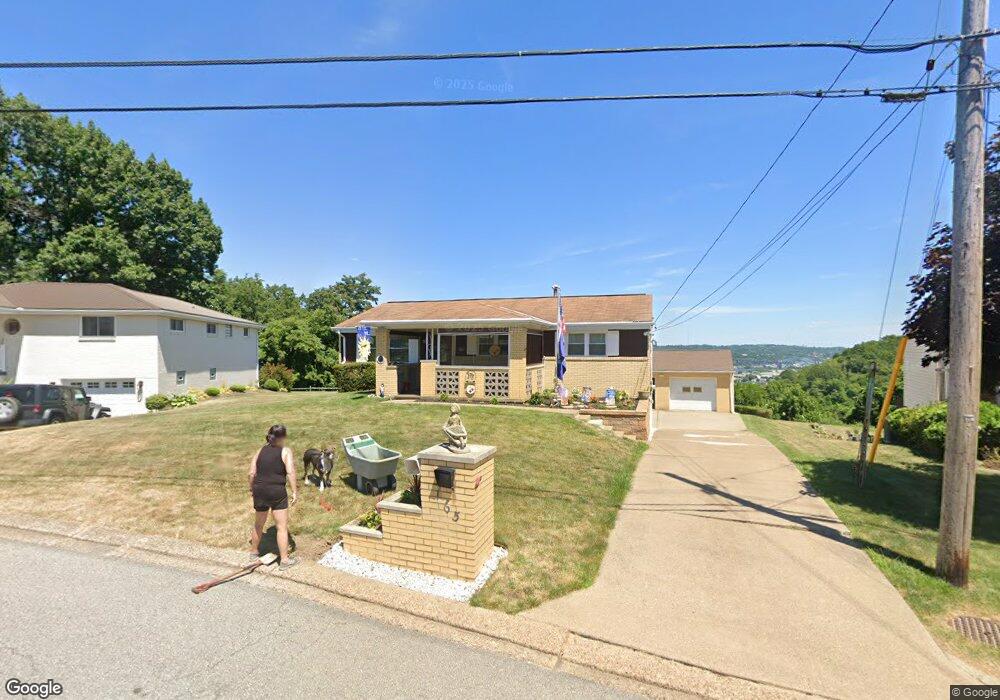
165 William Cir Mc Kees Rocks, PA 15136
Stowe Township NeighborhoodEstimated Value: $202,000 - $242,525
3
Beds
2
Baths
1,177
Sq Ft
$190/Sq Ft
Est. Value
About This Home
This home is located at 165 William Cir, Mc Kees Rocks, PA 15136 and is currently estimated at $224,131, approximately $190 per square foot. 165 William Cir is a home located in Allegheny County with nearby schools including Sto-Rox Upper Elementary School, Sto-Rox Primary Center, and Sto-Rox Junior/Senior High School.
Ownership History
Date
Name
Owned For
Owner Type
Purchase Details
Closed on
May 14, 2025
Sold by
Creel Samantha L Exrx and Sigmund Nancy L Est
Bought by
Creel Samantha L and Sigmund Jacob W
Current Estimated Value
Purchase Details
Closed on
Nov 15, 2021
Sold by
Bannon Edward P Living Trust and Bannon Edward P Trust
Bought by
Sigmund Nancy L
Purchase Details
Closed on
Nov 9, 2021
Sold by
Bannon Livingtrust Edward P and Bannon Livingtrust Joan
Bought by
Sigmund Nancy L
Purchase Details
Closed on
May 23, 2018
Sold by
Bannon Edward P and Bannon Joan I
Bought by
Bannon Edward P and Bannon Joan I
Purchase Details
Closed on
Jul 5, 1961
Bought by
Bannon Edward P and Bannon Joan I
Create a Home Valuation Report for This Property
The Home Valuation Report is an in-depth analysis detailing your home's value as well as a comparison with similar homes in the area
Home Values in the Area
Average Home Value in this Area
Purchase History
| Date | Buyer | Sale Price | Title Company |
|---|---|---|---|
| Creel Samantha L | -- | -- | |
| Sigmund Nancy L | -- | -- | |
| Bannon Edward P | -- | None Available | |
| Bannon Edward P | -- | -- | |
| Sigmund Nancy L | -- | -- |
Source: Public Records
Tax History Compared to Growth
Tax History
| Year | Tax Paid | Tax Assessment Tax Assessment Total Assessment is a certain percentage of the fair market value that is determined by local assessors to be the total taxable value of land and additions on the property. | Land | Improvement |
|---|---|---|---|---|
| 2025 | $3,885 | $97,600 | $20,500 | $77,100 |
| 2024 | $3,885 | $89,900 | $20,500 | $69,400 |
| 2023 | $3,734 | $89,900 | $20,500 | $69,400 |
| 2022 | $4,339 | $89,900 | $20,500 | $69,400 |
| 2021 | $425 | $89,900 | $20,500 | $69,400 |
| 2020 | $3,533 | $89,900 | $20,500 | $69,400 |
| 2019 | $3,533 | $89,900 | $20,500 | $69,400 |
| 2018 | $425 | $89,900 | $20,500 | $69,400 |
| 2017 | $3,452 | $89,900 | $20,500 | $69,400 |
| 2016 | $425 | $89,900 | $20,500 | $69,400 |
| 2015 | $425 | $89,900 | $20,500 | $69,400 |
| 2014 | $3,452 | $89,900 | $20,500 | $69,400 |
Source: Public Records
Map
Nearby Homes
- 179 William Cir
- 1550 Glenn Way
- 214 Barbara Dr
- 1490 Island Ave
- 1421 Fleming Ave
- 104 Thorncrest Dr
- 86 Thorncrest Dr
- 155 Roosevelt Ave
- 270 Wheeler Ave
- 23 Castle View Dr
- 543 Elizabeth Ave
- 8 Court Place
- 124 Pleasant Ridge Rd
- 1408 Broadway Ave
- 1406 Broadway Ave
- 1017 Mccoy Rd
- 1212 Woodward Ave
- 172 N Vireo Dr
- 932 Ridge Ave
- 108 Harrison Ave
- 163 William Cir
- 167 William Cir
- 164 William Cir
- 169 William Cir
- 161 William Cir
- 168 William Cir
- 160 William Cir
- 171 William Cir
- 159 William Cir
- 158 William Cir
- 172 William Cir
- 117 Homer Cir
- 156 William Cir
- 119 Homer Cir
- 174 William Cir
- 175 William Cir
- 121 Homer Cir
- 176 William Cir
- 154 William Cir
- 115 Homer Cir