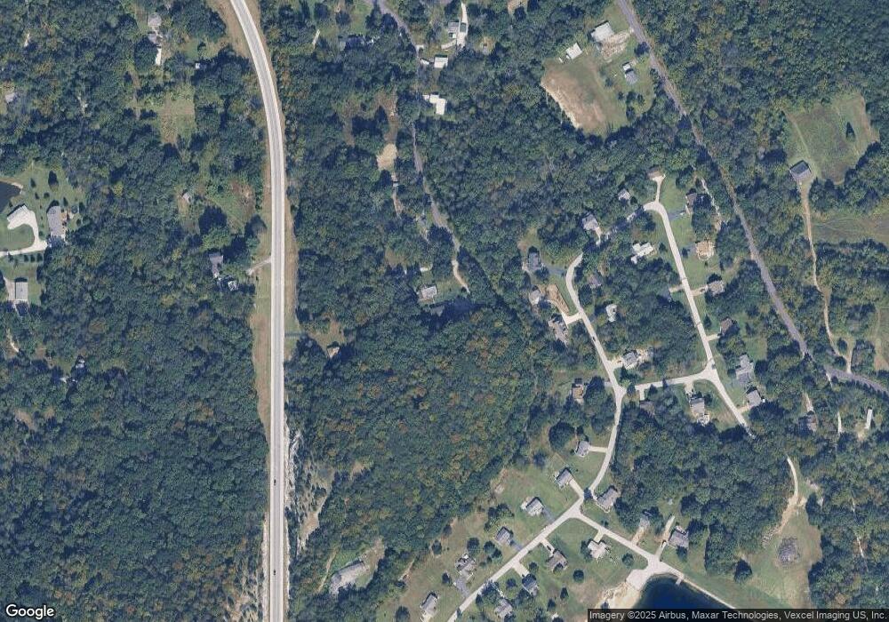
1650 Buscher Rd Pacific, MO 63069
Estimated Value: $302,000 - $418,000
4
Beds
3
Baths
2,880
Sq Ft
$131/Sq Ft
Est. Value
About This Home
This home is located at 1650 Buscher Rd, Pacific, MO 63069 and is currently estimated at $377,729, approximately $131 per square foot. 1650 Buscher Rd is a home located in Jefferson County with nearby schools including Pacific High School and St Bridget Elementary School.
Ownership History
Date
Name
Owned For
Owner Type
Purchase Details
Closed on
Mar 11, 2013
Sold by
Federal Home Loan Mortgage Corporation
Bought by
Creg Gary and Creg Lois
Current Estimated Value
Home Financials for this Owner
Home Financials are based on the most recent Mortgage that was taken out on this home.
Original Mortgage
$132,905
Outstanding Balance
$94,000
Interest Rate
3.59%
Mortgage Type
New Conventional
Estimated Equity
$283,729
Purchase Details
Closed on
Nov 5, 2012
Sold by
Citimortgage Inc
Bought by
Federal Home Loan Mortgage Corporation
Purchase Details
Closed on
Oct 9, 2012
Sold by
Penny Keith David and Penny Keith
Bought by
Citimortgage Inc
Purchase Details
Closed on
Oct 27, 2000
Sold by
Doyle Keith W and Doyle Madonna M
Bought by
Keith David B and Keith Penny J
Home Financials for this Owner
Home Financials are based on the most recent Mortgage that was taken out on this home.
Original Mortgage
$263,500
Interest Rate
7.3%
Create a Home Valuation Report for This Property
The Home Valuation Report is an in-depth analysis detailing your home's value as well as a comparison with similar homes in the area
Purchase History
| Date | Buyer | Sale Price | Title Company |
|---|---|---|---|
| Creg Gary | -- | Stewart Title | |
| Federal Home Loan Mortgage Corporation | -- | None Available | |
| Citimortgage Inc | $224,918 | None Available | |
| Keith David B | -- | Commonwealth Title |
Source: Public Records
Mortgage History
| Date | Status | Borrower | Loan Amount |
|---|---|---|---|
| Open | Creg Gary | $132,905 | |
| Previous Owner | Keith David B | $263,500 | |
| Closed | Keith David B | $31,500 |
Source: Public Records
Tax History Compared to Growth
Tax History
| Year | Tax Paid | Tax Assessment Tax Assessment Total Assessment is a certain percentage of the fair market value that is determined by local assessors to be the total taxable value of land and additions on the property. | Land | Improvement |
|---|---|---|---|---|
| 2025 | $3,081 | $44,900 | $3,300 | $41,600 |
| 2024 | $3,081 | $41,600 | $3,300 | $38,300 |
| 2023 | $3,081 | $41,600 | $3,300 | $38,300 |
| 2022 | $2,821 | $41,600 | $3,300 | $38,300 |
| 2021 | $2,810 | $41,600 | $3,300 | $38,300 |
| 2020 | $2,514 | $37,200 | $3,000 | $34,200 |
| 2019 | $2,512 | $37,200 | $3,000 | $34,200 |
| 2018 | $2,514 | $36,600 | $3,000 | $33,600 |
| 2016 | $2,181 | $33,500 | $3,000 | $30,500 |
Source: Public Records
Map
Nearby Homes
- 1802 Deer Run Trail
- 1821 Deer Run Trail
- 1833 Opeechee Beach Rd
- 1042 Palisades Ln
- O McNamee Rd
- 416 Parkview Ln
- 2075 Meaghan Ln
- 400 Denton Rd
- 513 S 2nd St
- Meramec St. W Meramec St
- 0 N Lakeshore Dr
- 412 E Frisco St
- 222 W Saint Louis St
- 806 W Congress St
- 1505 Cypress Dr
- 519 N Elm St
- 0 N 6th St Unit MAR24075265
- 1709 W Hawthorne Dr
- 1796 Meade Ct
- 1808 Westlake Ct
- 1754 Fawn Cir
- 1770 Deer Run Trail
- 1650 State Road F
- 1763 Deer Run Trail
- 1778 Deer Run Trail
- 1771 Deer Run Trail
- 1731 Fawn Cir
- 1786 Deer Run Trail
- 1794 Deer Run Trail
- 1775 Deer Run Trail
- 1739 Fawn Cir
- 1738 Fawn Cir
- 1768 Fawn Cir
- 1810 Deer Run Trail
- 1779 Deer Run Trail
- 0B Deer Run Trail
- 1633 State Road F
- 1793 Deer Run Trail
- 1818 Deer Run Trail
- 1751 Fawn Cir
