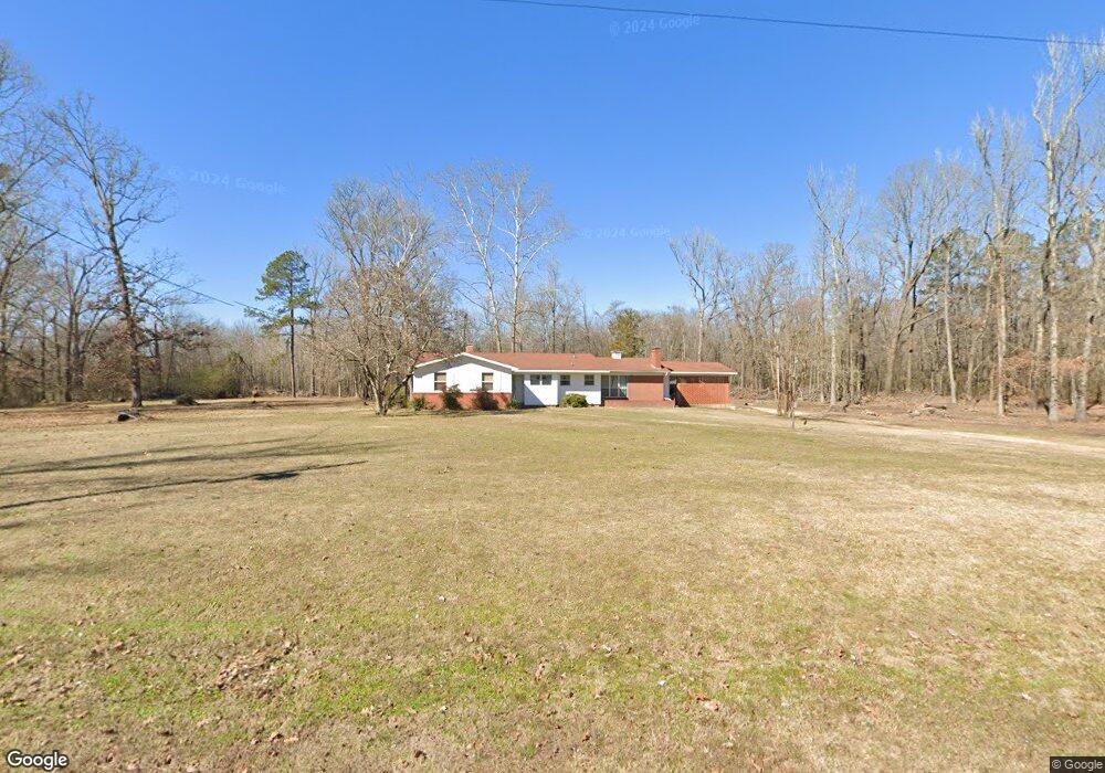
1650 Stevenson Rd Gurdon, AR 71743
Estimated Value: $51,000 - $100,000
Studio
2
Baths
2,262
Sq Ft
$31/Sq Ft
Est. Value
About This Home
This home is located at 1650 Stevenson Rd, Gurdon, AR 71743 and is currently estimated at $69,000, approximately $30 per square foot. 1650 Stevenson Rd is a home located in Clark County with nearby schools including Louisa Perritt Primary School, Peake Elementary School, and Goza Middle School.
Ownership History
Date
Name
Owned For
Owner Type
Purchase Details
Closed on
Nov 12, 2024
Sold by
Stevenson Steven O
Bought by
Cowboys Property Lease Company Llc
Current Estimated Value
Purchase Details
Closed on
Aug 29, 2024
Sold by
B2 Land & Cattle Llc
Bought by
Stevenson Steven O
Purchase Details
Closed on
Oct 28, 2015
Bought by
Stevenson Family Farm and Limited Partnership
Purchase Details
Closed on
Apr 25, 2008
Bought by
Stevenson R W
Purchase Details
Closed on
Feb 16, 2000
Bought by
Stevenson Family Farm Limited and Partnership
Purchase Details
Closed on
Jan 1, 1980
Bought by
Stevenson R W
Create a Home Valuation Report for This Property
The Home Valuation Report is an in-depth analysis detailing your home's value as well as a comparison with similar homes in the area
Purchase History
| Date | Buyer | Sale Price | Title Company |
|---|---|---|---|
| Cowboys Property Lease Company Llc | -- | None Listed On Document | |
| Cowboys Land Timber And Rv Park Llc | -- | None Listed On Document | |
| Stevenson Steven O | $100,000 | First National Title | |
| Stevenson Family Farm | -- | -- | |
| Stevenson R W | -- | -- | |
| Stevenson Family Farm Limited | -- | -- | |
| Stevenson R W | -- | -- |
Source: Public Records
Tax History
| Year | Tax Paid | Tax Assessment Tax Assessment Total Assessment is a certain percentage of the fair market value that is determined by local assessors to be the total taxable value of land and additions on the property. | Land | Improvement |
|---|---|---|---|---|
| 2025 | $154 | $2,980 | $2,980 | $0 |
| 2024 | $1,137 | $21,360 | $1,170 | $20,190 |
| 2023 | $1,109 | $21,360 | $1,170 | $20,190 |
| 2022 | $1,109 | $21,360 | $1,170 | $20,190 |
| 2021 | $1,109 | $21,360 | $1,170 | $20,190 |
| 2020 | $1,109 | $21,360 | $1,170 | $20,190 |
| 2019 | $1,037 | $20,000 | $1,460 | $18,540 |
| 2018 | $1,027 | $20,000 | $1,460 | $18,540 |
| 2017 | $1,025 | $20,000 | $1,460 | $18,540 |
| 2016 | $1,027 | $20,000 | $1,460 | $18,540 |
| 2015 | $1,025 | $20,000 | $1,460 | $18,540 |
| 2014 | $133 | $10,625 | $1,560 | $9,065 |
Source: Public Records
Map
Nearby Homes
- 4174 Central Rd
- 52 Curtis Rd
- 72 Curtis Rd
- 82 Curtis Rd
- 108 Curtis Rd
- 4161 U S 67
- 602 Stevenson Rd
- 16 Jackson Rd
- 390 Curtis Rd
- 196 Stevenson Rd
- 89 Nantz Trail
- 3506 U S 67
- 3506 Highway 67 S
- 1414 Ar-53 South Hwy
- 107 Richwoods Rd
- 1440 Central Rd
- Tbd Clayborn Chapel Rd Unit LotWP001
- 705 N 9th St
- 847 Central Rd
- 1029 Center Point Rd
- 3839 Central Rd
- 1586 Stevenson Rd
- 1581 Stevenson Rd
- 3844 Central Rd
- 3868 Central Rd
- 3725 Central Rd
- 3860 Central Rd
- 3878 Central Rd
- 3892 Central Rd
- 3897 Central Rd
- 35 Sonny Rd
- 3902 Central Rd
- 3911 Central Rd
- 57 Sonny Rd
- 3910 Central Rd
- 3659 Central Rd
- 3952 Central Rd
- 3975 Central Rd
- 3987 Central Rd
- 4003 Central Rd
Your Personal Tour Guide
Ask me questions while you tour the home.