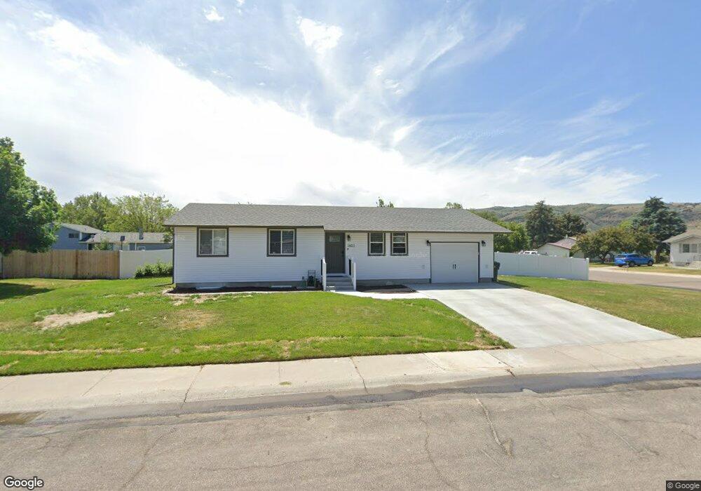
1651 Melanie Cir Pocatello, ID 83201
Northwest Pocatello NeighborhoodEstimated Value: $301,000 - $322,128
4
Beds
1
Bath
1,932
Sq Ft
$159/Sq Ft
Est. Value
About This Home
This home is located at 1651 Melanie Cir, Pocatello, ID 83201 and is currently estimated at $306,782, approximately $158 per square foot. 1651 Melanie Cir is a home located in Bannock County with nearby schools including Claude A. Wilcox Elementary School, Hawthorne Middle School, and Pocatello High School.
Ownership History
Date
Name
Owned For
Owner Type
Purchase Details
Closed on
Nov 24, 2009
Sold by
Merzlock Justin and Merzlock November
Bought by
Johnson Marc and Johnson Marie
Current Estimated Value
Home Financials for this Owner
Home Financials are based on the most recent Mortgage that was taken out on this home.
Original Mortgage
$120,573
Outstanding Balance
$78,042
Interest Rate
4.83%
Mortgage Type
FHA
Estimated Equity
$228,740
Purchase Details
Closed on
Aug 14, 2008
Sold by
Paulsen Shane D and Paulsen Lynette E
Bought by
Merzlock Justin and Merzlock November
Home Financials for this Owner
Home Financials are based on the most recent Mortgage that was taken out on this home.
Original Mortgage
$123,906
Interest Rate
6.32%
Mortgage Type
FHA
Create a Home Valuation Report for This Property
The Home Valuation Report is an in-depth analysis detailing your home's value as well as a comparison with similar homes in the area
Home Values in the Area
Average Home Value in this Area
Purchase History
| Date | Buyer | Sale Price | Title Company |
|---|---|---|---|
| Johnson Marc | -- | -- | |
| Merzlock Justin | -- | -- |
Source: Public Records
Mortgage History
| Date | Status | Borrower | Loan Amount |
|---|---|---|---|
| Open | Johnson Marc | $120,573 | |
| Previous Owner | Merzlock Justin | $123,906 |
Source: Public Records
Tax History Compared to Growth
Tax History
| Year | Tax Paid | Tax Assessment Tax Assessment Total Assessment is a certain percentage of the fair market value that is determined by local assessors to be the total taxable value of land and additions on the property. | Land | Improvement |
|---|---|---|---|---|
| 2024 | $1,614 | $249,604 | $55,000 | $194,604 |
| 2023 | $1,891 | $263,212 | $55,000 | $208,212 |
| 2022 | $1,891 | $208,542 | $49,680 | $158,862 |
| 2021 | $1,780 | $208,542 | $49,680 | $158,862 |
| 2020 | $1,396 | $174,854 | $41,400 | $133,454 |
| 2019 | $1,704 | $174,196 | $41,400 | $132,796 |
| 2018 | $1,504 | $133,747 | $30,000 | $103,747 |
| 2017 | $1,492 | $133,747 | $30,000 | $103,747 |
| 2016 | $1,480 | $133,747 | $30,000 | $103,747 |
| 2015 | $1,495 | $0 | $0 | $0 |
| 2012 | -- | $122,922 | $30,000 | $92,922 |
Source: Public Records
Map
Nearby Homes
- 3959 Aaron Ln
- 3978 Cobble Ct
- 1730 W Quinn Rd Unit 513
- 1730 W Quinn Rd Unit 613
- 1730 W Quinn Rd
- 1852 Brock Dr
- 1831 Brock Dr
- 1725 Brock Dr
- 1900 W Quinn Rd Unit 224
- 1900 W Quinn Rd
- 3780 Philbin Rd
- 3780 Philbin Rd Unit 5
- Breezy Commons Plan at Breezy Commons
- 3780 Philbin Rd Unit 28
- 1309 Troy Ln
- 1301 Troy Ln
- 1300 Troy Ln
- 1579 Roy St
- 1635 Melanie Cir
- 1646 Kinghorn Rd
- 1648 Kinghorn Rd
- 1634 Melanie Cir
- 1650 Melanie Cir
- 3885 Ethel Ln
- 1636 Kinghorn Rd
- 1623 Melanie Cir
- 3877 Ethel Ln
- 3901 Ethel Ln
- 1622 Kinghorn Rd
- 1665 Kinghorn Rd
- 1676 Kinghorn Rd
- 1622 Melanie Cir
- 3918 Ethel Ln
- 3911 Ethel Ln
- 1637 Kinghorn Rd
- 1645 Kinghorn Rd
- 1612 Kinghorn Rd
- 1617 Melanie Cir