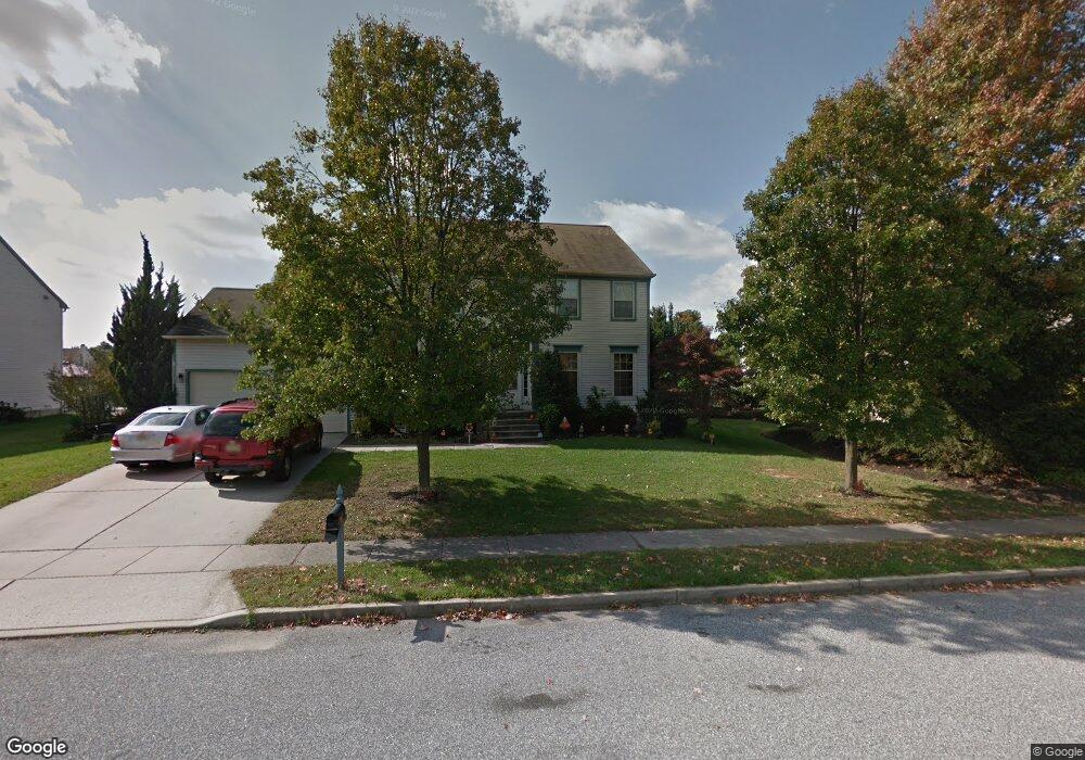
1651 Pennfield Dr West Deptford, NJ 08086
West Deptford Township NeighborhoodEstimated Value: $604,000 - $723,000
--
Bed
--
Bath
3,249
Sq Ft
$204/Sq Ft
Est. Value
About This Home
This home is located at 1651 Pennfield Dr, West Deptford, NJ 08086 and is currently estimated at $663,397, approximately $204 per square foot. 1651 Pennfield Dr is a home located in Gloucester County with nearby schools including Green-Fields Elementary School, Red Bank Elementary School, and Oakview Elementary School.
Ownership History
Date
Name
Owned For
Owner Type
Purchase Details
Closed on
May 5, 2003
Sold by
Clifford Sherrie L
Bought by
Wakeley Robert J and Wakeley Maureen L
Current Estimated Value
Home Financials for this Owner
Home Financials are based on the most recent Mortgage that was taken out on this home.
Original Mortgage
$303,300
Outstanding Balance
$132,300
Interest Rate
5.84%
Mortgage Type
Purchase Money Mortgage
Estimated Equity
$531,097
Purchase Details
Closed on
Nov 14, 1997
Sold by
Clifford Raymond
Bought by
Clifford Sherrie L
Purchase Details
Closed on
Sep 30, 1993
Sold by
Scarborough Corp
Bought by
Clifford Raymond and Clifford Sherri L
Home Financials for this Owner
Home Financials are based on the most recent Mortgage that was taken out on this home.
Original Mortgage
$150,000
Interest Rate
7%
Create a Home Valuation Report for This Property
The Home Valuation Report is an in-depth analysis detailing your home's value as well as a comparison with similar homes in the area
Home Values in the Area
Average Home Value in this Area
Purchase History
| Date | Buyer | Sale Price | Title Company |
|---|---|---|---|
| Wakeley Robert J | $337,000 | -- | |
| Clifford Sherrie L | -- | First American Title Ins Co | |
| Clifford Raymond | $231,542 | -- |
Source: Public Records
Mortgage History
| Date | Status | Borrower | Loan Amount |
|---|---|---|---|
| Open | Wakeley Robert J | $303,300 | |
| Previous Owner | Clifford Raymond | $150,000 |
Source: Public Records
Tax History Compared to Growth
Tax History
| Year | Tax Paid | Tax Assessment Tax Assessment Total Assessment is a certain percentage of the fair market value that is determined by local assessors to be the total taxable value of land and additions on the property. | Land | Improvement |
|---|---|---|---|---|
| 2025 | $14,827 | $424,600 | $70,500 | $354,100 |
| 2024 | $14,636 | $424,600 | $70,500 | $354,100 |
| 2023 | $14,636 | $424,600 | $70,500 | $354,100 |
| 2022 | $14,469 | $421,700 | $70,500 | $351,200 |
| 2021 | $14,418 | $421,700 | $70,500 | $351,200 |
| 2020 | $14,384 | $421,700 | $70,500 | $351,200 |
| 2019 | $13,984 | $421,700 | $70,500 | $351,200 |
| 2018 | $13,604 | $421,700 | $70,500 | $351,200 |
| 2017 | $13,288 | $421,700 | $70,500 | $351,200 |
| 2016 | $12,917 | $421,700 | $70,500 | $351,200 |
| 2015 | $12,305 | $421,700 | $70,500 | $351,200 |
| 2014 | $11,694 | $421,700 | $70,500 | $351,200 |
Source: Public Records
Map
Nearby Homes
- 1810 Fernwood Dr
- 740 Carter Hill Dr
- 1311 Barnesdale Rd
- 64 Tilden Rd
- 4 Saint Emilion Ct
- 1102 Barnesdale Rd
- 433 Crown Point Rd
- 863 Doncaster Dr
- 439 Crown Point Rd
- 1220 Royal Ln
- 640 Worcester Dr
- 97 Church St
- 121 Cape May Ave
- 87 Woodway Dr Unit 87
- 10 Kennedy Ct
- 266 Passaic Ave
- 558 Prince St
- 247 Crown Point Rd
- 107 Audubon Ave
- 67 Pelican Place
- 1649 Pennfield Dr
- 1653 Pennfield Dr
- 1647 Pennfield Dr
- 1650 Pennfield Dr
- 1648 Pennfield Dr
- 1652 Pennfield Dr
- 1646 Pennfield Dr
- 1645 Pennfield Dr
- 1502 Cobblestone Ct
- 1613 Pennfield Dr
- 1644 Pennfield Dr
- 1620 Pennfield Dr
- 1624 Pennfield Dr
- 1504 Cobblestone Ct
- 1626 Pennfield Dr
- 1643 Pennfield Dr
- 1401 Weatherly Ct
- 1615 Pennfield Dr
- 1628 Pennfield Dr
- 1403 Weatherly Ct