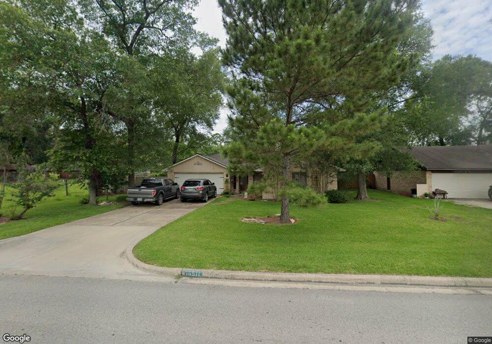
16511 Port o Call St Crosby, TX 77532
Estimated Value: $216,243 - $236,000
3
Beds
2
Baths
1,563
Sq Ft
$146/Sq Ft
Est. Value
About This Home
This home is located at 16511 Port o Call St, Crosby, TX 77532 and is currently estimated at $227,811, approximately $145 per square foot. 16511 Port o Call St is a home located in Harris County with nearby schools including Crosby Elementary School, Crosby Middle School, and Crosby High School.
Ownership History
Date
Name
Owned For
Owner Type
Purchase Details
Closed on
Mar 31, 2004
Sold by
Malchar Brian Leon and Malchar Karen Annette
Bought by
Lopez Deborah
Current Estimated Value
Home Financials for this Owner
Home Financials are based on the most recent Mortgage that was taken out on this home.
Original Mortgage
$88,755
Outstanding Balance
$41,563
Interest Rate
5.59%
Mortgage Type
Purchase Money Mortgage
Estimated Equity
$186,248
Purchase Details
Closed on
Dec 10, 1993
Sold by
Burns Lee R and Burns Elma M
Bought by
Malchar Brian Leon and Malchar Karen Annette
Home Financials for this Owner
Home Financials are based on the most recent Mortgage that was taken out on this home.
Original Mortgage
$57,630
Interest Rate
7.19%
Mortgage Type
VA
Create a Home Valuation Report for This Property
The Home Valuation Report is an in-depth analysis detailing your home's value as well as a comparison with similar homes in the area
Home Values in the Area
Average Home Value in this Area
Purchase History
| Date | Buyer | Sale Price | Title Company |
|---|---|---|---|
| Lopez Deborah | -- | Chicago Title Insurance Co | |
| Malchar Brian Leon | -- | -- |
Source: Public Records
Mortgage History
| Date | Status | Borrower | Loan Amount |
|---|---|---|---|
| Open | Lopez Deborah | $88,755 | |
| Previous Owner | Malchar Brian Leon | $57,630 |
Source: Public Records
Tax History Compared to Growth
Tax History
| Year | Tax Paid | Tax Assessment Tax Assessment Total Assessment is a certain percentage of the fair market value that is determined by local assessors to be the total taxable value of land and additions on the property. | Land | Improvement |
|---|---|---|---|---|
| 2025 | $1,899 | $169,847 | $51,612 | $118,235 |
| 2024 | $1,899 | $175,466 | $51,612 | $123,854 |
| 2023 | $1,899 | $212,264 | $51,612 | $160,652 |
| 2022 | $3,962 | $183,330 | $37,536 | $145,794 |
| 2021 | $3,717 | $137,142 | $37,536 | $99,606 |
| 2020 | $3,992 | $141,571 | $37,536 | $104,035 |
| 2019 | $3,945 | $134,012 | $28,152 | $105,860 |
| 2018 | $1,632 | $123,884 | $16,958 | $106,926 |
| 2017 | $3,722 | $123,884 | $16,958 | $106,926 |
| 2016 | $3,498 | $116,422 | $16,958 | $99,464 |
| 2015 | $2,656 | $111,191 | $16,958 | $94,233 |
| 2014 | $2,656 | $101,854 | $16,958 | $84,896 |
Source: Public Records
Map
Nearby Homes
- 16431 Spinnaker Dr
- 16402 Port o Call St
- 16511 Bluefin St
- 16507 Bluefin St
- 16611 Port o Call St
- 502 Nautilus St
- 710 Equinox St
- 16411 Porpoise Ct
- 606 Fiji Ct
- 16626 Bluefin St
- 415 Binnacle Way
- 516 Aweigh Dr
- 302 Kings Port St
- 711 Nautilus St
- 16659 Bluefin St
- 16411 Seven Waves Ct
- 631 Aweigh Dr
- 1103 Channels St
- 439 Fishhawk Way
- 711 N Hyannis Port St
- 16510 Bluefin St
- 16506 Bluefin St
- 16521 Port o Call St
- 16514 Bluefin St
- 16514 Port o Call St
- 16510 Port o Call St
- 16518 Port o Call St
- 16506 Port o Call St
- 16427 Spinnaker Dr
- 16522 Port o Call St
- 16502 Port o Call St
- 0 N Starboard Unit 7215369
- 0 N Starboard Unit 20504452
- 623 N Starboard St
- 619 N Starboard St
- 16527 Port o Call St
- 615 N Starboard St
- 16519 Bluefin St
- 631 N Starboard St
- 16526 Bluefin St