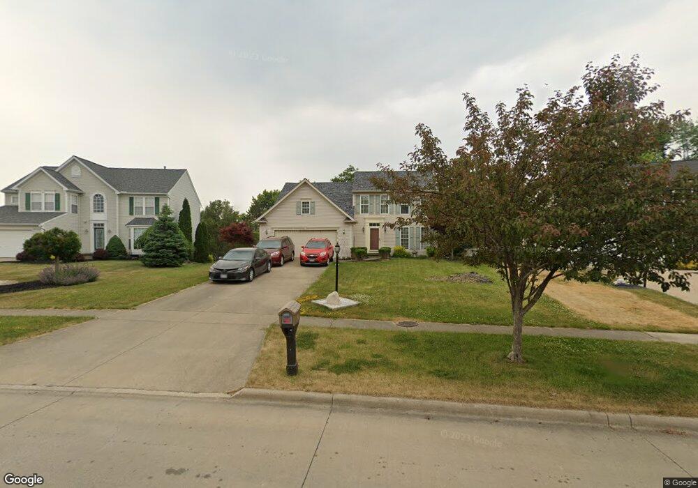
16516 Selby Cir Strongsville, OH 44136
Estimated Value: $441,000 - $509,000
3
Beds
3
Baths
2,438
Sq Ft
$190/Sq Ft
Est. Value
About This Home
This home is located at 16516 Selby Cir, Strongsville, OH 44136 and is currently estimated at $463,374, approximately $190 per square foot. 16516 Selby Cir is a home located in Cuyahoga County with nearby schools including Strongsville High School.
Ownership History
Date
Name
Owned For
Owner Type
Purchase Details
Closed on
Oct 29, 2001
Sold by
Nvr Inc
Bought by
Bartley William T and Bartley Theresa M
Current Estimated Value
Home Financials for this Owner
Home Financials are based on the most recent Mortgage that was taken out on this home.
Original Mortgage
$58,350
Outstanding Balance
$23,075
Interest Rate
6.88%
Estimated Equity
$440,299
Purchase Details
Closed on
Jul 30, 2001
Sold by
Nexcom Investment Ltd
Bought by
Nvr Inc and Ryan Homes
Create a Home Valuation Report for This Property
The Home Valuation Report is an in-depth analysis detailing your home's value as well as a comparison with similar homes in the area
Home Values in the Area
Average Home Value in this Area
Purchase History
| Date | Buyer | Sale Price | Title Company |
|---|---|---|---|
| Bartley William T | $228,400 | Nvr Title Agency Llc | |
| Nvr Inc | $55,000 | -- |
Source: Public Records
Mortgage History
| Date | Status | Borrower | Loan Amount |
|---|---|---|---|
| Open | Bartley William T | $58,350 |
Source: Public Records
Tax History Compared to Growth
Tax History
| Year | Tax Paid | Tax Assessment Tax Assessment Total Assessment is a certain percentage of the fair market value that is determined by local assessors to be the total taxable value of land and additions on the property. | Land | Improvement |
|---|---|---|---|---|
| 2024 | $6,601 | $140,595 | $26,495 | $114,100 |
| 2023 | $7,087 | $113,190 | $28,490 | $84,700 |
| 2022 | $7,036 | $113,190 | $28,490 | $84,700 |
| 2021 | $6,980 | $113,190 | $28,490 | $84,700 |
| 2020 | $6,468 | $92,790 | $23,350 | $69,440 |
| 2019 | $6,279 | $265,100 | $66,700 | $198,400 |
| 2018 | $5,448 | $92,790 | $23,350 | $69,440 |
| 2017 | $5,294 | $79,800 | $17,780 | $62,020 |
| 2016 | $5,251 | $79,800 | $17,780 | $62,020 |
| 2015 | $5,325 | $79,800 | $17,780 | $62,020 |
| 2014 | $5,325 | $79,800 | $17,780 | $62,020 |
Source: Public Records
Map
Nearby Homes
- 16650 Lanier Ave
- 17159 Turkey Meadow Ln
- 16486 S Red Rock Dr
- 17130 Golden Star Dr
- 16450 Howe Rd
- 17682 Drake Rd
- 18229 Howe Rd
- 17029 Eagles Nest Cir
- 18294 Drake Rd
- 17069 Partridge Dr
- 17934 Cambridge Oval
- 16711 Beech Cir
- 14558 Drake Rd
- 18411 Yorktown Oval
- 18162 Fawn Cir
- 17745 Brick Mill Run
- 14826 Lenox Dr
- 14132 Walking Stick Way
- 18987 Laurell Cir
- 14985 Camden Cir
- 16552 Selby Cir
- 16480 Selby Cir
- 16588 Selby Cir
- 16444 Selby Cir
- 16519 Delmont Ave
- 16561 Delmont Ave
- 16511 Delmont Ave
- 16408 Selby Cir
- 16507 Selby Cir
- 16605 Delmont Ave
- 16471 Selby Cir
- 16469 Delmont Ave
- 17183 Park Lane Dr
- 17171 Park Lane Dr
- 16543 Selby Cir
- 17195 Park Lane Dr
- 16609 Delmont Ave
- 16435 Selby Cir
- 16372 Selby Cir
- 17195 Parklane Dr