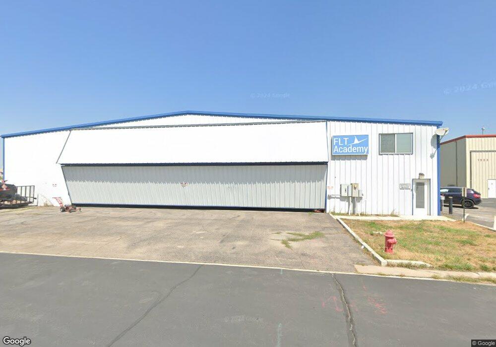
1652 W 1940 S Unit 58 Woods Cross, UT 84087
--
Bed
--
Bath
10,000
Sq Ft
0.62
Acres
About This Home
This home is located at 1652 W 1940 S Unit 58, Woods Cross, UT 84087. 1652 W 1940 S Unit 58 is a home located in Davis County with nearby schools including Odyssey School, South Davis Junior High School, and Woods Cross High School.
Ownership History
Date
Name
Owned For
Owner Type
Purchase Details
Closed on
Sep 17, 2024
Sold by
Lead Properties Llc
Bought by
Aurora Leasing Llc
Purchase Details
Closed on
Jul 19, 2021
Sold by
Jason Wallin Properties Llc
Bought by
Lead Properties Llc
Purchase Details
Closed on
Jun 28, 2019
Sold by
Ward R Charles and Ward Karma H
Bought by
Jason Wallin Properties Llc
Home Financials for this Owner
Home Financials are based on the most recent Mortgage that was taken out on this home.
Original Mortgage
$500,000
Interest Rate
4%
Mortgage Type
Commercial
Create a Home Valuation Report for This Property
The Home Valuation Report is an in-depth analysis detailing your home's value as well as a comparison with similar homes in the area
Home Values in the Area
Average Home Value in this Area
Purchase History
| Date | Buyer | Sale Price | Title Company |
|---|---|---|---|
| Aurora Leasing Llc | -- | Sutherland Title | |
| Lead Properties Llc | -- | Sutherland Title Com | |
| Jason Wallin Properties Llc | -- | Mountain View Title |
Source: Public Records
Mortgage History
| Date | Status | Borrower | Loan Amount |
|---|---|---|---|
| Previous Owner | Jason Wallin Properties Llc | $500,000 |
Source: Public Records
Tax History Compared to Growth
Tax History
| Year | Tax Paid | Tax Assessment Tax Assessment Total Assessment is a certain percentage of the fair market value that is determined by local assessors to be the total taxable value of land and additions on the property. | Land | Improvement |
|---|---|---|---|---|
| 2025 | $8,508 | $799,138 | $236,311 | $562,827 |
| 2024 | $8,288 | $435,812 | $126,258 | $309,554 |
| 2023 | $7,878 | $420,959 | $111,404 | $309,554 |
| 2022 | $7,837 | $765,380 | $202,553 | $562,827 |
| 2021 | $8,331 | $713,765 | $150,938 | $562,827 |
| 2020 | $8,318 | $706,760 | $143,933 | $562,827 |
| 2019 | $8,515 | $706,760 | $143,933 | $562,827 |
| 2018 | $7,467 | $602,000 | $69,273 | $532,727 |
| 2016 | $7,136 | $573,500 | $69,273 | $504,227 |
| 2015 | $6,637 | $500,000 | $69,273 | $430,727 |
| 2014 | $8,745 | $500,000 | $69,273 | $430,727 |
| 2013 | -- | $691,000 | $69,273 | $621,727 |
Source: Public Records
Map
Nearby Homes
- 1998 S 1600 W
- 1984 S 1500 W
- 1384 W 2175 S
- 1846 W 2280 S
- 1971 W 1870 S
- 1255 W 2050 S
- 1349 S Mountain Crest Dr
- 1422 W 1300 S
- 1334 W 1300 S
- 1844 S 2065 W
- 2038 W 2185 S
- 1309 W 1200 S
- 826 W Ivywell Ln Unit 219
- 828 W Ivywell Ln Unit 220
- 1153 N Meridian Ln Unit 120
- 1160 N Clifton Dr Unit 114
- 1156 N Clifton Dr Unit 115
- Kensington Plan at Clifton Place Townhomes
- Charleston Plan at Clifton Place Townhomes
- Camden Plan at Clifton Place Townhomes