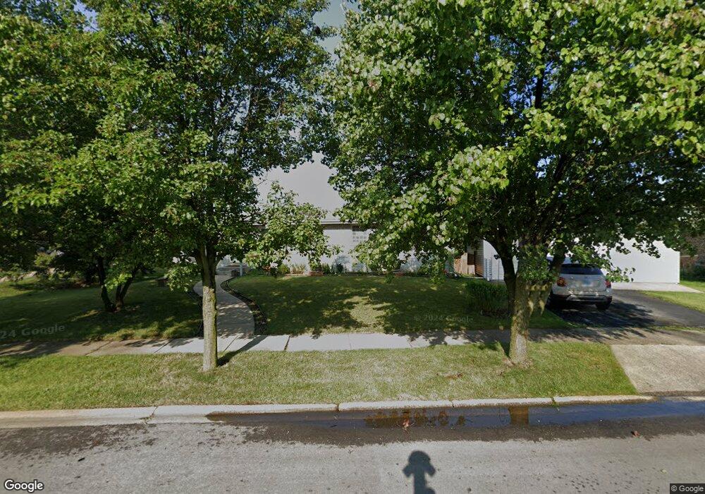
16520 George Dr Oak Forest, IL 60452
Estimated Value: $256,000 - $293,000
3
Beds
2
Baths
1,458
Sq Ft
$190/Sq Ft
Est. Value
About This Home
This home is located at 16520 George Dr, Oak Forest, IL 60452 and is currently estimated at $277,219, approximately $190 per square foot. 16520 George Dr is a home located in Cook County with nearby schools including Fieldcrest Elementary School, Prairie-Hills Junior High School, and Tinley Park High School.
Ownership History
Date
Name
Owned For
Owner Type
Purchase Details
Closed on
Dec 22, 1997
Sold by
Waitman Anne M Daley and Daley Anne Marie
Bought by
Ostrowski Eric A and Hailey Dazel J
Current Estimated Value
Home Financials for this Owner
Home Financials are based on the most recent Mortgage that was taken out on this home.
Original Mortgage
$105,317
Outstanding Balance
$17,865
Interest Rate
7.26%
Mortgage Type
FHA
Estimated Equity
$259,354
Purchase Details
Closed on
May 7, 1996
Sold by
Daley Terrence W
Bought by
Daley Anne Marie
Purchase Details
Closed on
Aug 30, 1993
Sold by
Gorman John Daniel and Gorman Pamela A
Bought by
Daley Terrence W and Daley Anne Marie
Home Financials for this Owner
Home Financials are based on the most recent Mortgage that was taken out on this home.
Original Mortgage
$92,000
Interest Rate
7.22%
Create a Home Valuation Report for This Property
The Home Valuation Report is an in-depth analysis detailing your home's value as well as a comparison with similar homes in the area
Home Values in the Area
Average Home Value in this Area
Purchase History
| Date | Buyer | Sale Price | Title Company |
|---|---|---|---|
| Ostrowski Eric A | $112,500 | -- | |
| Daley Anne Marie | -- | -- | |
| Daley Terrence W | $71,333 | -- |
Source: Public Records
Mortgage History
| Date | Status | Borrower | Loan Amount |
|---|---|---|---|
| Open | Ostrowski Eric A | $105,317 | |
| Previous Owner | Daley Terrence W | $92,000 |
Source: Public Records
Tax History Compared to Growth
Tax History
| Year | Tax Paid | Tax Assessment Tax Assessment Total Assessment is a certain percentage of the fair market value that is determined by local assessors to be the total taxable value of land and additions on the property. | Land | Improvement |
|---|---|---|---|---|
| 2024 | $6,661 | $21,000 | $4,545 | $16,455 |
| 2023 | $6,177 | $21,000 | $4,545 | $16,455 |
| 2022 | $6,177 | $15,550 | $4,040 | $11,510 |
| 2021 | $6,029 | $15,549 | $4,040 | $11,509 |
| 2020 | $6,021 | $15,549 | $4,040 | $11,509 |
| 2019 | $6,505 | $16,889 | $3,787 | $13,102 |
| 2018 | $6,385 | $16,889 | $3,787 | $13,102 |
| 2017 | $6,129 | $16,889 | $3,787 | $13,102 |
| 2016 | $5,990 | $15,290 | $3,282 | $12,008 |
| 2015 | $5,674 | $15,290 | $3,282 | $12,008 |
| 2014 | $5,567 | $15,290 | $3,282 | $12,008 |
| 2013 | $5,354 | $16,488 | $3,282 | $13,206 |
Source: Public Records
Map
Nearby Homes
- 16465 Roy St
- 4401 Adele Ln
- 16453 Harold St
- 16520 Brenden Ln
- 16524 Brockton Ln
- 16409 Craig Dr
- 4348 Mann St
- 4363 Henry St
- 16740 Forest Ave
- 4316 Mann St
- 4230 Barry Ln
- 16224 S Cicero Ave
- 16934 Cicero Ave
- 16938 Cicero Ave
- 5112 Deerpath Rd Unit 4
- 16104 Oak Ave
- 5103 Elmwood Rd
- 5185 Greentree Rd
- 5256 169th Place
- 15240 S Cicero Ave
- 16512 George Dr
- 16528 George Dr
- 16531 Lockridge Ave
- 16508 George Dr
- 16521 Lockridge Ave
- 16541 Lockridge Ave
- 16515 George Dr
- 16511 Lockridge Ave
- 16534 Terry Ct
- 16532 Terry Ct
- 16511 George Dr
- 16551 Lockridge Ave
- 16504 George Dr
- 16516 Terry Ln
- 16501 Lockridge Ave
- 16509 George Dr
- 16561 Lockridge Ave
- 16500 George Dr
- 16512 Terry Ln
- 16505 George Dr