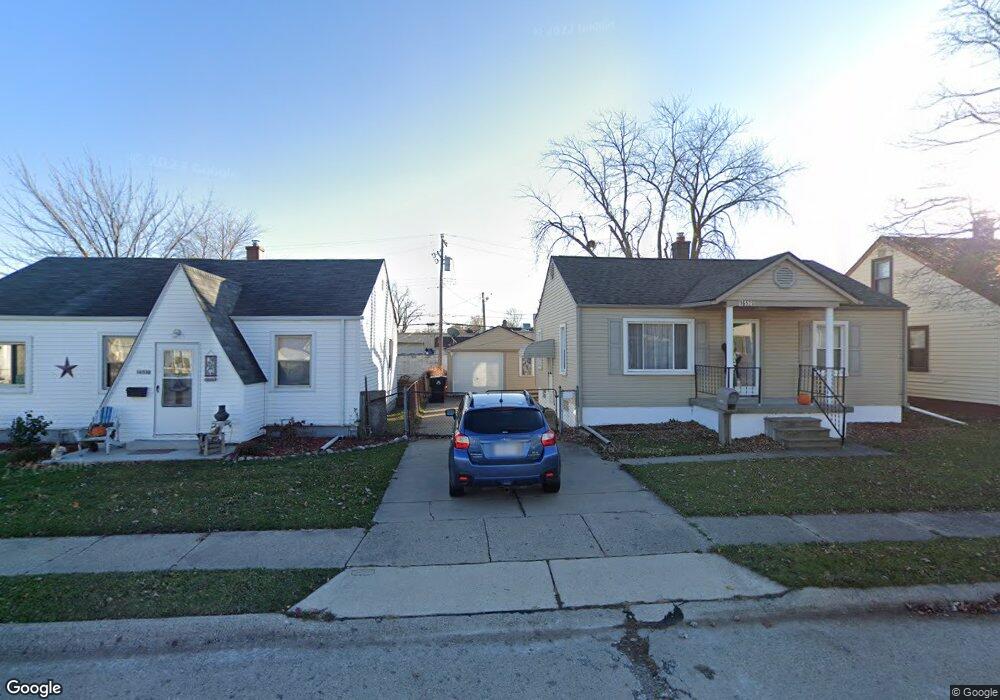
16520 Roberts St Unit Bldg-Unit Roseville, MI 48066
Estimated Value: $142,000 - $157,611
2
Beds
2
Baths
735
Sq Ft
$199/Sq Ft
Est. Value
About This Home
This home is located at 16520 Roberts St Unit Bldg-Unit, Roseville, MI 48066 and is currently estimated at $145,903, approximately $198 per square foot. 16520 Roberts St Unit Bldg-Unit is a home located in Macomb County with nearby schools including Dort Elementary School, Joseph G. Steenland Elementary School, and Fountain Elementary School.
Ownership History
Date
Name
Owned For
Owner Type
Purchase Details
Closed on
Mar 31, 2022
Sold by
Raychelle Lyman
Bought by
Lyman Raychelle
Current Estimated Value
Purchase Details
Closed on
Oct 23, 2020
Sold by
Lam Chi
Bought by
Lyman Raychelle
Purchase Details
Closed on
Jan 10, 2018
Sold by
Schumacher Scott J
Bought by
Lam Chi
Purchase Details
Closed on
Sep 2, 2005
Sold by
Lopez Vickie M
Bought by
Schumacher Scott J
Purchase Details
Closed on
Aug 14, 1997
Sold by
Johnson J and Johnson L
Bought by
Lopez V
Create a Home Valuation Report for This Property
The Home Valuation Report is an in-depth analysis detailing your home's value as well as a comparison with similar homes in the area
Home Values in the Area
Average Home Value in this Area
Purchase History
| Date | Buyer | Sale Price | Title Company |
|---|---|---|---|
| Lyman Raychelle | $130,000 | Vanguard Title | |
| Lyman Raychelle | $105,000 | Partners Title Agency Llc | |
| Lam Chi | $71,800 | Title Express Llc | |
| Schumacher Scott J | $99,900 | Htc | |
| Lopez V | $65,500 | -- |
Source: Public Records
Tax History Compared to Growth
Tax History
| Year | Tax Paid | Tax Assessment Tax Assessment Total Assessment is a certain percentage of the fair market value that is determined by local assessors to be the total taxable value of land and additions on the property. | Land | Improvement |
|---|---|---|---|---|
| 2025 | -- | $50,600 | $0 | $0 |
| 2024 | -- | $49,300 | $0 | $0 |
| 2023 | -- | $0 | $0 | $0 |
| 2022 | $1,205 | $39,400 | $0 | $0 |
| 2021 | $2,843 | $37,100 | $0 | $0 |
| 2020 | $1,007 | $32,300 | $0 | $0 |
| 2019 | $1,547 | $29,200 | $0 | $0 |
| 2018 | $1,088 | $7,180 | $0 | $0 |
| 2017 | $1,436 | $21,800 | $4,500 | $17,300 |
| 2016 | $1,426 | $21,800 | $0 | $0 |
| 2015 | $678 | $20,725 | $0 | $0 |
| 2013 | -- | $20,266 | $0 | $0 |
| 2011 | -- | $27,541 | $0 | $0 |
Source: Public Records
Map
Nearby Homes
- 25110 Ford St
- 25530 Chalmers St
- 16097 Manchester Ave
- 16561 Capri Place
- 16106 Chesterfield Ave
- 16850 May St
- 25287 Buick St
- 16123 Bell Ave
- 25825 Berkshire St
- 25673 Ford St
- 24656 Dwight Ave
- 16656 Frazho Rd
- 24860 Saxony Ave
- 16531 Frazho Rd
- 16511 Frazho Rd
- 24707 Saxony Ave
- 25143 Fern St
- 16142 Frazho Rd
- 25124 Blair St
- 24869 Tuscany Ave
- 16520 Roberts St
- 16530 Roberts St
- 16510 Roberts St
- 16538 Roberts St
- 16519 Roberts St
- 16509 Roberts St
- 16541 Roberts St
- 16490 Roberts St
- 16495 Roberts St
- 16616 Roberts St
- 16480 Roberts St
- 16579 Roberts St
- 16485 Roberts St
- 16500 Bowman St
- 16508 Bowman St
- 16615 Roberts St
- 16475 Roberts St
- 16492 Bowman St
- 16470 Roberts St
- 16626 Roberts St