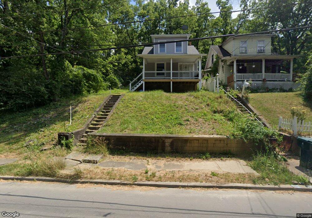
1653 Carll St Cincinnati, OH 45225
North Fairmount NeighborhoodEstimated Value: $74,539 - $101,000
2
Beds
1
Bath
1,264
Sq Ft
$70/Sq Ft
Est. Value
About This Home
This home is located at 1653 Carll St, Cincinnati, OH 45225 and is currently estimated at $88,635, approximately $70 per square foot. 1653 Carll St is a home located in Hamilton County with nearby schools including Ethel M. Taylor Academy, Robert A. Taft Information Technology High School, and Gilbert A. Dater High School.
Ownership History
Date
Name
Owned For
Owner Type
Purchase Details
Closed on
Oct 8, 2020
Sold by
Greer Olivia D
Bought by
Chyaman Adriana
Current Estimated Value
Purchase Details
Closed on
Feb 25, 2019
Sold by
Brown Earle F
Bought by
Greer Olivia D
Purchase Details
Closed on
Apr 19, 2002
Sold by
Johnny Greer and Johnny M
Bought by
Greer Olivia D
Create a Home Valuation Report for This Property
The Home Valuation Report is an in-depth analysis detailing your home's value as well as a comparison with similar homes in the area
Home Values in the Area
Average Home Value in this Area
Purchase History
| Date | Buyer | Sale Price | Title Company |
|---|---|---|---|
| Chyaman Adriana | $18,500 | Rivertowne Title | |
| Greer Olivia D | -- | None Available | |
| Greer Olivia D | -- | -- |
Source: Public Records
Tax History
| Year | Tax Paid | Tax Assessment Tax Assessment Total Assessment is a certain percentage of the fair market value that is determined by local assessors to be the total taxable value of land and additions on the property. | Land | Improvement |
|---|---|---|---|---|
| 2025 | $774 | $12,082 | $1,449 | $10,633 |
| 2024 | $773 | $12,082 | $1,449 | $10,633 |
| 2023 | $775 | $12,082 | $1,449 | $10,633 |
| 2022 | $587 | $8,201 | $1,456 | $6,745 |
| 2021 | $574 | $8,201 | $1,456 | $6,745 |
| 2020 | $576 | $8,201 | $1,456 | $6,745 |
| 2019 | $575 | $7,455 | $1,323 | $6,132 |
| 2018 | $575 | $7,455 | $1,323 | $6,132 |
| 2017 | $554 | $7,455 | $1,323 | $6,132 |
| 2016 | $280 | $3,623 | $1,656 | $1,967 |
| 2015 | $251 | $3,623 | $1,656 | $1,967 |
| 2014 | $252 | $3,623 | $1,656 | $1,967 |
| 2013 | $253 | $3,584 | $1,638 | $1,946 |
Source: Public Records
Map
Nearby Homes
- 2658 Linden St
- 2656 Linden St
- 2654 Linden St
- 2652 Linden St
- 2650 Linden St
- 1674 Baltimore Ave
- 1613 Pulte St
- 1607 Pulte St
- 2568 Trevor Place
- 1646 Pulte St
- 2594 Seegar Ave
- 2572 Liddell St
- 2564 Linden St
- 1781 Baltimore Ave
- 1642 Sutter Ave
- 2911 Moosewood Ct
- 1793 Baltimore Ave
- 1797 Denham St
- 1808 Carll St
- 1637 Waverly Ave
- 1655 Carll St
- 1645 Carll St
- 1654 Baltimore Ave
- 1680 Baltimore Ave
- 1658 Carll St
- 1640 Carll St
- 1637 Carll St
- 1660 Carll St
- 1650 Baltimore Ave
- 1636 Carll St
- 1633 Carll St
- 1700 Baltimore Ave
- 1651 Baltimore Ave
- 1632 Carll St
- 1647 Baltimore Ave
- 1630 Carll St
- 1645 Denham St
- 1641 Denham St
- 1706 Baltimore Ave
- 1639 Denham St
Your Personal Tour Guide
Ask me questions while you tour the home.