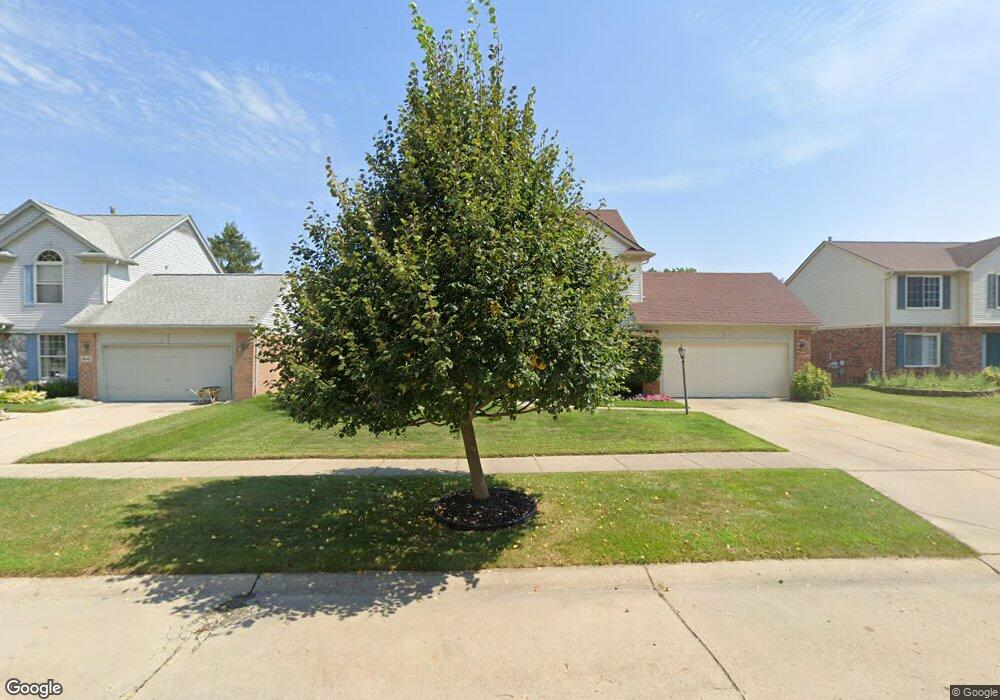
1653 Dunston Rd Canton, MI 48188
Estimated Value: $413,519 - $485,000
--
Bed
3
Baths
2,208
Sq Ft
$205/Sq Ft
Est. Value
About This Home
This home is located at 1653 Dunston Rd, Canton, MI 48188 and is currently estimated at $452,130, approximately $204 per square foot. 1653 Dunston Rd is a home located in Wayne County with nearby schools including Canton High School, Salem High School, and Plymouth High School.
Ownership History
Date
Name
Owned For
Owner Type
Purchase Details
Closed on
Nov 23, 2010
Sold by
Blayer Carolyn M and Wilson Carolyn M
Bought by
Wilson Carolyn M and Wilson Lawrence
Current Estimated Value
Home Financials for this Owner
Home Financials are based on the most recent Mortgage that was taken out on this home.
Original Mortgage
$144,000
Interest Rate
4.19%
Mortgage Type
New Conventional
Create a Home Valuation Report for This Property
The Home Valuation Report is an in-depth analysis detailing your home's value as well as a comparison with similar homes in the area
Home Values in the Area
Average Home Value in this Area
Purchase History
| Date | Buyer | Sale Price | Title Company |
|---|---|---|---|
| Wilson Carolyn M | -- | Title Direct |
Source: Public Records
Mortgage History
| Date | Status | Borrower | Loan Amount |
|---|---|---|---|
| Closed | Wilson Carolyn M | $144,000 |
Source: Public Records
Tax History Compared to Growth
Tax History
| Year | Tax Paid | Tax Assessment Tax Assessment Total Assessment is a certain percentage of the fair market value that is determined by local assessors to be the total taxable value of land and additions on the property. | Land | Improvement |
|---|---|---|---|---|
| 2025 | $2,410 | $214,200 | $0 | $0 |
| 2024 | $2,410 | $208,500 | $0 | $0 |
| 2023 | $2,298 | $177,200 | $0 | $0 |
| 2022 | $5,016 | $156,100 | $0 | $0 |
| 2021 | $4,867 | $153,800 | $0 | $0 |
| 2020 | $4,806 | $153,200 | $0 | $0 |
| 2019 | $4,720 | $145,280 | $0 | $0 |
| 2018 | $1,953 | $137,910 | $0 | $0 |
| 2017 | $4,797 | $138,400 | $0 | $0 |
| 2016 | $4,290 | $135,700 | $0 | $0 |
| 2015 | $10,731 | $120,580 | $0 | $0 |
| 2013 | $10,396 | $109,600 | $0 | $0 |
| 2010 | -- | $108,830 | $53,900 | $54,930 |
Source: Public Records
Map
Nearby Homes
- 1913 Pebble Creek Dr
- 39605 Dorchester Cir
- 2098 Preserve Cir W Unit 80
- 40488 Glen Eagle Ln Unit 75
- 39260 Phlox Ln Unit 12
- 1786 Daisy Ln
- 2065 Pinecroft Dr Unit 201
- 2322 Arcadia Dr Unit 254
- 1803 Pinecroft Dr Unit 171
- 2297 Hannan Rd
- 2448 Arcadia Dr
- 39250 Northampton St
- 2618 Hannan Rd
- 632 Georgetown St
- 39214 Dillingham St
- 38692 Watson Cir
- 00000 Avondale St
- 39615 Kirkland Dr
- 000 S Lotz Rd
- 41441 Cumberland Dr
- 1641 Dunston Rd
- 1675 Dunston Rd
- 1689 Dunston Rd
- 1614 Crestview Dr
- 1648 Dunston Rd
- 1622 Crestview Dr
- 1662 Dunston Rd
- 1634 Dunston Rd
- 1709 Dunston Rd
- 1680 Dunston Rd
- 1630 Crestview Dr
- 1618 Dunston Rd
- 1732 Crestview Dr
- 1718 Crestview Dr
- 1740 Crestview Dr
- 1710 Crestview Dr
- 1694 Dunston Rd
- 1600 Dunston Rd
- 1731 Dunston Rd
- 1752 Crestview Dr