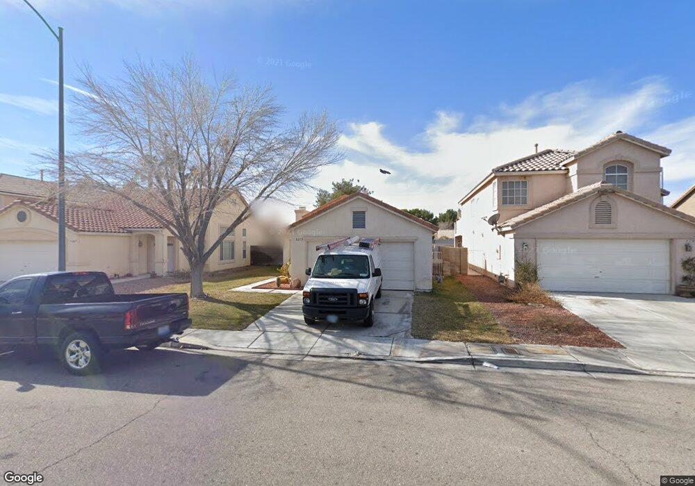
1653 Splinter Rock Way North Las Vegas, NV 89031
Craig Ranch NeighborhoodEstimated Value: $349,002 - $373,000
3
Beds
2
Baths
1,138
Sq Ft
$314/Sq Ft
Est. Value
About This Home
This home is located at 1653 Splinter Rock Way, North Las Vegas, NV 89031 and is currently estimated at $357,001, approximately $313 per square foot. 1653 Splinter Rock Way is a home located in Clark County with nearby schools including Lee Antonello Elementary School, Brian & Teri Cram Middle School, and Legacy High School.
Ownership History
Date
Name
Owned For
Owner Type
Purchase Details
Closed on
Dec 21, 2004
Sold by
Gulley Phillip Dean
Bought by
Gulley Phillip Dean
Current Estimated Value
Home Financials for this Owner
Home Financials are based on the most recent Mortgage that was taken out on this home.
Original Mortgage
$107,500
Interest Rate
5.76%
Mortgage Type
New Conventional
Purchase Details
Closed on
Mar 17, 1999
Sold by
Hill Melissa A
Bought by
Gulley Phillip Dean
Purchase Details
Closed on
May 12, 1995
Sold by
Pardee Construction Company Of Nevada
Bought by
Gulley Phillip Dean and Gulley Melissa A
Home Financials for this Owner
Home Financials are based on the most recent Mortgage that was taken out on this home.
Original Mortgage
$95,950
Interest Rate
8.43%
Mortgage Type
Assumption
Create a Home Valuation Report for This Property
The Home Valuation Report is an in-depth analysis detailing your home's value as well as a comparison with similar homes in the area
Home Values in the Area
Average Home Value in this Area
Purchase History
| Date | Buyer | Sale Price | Title Company |
|---|---|---|---|
| Gulley Phillip Dean | -- | Southwest Title | |
| Gulley Phillip Dean | -- | -- | |
| Gulley Phillip Dean | $96,000 | National Title Company |
Source: Public Records
Mortgage History
| Date | Status | Borrower | Loan Amount |
|---|---|---|---|
| Closed | Gulley Phillip Dean | $107,500 | |
| Previous Owner | Gulley Phillip Dean | $95,950 |
Source: Public Records
Tax History Compared to Growth
Tax History
| Year | Tax Paid | Tax Assessment Tax Assessment Total Assessment is a certain percentage of the fair market value that is determined by local assessors to be the total taxable value of land and additions on the property. | Land | Improvement |
|---|---|---|---|---|
| 2025 | $1,109 | $75,427 | $31,500 | $43,927 |
| 2024 | $1,077 | $75,427 | $31,500 | $43,927 |
| 2023 | $1,077 | $70,904 | $29,050 | $41,854 |
| 2022 | $1,046 | $60,761 | $22,400 | $38,361 |
| 2021 | $1,016 | $57,643 | $21,000 | $36,643 |
| 2020 | $983 | $57,107 | $20,650 | $36,457 |
| 2019 | $971 | $53,820 | $17,850 | $35,970 |
| 2018 | $927 | $49,144 | $14,350 | $34,794 |
| 2017 | $1,608 | $47,947 | $12,600 | $35,347 |
| 2016 | $869 | $43,661 | $8,750 | $34,911 |
| 2015 | $866 | $35,200 | $7,000 | $28,200 |
| 2014 | $840 | $24,780 | $7,000 | $17,780 |
Source: Public Records
Map
Nearby Homes
- 6056 Fort Wayne Ct
- 1515 Fort Dix Cir
- 5871 Prairie Ridge Cir
- 1611 Spotted Pony Dr
- 5904 Arrowleaf St
- 5823 Rose Sage St
- 6126 Leaning Rock Ct
- 1415 Black Hills Way
- 1901 Desert Sage Ave
- 1903 Ginger Blossom Ave
- 1323 Borderwood Ln
- 1642 Heather Ridge Rd
- 5655 Indian Springs St
- 6241 Golden Rain St
- 5738 Bear Springs St
- 1910 Night Shadow Ave
- 6236 Badgerglen Place
- 5624 Deer Run Ct
- 5912 Hollowridge Rd
- 2116 W El Campo Grande Ave
- 1705 Splinter Rock Way
- 1649 Splinter Rock Way
- 1709 Splinter Rock Way
- 1645 Splinter Rock Way
- 1713 Splinter Rock Way
- 1641 Splinter Rock Way
- 6032 Fort Wayne Ct
- 1648 Splinter Rock Way
- 1740 Desert Ridge Ave Unit 5
- 1740 Desert Ridge Ave
- 1730 Desert Ridge Ave
- 1644 Splinter Rock Way
- 1750 Desert Ridge Ave
- 1637 Splinter Rock Way
- 1717 Splinter Rock Way
- 1720 Desert Ridge Ave
- 6036 Fort Wayne Ct
- 1640 Splinter Rock Way
- 1760 Desert Ridge Ave
- 1633 Splinter Rock Way