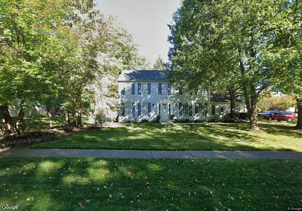
16534 S White Oaks Dr Strongsville, OH 44136
Estimated Value: $366,000 - $370,000
4
Beds
3
Baths
2,400
Sq Ft
$154/Sq Ft
Est. Value
About This Home
This home is located at 16534 S White Oaks Dr, Strongsville, OH 44136 and is currently estimated at $368,674, approximately $153 per square foot. 16534 S White Oaks Dr is a home located in Cuyahoga County with nearby schools including Strongsville High School and Saint Ambrose Catholic School.
Ownership History
Date
Name
Owned For
Owner Type
Purchase Details
Closed on
May 9, 2016
Sold by
Damert Sandra J
Bought by
Damert Sandra J
Current Estimated Value
Purchase Details
Closed on
Mar 24, 1992
Bought by
Damert Sandra J
Purchase Details
Closed on
Jun 22, 1984
Sold by
Prescott James A
Bought by
Damert Gary Jay & Sandra J
Purchase Details
Closed on
Dec 22, 1981
Sold by
Sayers Michael R
Bought by
Prescott James A
Purchase Details
Closed on
Mar 6, 1980
Sold by
Oconnor Ernest T
Bought by
Sayers Michael R
Purchase Details
Closed on
Jun 15, 1978
Bought by
Oconnor Ernest T
Purchase Details
Closed on
Jan 5, 1978
Bought by
New Concord Homes Inc
Purchase Details
Closed on
Jan 1, 1977
Bought by
North East Land Co
Create a Home Valuation Report for This Property
The Home Valuation Report is an in-depth analysis detailing your home's value as well as a comparison with similar homes in the area
Home Values in the Area
Average Home Value in this Area
Purchase History
| Date | Buyer | Sale Price | Title Company |
|---|---|---|---|
| Damert Sandra J | -- | Attorney | |
| Damert Sandra J | -- | -- | |
| Damert Gary Jay & Sandra J | $120,500 | -- | |
| Prescott James A | $109,000 | -- | |
| Sayers Michael R | $107,000 | -- | |
| Oconnor Ernest T | $87,600 | -- | |
| New Concord Homes Inc | $27,000 | -- | |
| North East Land Co | -- | -- |
Source: Public Records
Tax History Compared to Growth
Tax History
| Year | Tax Paid | Tax Assessment Tax Assessment Total Assessment is a certain percentage of the fair market value that is determined by local assessors to be the total taxable value of land and additions on the property. | Land | Improvement |
|---|---|---|---|---|
| 2024 | $5,242 | $111,650 | $23,065 | $88,585 |
| 2023 | $5,424 | $86,630 | $23,490 | $63,140 |
| 2022 | $5,385 | $86,630 | $23,490 | $63,140 |
| 2021 | $5,342 | $86,630 | $23,490 | $63,140 |
| 2020 | $4,951 | $71,020 | $19,250 | $51,770 |
| 2019 | $4,805 | $202,900 | $55,000 | $147,900 |
| 2018 | $4,278 | $71,020 | $19,250 | $51,770 |
| 2017 | $4,291 | $64,680 | $15,260 | $49,420 |
| 2016 | $4,237 | $64,400 | $15,260 | $49,140 |
| 2015 | $4,194 | $64,400 | $15,260 | $49,140 |
| 2014 | $4,297 | $64,400 | $15,260 | $49,140 |
Source: Public Records
Map
Nearby Homes
- 16711 Beech Cir
- 16486 S Red Rock Dr
- 18229 Howe Rd
- 17130 Golden Star Dr
- 17159 Turkey Meadow Ln
- 3550 Boston Rd
- 17682 Drake Rd
- 15604-REAR Boston Rd
- 19694 Benbow Rd
- 19740 Benbow Rd
- 14985 Camden Cir
- 17024 Bear Creek Ln
- 16650 Lanier Ave
- 97 Weathervane Ln
- 18411 Yorktown Oval
- 15188 Trails Landing
- 18987 Laurell Cir
- 17934 Cambridge Oval
- 18294 Drake Rd
- 16450 Howe Rd
- 17210 Gold Rush Dr
- 17206 Gold Rush Dr
- 17215 Gold Rush Dr
- 17211 Gold Rush Dr
- 16542 S White Oaks Dr
- 16549 S White Oaks Dr
- 16553 S White Oaks Dr
- 17207 Gold Rush Dr
- 17219 Misty Lake Dr
- 17207 Misty Lake Dr
- 17202 Gold Rush Dr
- 17223 Misty Lake Dr
- 17203 Gold Rush Dr
- 17203 Misty Lake Dr
- 16568 Pepperwood Ct
- 17198 Gold Rush Dr
- 16617 Pepperwood Ct
- 16617 Pepperwood Ct Unit 34
- 16592 Falmouth Dr
- 17208 Misty Lake Dr