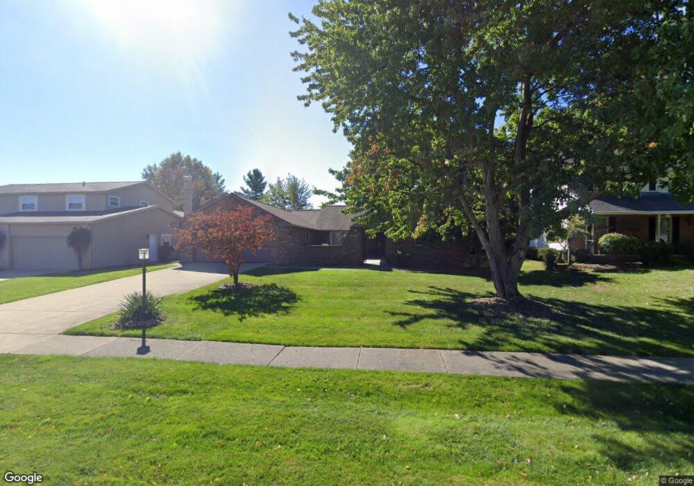
16535 S Red Rock Dr Strongsville, OH 44136
Estimated Value: $362,837 - $416,000
4
Beds
2
Baths
2,554
Sq Ft
$151/Sq Ft
Est. Value
About This Home
This home is located at 16535 S Red Rock Dr, Strongsville, OH 44136 and is currently estimated at $385,709, approximately $151 per square foot. 16535 S Red Rock Dr is a home located in Cuyahoga County with nearby schools including Strongsville High School.
Ownership History
Date
Name
Owned For
Owner Type
Purchase Details
Closed on
Jul 3, 2018
Sold by
Zucco George C and Zucco Martha M
Bought by
Zucco George C
Current Estimated Value
Purchase Details
Closed on
Aug 4, 1992
Sold by
Zucco George C
Bought by
Zucco George C
Purchase Details
Closed on
Dec 8, 1987
Sold by
Marge Mittelstadt
Bought by
Zucco George C
Purchase Details
Closed on
Jul 30, 1980
Sold by
Mittelstadt Dennis G
Bought by
Marge Mittelstadt
Purchase Details
Closed on
Oct 1, 1979
Sold by
Mittelstadt Dennis G and Mittelstadt Marge
Bought by
Mittelstadt Dennis G
Purchase Details
Closed on
Jan 3, 1979
Bought by
Mittelstadt Dennis G and Mittelstadt Marge
Purchase Details
Closed on
Jan 1, 1977
Bought by
Howison Homes Inc
Create a Home Valuation Report for This Property
The Home Valuation Report is an in-depth analysis detailing your home's value as well as a comparison with similar homes in the area
Home Values in the Area
Average Home Value in this Area
Purchase History
| Date | Buyer | Sale Price | Title Company |
|---|---|---|---|
| Zucco George C | -- | None Available | |
| Zucco George C | -- | -- | |
| Zucco George C | $111,500 | -- | |
| Marge Mittelstadt | -- | -- | |
| Mittelstadt Dennis G | -- | -- | |
| Mittelstadt Dennis G | $101,500 | -- | |
| Howison Homes Inc | -- | -- |
Source: Public Records
Tax History Compared to Growth
Tax History
| Year | Tax Paid | Tax Assessment Tax Assessment Total Assessment is a certain percentage of the fair market value that is determined by local assessors to be the total taxable value of land and additions on the property. | Land | Improvement |
|---|---|---|---|---|
| 2024 | $4,651 | $108,850 | $22,015 | $86,835 |
| 2023 | $5,030 | $89,500 | $22,300 | $67,200 |
| 2022 | $5,019 | $89,500 | $22,300 | $67,200 |
| 2021 | $4,980 | $89,500 | $22,300 | $67,200 |
| 2020 | $4,504 | $73,360 | $18,270 | $55,090 |
| 2019 | $4,372 | $209,600 | $52,200 | $157,400 |
| 2018 | $1,984 | $73,360 | $18,270 | $55,090 |
| 2017 | $3,948 | $68,260 | $14,460 | $53,800 |
| 2016 | $3,916 | $68,260 | $14,460 | $53,800 |
| 2015 | $3,971 | $68,260 | $14,460 | $53,800 |
| 2014 | $3,971 | $68,260 | $14,460 | $53,800 |
Source: Public Records
Map
Nearby Homes
- 16486 S Red Rock Dr
- 17130 Golden Star Dr
- 17159 Turkey Meadow Ln
- 18229 Howe Rd
- 17682 Drake Rd
- 16650 Lanier Ave
- 16711 Beech Cir
- 17024 Bear Creek Ln
- 18294 Drake Rd
- 17934 Cambridge Oval
- 18411 Yorktown Oval
- 16450 Howe Rd
- 3550 Boston Rd
- 14985 Camden Cir
- 19694 Benbow Rd
- 15604-REAR Boston Rd
- 18987 Laurell Cir
- 19740 Benbow Rd
- 17069 Partridge Dr
- 15188 Trails Landing
- 16539 S Red Rock Dr
- 16531 S Red Rock Dr
- 16527 S Red Rock Dr
- 16543 S Red Rock Dr
- 16536 Pepper Grass Cir
- 16540 Pepper Grass Cir
- 16532 Pepper Grass Cir
- 16547 S Red Rock Dr
- 16536 S Red Rock Dr
- 16540 S Red Rock Dr
- 16544 Pepper Grass Cir
- 16532 S Red Rock Dr
- 17160 Misty Lake Dr
- 16544 S Red Rock Dr
- 17156 Misty Lake Dr
- 17164 Misty Lake Dr
- 16528 S Red Rock Dr
- 17168 Misty Lake Dr
- 16528 Pepper Grass Cir
- 16551 S Red Rock Dr