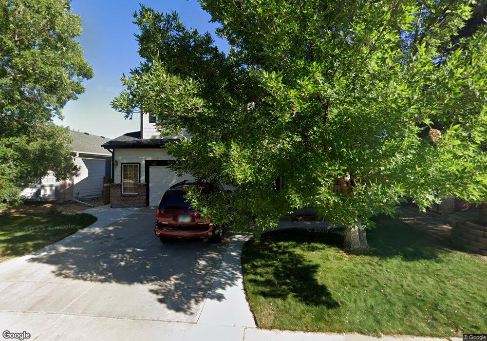
1655 E 131st Cir Thornton, CO 80241
Hunters Glen NeighborhoodEstimated Value: $534,000 - $546,000
3
Beds
3
Baths
2,700
Sq Ft
$201/Sq Ft
Est. Value
About This Home
This home is located at 1655 E 131st Cir, Thornton, CO 80241 and is currently estimated at $541,758, approximately $200 per square foot. 1655 E 131st Cir is a home located in Adams County with nearby schools including Hunters Glen Elementary School, Century Middle School, and Mountain Range High School.
Ownership History
Date
Name
Owned For
Owner Type
Purchase Details
Closed on
Feb 10, 2003
Sold by
Parker Janet Jillian and Rosengren Dave A
Bought by
Parker Janet Jillian
Current Estimated Value
Home Financials for this Owner
Home Financials are based on the most recent Mortgage that was taken out on this home.
Original Mortgage
$112,000
Outstanding Balance
$45,821
Interest Rate
5.83%
Estimated Equity
$495,937
Purchase Details
Closed on
Dec 30, 1998
Sold by
Kdb Homes Inc
Bought by
Rosengren Dave A and Parker Janet Jillian
Home Financials for this Owner
Home Financials are based on the most recent Mortgage that was taken out on this home.
Original Mortgage
$112,400
Interest Rate
6.74%
Create a Home Valuation Report for This Property
The Home Valuation Report is an in-depth analysis detailing your home's value as well as a comparison with similar homes in the area
Home Values in the Area
Average Home Value in this Area
Purchase History
| Date | Buyer | Sale Price | Title Company |
|---|---|---|---|
| Parker Janet Jillian | -- | -- | |
| Rosengren Dave A | $176,621 | First American Heritage Titl |
Source: Public Records
Mortgage History
| Date | Status | Borrower | Loan Amount |
|---|---|---|---|
| Open | Parker Janet Jillian | $112,000 | |
| Closed | Rosengren Dave A | $112,400 |
Source: Public Records
Tax History Compared to Growth
Tax History
| Year | Tax Paid | Tax Assessment Tax Assessment Total Assessment is a certain percentage of the fair market value that is determined by local assessors to be the total taxable value of land and additions on the property. | Land | Improvement |
|---|---|---|---|---|
| 2025 | $2,822 | $35,220 | $8,500 | $26,720 |
| 2024 | $2,822 | $32,370 | $7,810 | $24,560 |
| 2023 | $2,793 | $37,750 | $7,100 | $30,650 |
| 2022 | $2,112 | $26,120 | $7,300 | $18,820 |
| 2021 | $2,183 | $26,120 | $7,300 | $18,820 |
| 2020 | $2,107 | $26,040 | $7,510 | $18,530 |
| 2019 | $2,112 | $26,040 | $7,510 | $18,530 |
| 2018 | $2,698 | $23,450 | $7,490 | $15,960 |
| 2017 | $2,453 | $23,450 | $7,490 | $15,960 |
| 2016 | $2,175 | $20,240 | $5,170 | $15,070 |
| 2015 | $2,172 | $20,240 | $5,170 | $15,070 |
| 2014 | -- | $18,050 | $3,580 | $14,470 |
Source: Public Records
Map
Nearby Homes
- 1162 E 130th Ave Unit B
- 12931 Lafayette St Unit G
- 12905 Lafayette St Unit H
- 56 Blue Heron Dr
- 2275 E 129th Ave
- 2297 E 128th Ave
- 2651 E 132nd Ave
- 2420 E 127th Ave
- 2788 E 132nd Cir
- 13242 Pearl Cir
- 13342 Clayton St
- 2375 Lake Ave
- 12534 2nd St
- 13550 Washington St Unit 7C
- 0 128th & Washington St
- 2670 E 136th Place
- 3450 E 128th Place
- 12380 Irma Dr
- 12962 Grant Cir E Unit A
- 12962 Grant Cir E Unit C
- 1651 E 131st Cir
- 1659 E 131st Cir
- 1649 E 131st Cir
- 1661 E 131st Cir
- 1654 E 131st Ct
- 1645 E 131st Cir
- 1665 E 131st Cir
- 1648 E 131st Cir
- 1641 E 131st Cir
- 1660 E 131st Ct
- 1669 E 131st Cir
- 1684 E 131st Ct
- 1668 E 131st Ct
- 1671 E 131st Cir
- 1639 E 131st Cir
- 1678 E 131st Ct
- 1642 E 131st Cir
- 1635 E 131st Cir
- 1672 E 131st Ct
- 1675 E 131st Cir