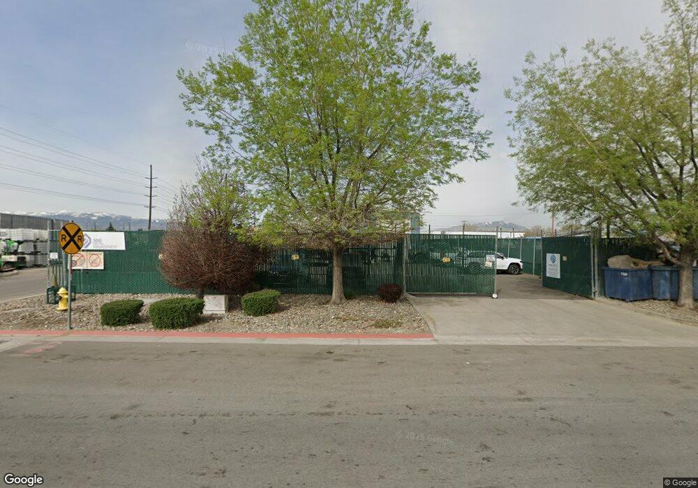
1655 Franklin Way Sparks, NV 89431
Estimated Value: $3,068,005
--
Bed
--
Bath
2,800
Sq Ft
$1,096/Sq Ft
Est. Value
About This Home
This home is located at 1655 Franklin Way, Sparks, NV 89431 and is currently estimated at $3,068,005, approximately $1,095 per square foot. 1655 Franklin Way is a home located in Washoe County with nearby schools including Hidden Valley Elementary School, Edward L Pine Middle School, and Earl Wooster High School.
Ownership History
Date
Name
Owned For
Owner Type
Purchase Details
Closed on
Feb 25, 2008
Sold by
Western Nevada Materials Llc
Bought by
Sims Group Usa Corp
Current Estimated Value
Purchase Details
Closed on
Oct 12, 2006
Sold by
Dp Industrial Llc
Bought by
Western Nevada Materials Llc
Purchase Details
Closed on
Feb 5, 2003
Sold by
Dp Operating Partnership Lp
Bought by
Dp Industrial Llc
Create a Home Valuation Report for This Property
The Home Valuation Report is an in-depth analysis detailing your home's value as well as a comparison with similar homes in the area
Home Values in the Area
Average Home Value in this Area
Purchase History
| Date | Buyer | Sale Price | Title Company |
|---|---|---|---|
| Sims Group Usa Corp | $1,500,000 | First Centennial Reno | |
| Western Nevada Materials Llc | $550,000 | First American Title | |
| Dp Industrial Llc | -- | First American Title |
Source: Public Records
Tax History Compared to Growth
Tax History
| Year | Tax Paid | Tax Assessment Tax Assessment Total Assessment is a certain percentage of the fair market value that is determined by local assessors to be the total taxable value of land and additions on the property. | Land | Improvement |
|---|---|---|---|---|
| 2025 | $10,208 | $331,927 | $172,592 | $159,335 |
| 2024 | $10,208 | $317,523 | $151,514 | $166,009 |
| 2023 | $9,454 | $287,922 | $139,662 | $148,260 |
| 2022 | $8,754 | $241,016 | $118,248 | $122,768 |
| 2021 | $8,108 | $220,633 | $96,835 | $123,798 |
| 2020 | $7,822 | $222,645 | $96,835 | $125,810 |
| 2019 | $7,451 | $208,962 | $87,610 | $121,352 |
| 2018 | $7,104 | $193,425 | $73,778 | $119,647 |
| 2017 | $6,848 | $186,594 | $64,888 | $121,706 |
| 2016 | $6,783 | $188,129 | $64,888 | $123,241 |
| 2015 | $6,770 | $184,426 | $60,606 | $123,820 |
| 2014 | $6,757 | $184,060 | $60,606 | $123,454 |
| 2013 | -- | $179,115 | $60,606 | $118,509 |
Source: Public Records
Map
Nearby Homes
- 695 E Greg St
- 675 Parlanti Ln Unit 88
- 675 Parlanti Ln Unit 63
- 675 Parlanti Ln Unit 101
- 675 Parlanti Ln Unit 42
- 675 Parlanti Ln Unit 52
- 907 Camino Real Dr
- 2100 Parkway Dr
- 694 Marracco Dr Unit 8
- 560 Nichols Blvd
- 644 Oakwood Dr Unit 2
- 611 Oakwood Dr Unit 1
- 601 Oakwood Dr Unit 4
- 684 Oakwood Dr Unit 3
- 445 Pine Meadows Dr Unit E25
- 445 Pine Meadows Dr Unit 29
- 1295 Pullman Ct
- 857 Cherry Tree Dr Unit 3
- 2265 Silky Sullivan Ln
- 1273 Junction Dr
- 1750 Franklin Way
- 1887 Deming Way
- 7905 Clean Water Way
- 860 E Greg St
- 8301 Clean Water Way
- 695 E Greg St Unit 48
- 475 E Greg St Unit 8 and 9
- 475 E Greg St Unit 8
- 475 E Greg St Unit 111
- 775 E Glendale Ave
- 000 Xyz Blvd
- 1945 Th St Unit 4
- 1945 Th St Unit 12
- 615 Spice Islands Dr Unit Spice Island Drive
- 1199 Harbour Cove Ct
- 1575 E Lincoln Way
- 605 Spice Island Dr Unit 4
- 1193 Harbour Cove Ct
- 1189 Harbour Cove Ct
- 595 Spice Islands Dr Unit 2