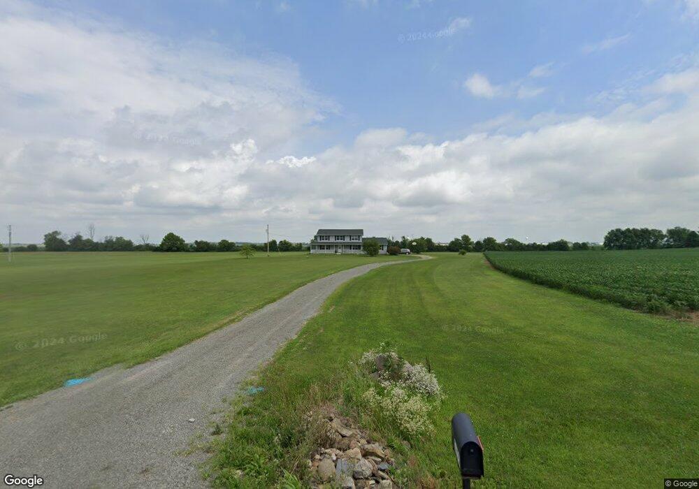
1655 Roberts Mill Rd London, OH 43140
Estimated Value: $376,000 - $493,000
4
Beds
3
Baths
2,300
Sq Ft
$193/Sq Ft
Est. Value
About This Home
This home is located at 1655 Roberts Mill Rd, London, OH 43140 and is currently estimated at $442,950, approximately $192 per square foot. 1655 Roberts Mill Rd is a home located in Madison County with nearby schools including Madison-Plains Elementary School, Madison-Plains Intermediate School, and Madison-Plains Junior High School.
Ownership History
Date
Name
Owned For
Owner Type
Purchase Details
Closed on
Jul 3, 2002
Sold by
Stephenson Keith A
Bought by
Stephenson Douglas S
Current Estimated Value
Home Financials for this Owner
Home Financials are based on the most recent Mortgage that was taken out on this home.
Original Mortgage
$146,972
Outstanding Balance
$63,187
Interest Rate
6.91%
Mortgage Type
FHA
Estimated Equity
$379,763
Purchase Details
Closed on
Aug 25, 1999
Sold by
Stephenson Douglas S
Bought by
Stephenson Keith A and Stephenson Athlinda
Home Financials for this Owner
Home Financials are based on the most recent Mortgage that was taken out on this home.
Original Mortgage
$240,000
Interest Rate
7.75%
Mortgage Type
New Conventional
Create a Home Valuation Report for This Property
The Home Valuation Report is an in-depth analysis detailing your home's value as well as a comparison with similar homes in the area
Home Values in the Area
Average Home Value in this Area
Purchase History
| Date | Buyer | Sale Price | Title Company |
|---|---|---|---|
| Stephenson Douglas S | $181,000 | -- | |
| Stephenson Keith A | $136,550 | -- |
Source: Public Records
Mortgage History
| Date | Status | Borrower | Loan Amount |
|---|---|---|---|
| Open | Stephenson Douglas S | $146,972 | |
| Previous Owner | Stephenson Keith A | $240,000 |
Source: Public Records
Tax History Compared to Growth
Tax History
| Year | Tax Paid | Tax Assessment Tax Assessment Total Assessment is a certain percentage of the fair market value that is determined by local assessors to be the total taxable value of land and additions on the property. | Land | Improvement |
|---|---|---|---|---|
| 2024 | $3,472 | $112,350 | $24,050 | $88,300 |
| 2023 | $3,472 | $112,350 | $24,050 | $88,300 |
| 2022 | $3,363 | $93,390 | $19,990 | $73,400 |
| 2021 | $3,206 | $93,390 | $19,990 | $73,400 |
| 2020 | $3,210 | $93,390 | $19,990 | $73,400 |
| 2019 | $2,833 | $85,810 | $23,110 | $62,700 |
| 2018 | $2,834 | $85,810 | $23,110 | $62,700 |
| 2017 | $2,178 | $85,810 | $23,110 | $62,700 |
| 2016 | $2,178 | $75,770 | $23,110 | $52,660 |
| 2015 | $2,178 | $75,770 | $23,110 | $52,660 |
| 2014 | $2,177 | $75,770 | $23,110 | $52,660 |
| 2013 | -- | $76,270 | $25,450 | $50,820 |
Source: Public Records
Map
Nearby Homes
- 108 Markley Rd
- 2425 Old Us Highway 40 NW
- 2206 State Route 56 SW
- 725 Cheney Pass
- 500 Reagan's Ridge
- 618 Lois Ln
- 437 Lukes Cir
- 0 S Houston Pike
- 418 Quincy Cir
- Spruce Plan at London Landing at Brooksedge
- Walnut Plan at London Landing at Brooksedge
- Palmetto Plan at London Landing at Brooksedge
- Ironwood Plan at London Landing at Brooksedge
- Norway Plan at London Landing at Brooksedge
- Aspen II Plan at London Landing at Brooksedge
- Ashton Plan at London Landing at Brooksedge
- Bradford Plan at London Landing at Brooksedge
- Cooper Plan at London Landing at Brooksedge
- Juniper Plan at London Landing at Brooksedge
- Empress Plan at London Landing at Brooksedge
- 1693 Roberts Mill Rd
- 1625 Roberts Mill Rd
- 1781 Roberts Mill Rd
- 1785 Roberts Mill Rd
- 1535 Roberts Mill Rd
- 1125 Roberts Mill Rd
- 1100 Roberts Mill Rd
- 2210 Roberts Mill Rd
- 1050 Roberts Mill Rd
- 2250 Roberts Mill Rd
- 1000 Roberts Mill Rd
- 2270 Roberts Mill Rd
- 0 Roberts Mill
- 898 Roberts Mill Rd
- 898 Roberts Mill Rd
- 3650 Old Springfield Rd
- 3590 Old Springfield Rd
- 3810 Old Springfield Rd
- 3690 Old Springfield Rd
- 3055 Old Springfield Rd