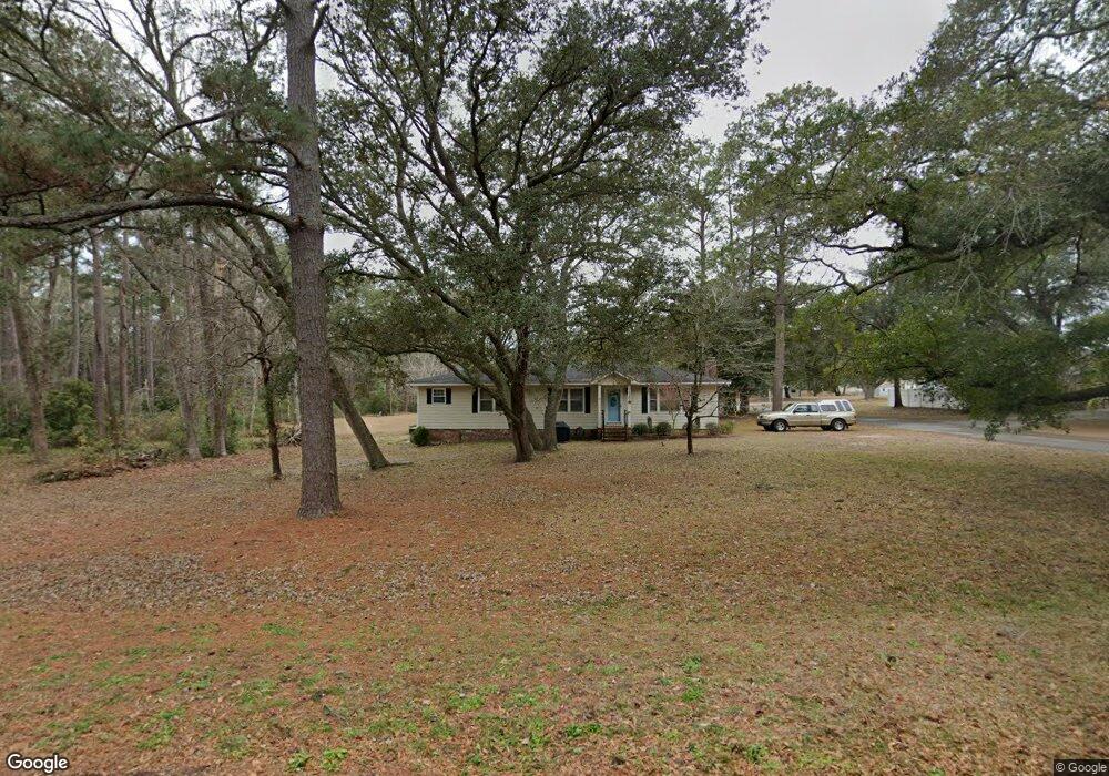
1656 Frink St SW Ocean Isle Beach, NC 28469
Estimated Value: $278,000 - $335,000
3
Beds
1
Bath
1,301
Sq Ft
$240/Sq Ft
Est. Value
About This Home
This home is located at 1656 Frink St SW, Ocean Isle Beach, NC 28469 and is currently estimated at $312,491, approximately $240 per square foot. 1656 Frink St SW is a home located in Brunswick County with nearby schools including Union Elementary School, Shallotte Middle School, and West Brunswick High School.
Ownership History
Date
Name
Owned For
Owner Type
Purchase Details
Closed on
Jun 2, 2011
Sold by
Branch Banking & Trust Co
Bought by
Firth William J and Firth Rhonda S
Current Estimated Value
Home Financials for this Owner
Home Financials are based on the most recent Mortgage that was taken out on this home.
Original Mortgage
$64,000
Outstanding Balance
$4,404
Interest Rate
4.79%
Mortgage Type
New Conventional
Estimated Equity
$308,087
Purchase Details
Closed on
Aug 24, 2010
Sold by
Smith Timothy M and Smith Thomas Mcginn
Bought by
Branch Banking & Trust Company
Purchase Details
Closed on
Apr 7, 2006
Sold by
Moody Douglas T and Moody Robin F
Bought by
Smith Thomas Mcginn and Smith Timothy Mcginn
Home Financials for this Owner
Home Financials are based on the most recent Mortgage that was taken out on this home.
Original Mortgage
$93,600
Interest Rate
6.37%
Mortgage Type
Adjustable Rate Mortgage/ARM
Create a Home Valuation Report for This Property
The Home Valuation Report is an in-depth analysis detailing your home's value as well as a comparison with similar homes in the area
Home Values in the Area
Average Home Value in this Area
Purchase History
| Date | Buyer | Sale Price | Title Company |
|---|---|---|---|
| Firth William J | $80,000 | None Available | |
| Branch Banking & Trust Company | $106,250 | None Available | |
| Smith Thomas Mcginn | $117,000 | None Available |
Source: Public Records
Mortgage History
| Date | Status | Borrower | Loan Amount |
|---|---|---|---|
| Open | Firth William J | $64,000 | |
| Previous Owner | Smith Thomas Mcginn | $93,600 |
Source: Public Records
Tax History Compared to Growth
Tax History
| Year | Tax Paid | Tax Assessment Tax Assessment Total Assessment is a certain percentage of the fair market value that is determined by local assessors to be the total taxable value of land and additions on the property. | Land | Improvement |
|---|---|---|---|---|
| 2025 | -- | $229,380 | $40,000 | $189,380 |
| 2024 | $984 | $229,380 | $40,000 | $189,380 |
| 2023 | $1,017 | $229,380 | $40,000 | $189,380 |
| 2022 | $1,000 | $168,530 | $30,000 | $138,530 |
| 2021 | $1,017 | $168,530 | $30,000 | $138,530 |
| 2020 | $1,000 | $168,530 | $30,000 | $138,530 |
| 2019 | $986 | $30,500 | $30,000 | $500 |
| 2018 | $741 | $22,660 | $22,000 | $660 |
| 2017 | $697 | $22,660 | $22,000 | $660 |
| 2016 | $672 | $22,660 | $22,000 | $660 |
| 2015 | $672 | $117,970 | $22,000 | $95,970 |
| 2014 | $706 | $137,016 | $45,000 | $92,016 |
Source: Public Records
Map
Nearby Homes
- 1616 Pierce St SW
- 1656 Butterfly Knot Dr
- 739 Little Gull Way SW
- 1649 Butterfly Knot Dr SW
- 1629 Marlin Spike Way SW
- 6494 Anchors Bend Dr
- 1812 Sandalwood Dr SW
- 1628 Waterway Cove Dr
- 1694 Lake Tree Dr SW
- 6460 Carrick Bend Trail SW
- 6514 Anchors Bend Dr
- 1766 Waterway Dr SW
- 5 Osprey Pointe
- 6445 Figure Eight Dr SW
- 4 Osprey Pointe
- 6439 Stopper Ln SW
- 3 Osprey Pointe
- 2 Osprey Pointe
- 6405 Pigott Ave SW
- 1 Osprey Pointe
- 1656 Frink St SW
- 1650 Frink St SW
- 0 Frink St SW
- 1615 Frink St SW
- 1609 Frink St SW
- L-2 Frink St SW
- 1653 Frink St SW
- 1646 Frink St SW
- 1643 Kennedy St SW
- 1708 Pearlie Ct SW
- 1639 Frink St SW
- 1636 Frink St SW
- 1660 Pierce St SW
- 1650 Pierce St SW
- 1635 Frink St SW
- 1640 Pierce St SW
- 1628 Frink St SW
- 1631 Frink St SW
- 1634 Kennedy St SW
- 1632 Pierce St SW