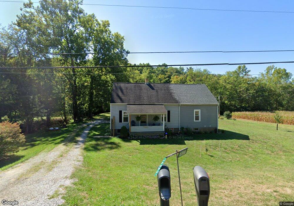
16560 State Route 550 Marietta, OH 45750
Estimated Value: $143,000 - $189,000
4
Beds
1
Bath
1,284
Sq Ft
$130/Sq Ft
Est. Value
About This Home
This home is located at 16560 State Route 550, Marietta, OH 45750 and is currently estimated at $167,459, approximately $130 per square foot. 16560 State Route 550 is a home with nearby schools including Warren High School.
Ownership History
Date
Name
Owned For
Owner Type
Purchase Details
Closed on
Dec 27, 2019
Sold by
Johnson Carl R and Johnson Marilyn A
Bought by
Rhodes Scott T and Rhodes Amy A
Current Estimated Value
Home Financials for this Owner
Home Financials are based on the most recent Mortgage that was taken out on this home.
Original Mortgage
$95,000
Outstanding Balance
$74,770
Interest Rate
3.7%
Mortgage Type
New Conventional
Estimated Equity
$92,689
Purchase Details
Closed on
Jan 4, 2000
Bought by
Johnson Carl R and Johnson Marilyn
Purchase Details
Closed on
May 1, 1987
Create a Home Valuation Report for This Property
The Home Valuation Report is an in-depth analysis detailing your home's value as well as a comparison with similar homes in the area
Home Values in the Area
Average Home Value in this Area
Purchase History
| Date | Buyer | Sale Price | Title Company |
|---|---|---|---|
| Rhodes Scott T | $100,000 | None Available | |
| Johnson Carl R | -- | -- | |
| -- | -- | -- |
Source: Public Records
Mortgage History
| Date | Status | Borrower | Loan Amount |
|---|---|---|---|
| Open | Rhodes Scott T | $95,000 |
Source: Public Records
Tax History Compared to Growth
Tax History
| Year | Tax Paid | Tax Assessment Tax Assessment Total Assessment is a certain percentage of the fair market value that is determined by local assessors to be the total taxable value of land and additions on the property. | Land | Improvement |
|---|---|---|---|---|
| 2024 | $1,171 | $30,940 | $7,440 | $23,500 |
| 2023 | $1,171 | $30,940 | $7,440 | $23,500 |
| 2022 | $1,170 | $30,940 | $7,440 | $23,500 |
| 2021 | $835 | $21,060 | $4,890 | $16,170 |
| 2020 | $834 | $21,060 | $4,890 | $16,170 |
| 2019 | $483 | $21,060 | $4,890 | $16,170 |
| 2018 | $408 | $18,950 | $4,250 | $14,700 |
| 2017 | $405 | $18,950 | $4,250 | $14,700 |
| 2016 | $965 | $18,950 | $4,250 | $14,700 |
| 2015 | $333 | $18,070 | $4,420 | $13,650 |
| 2014 | $930 | $18,070 | $4,420 | $13,650 |
| 2013 | $167 | $18,070 | $4,420 | $13,650 |
Source: Public Records
Map
Nearby Homes
- 2021 Robinson Hill Rd
- 254 Riggenbach Hill Rd
- 65 High Point Dr
- 203 57th St
- 302 57th St
- 411 58th St
- 407 56th St
- 5607 Grand Central Ave
- 53 Central Dr
- 0 River Rd Unit Lot WP001
- 5505 6th Ave
- 0 Fisher Ridge Rd Tract 8
- 0 Fisher Ridge Rd Tract 7
- 0 Fisher Ridge Rd Tract 6
- 0 Fisher Ridge Rd Tract 5
- 0 Fisher Ridge Rd Tract 4
- 0 Fisher Ridge Rd Tract 2
- 604 51st St
- 0 Fisher Ridge Rd Tract 1
- 20645 Ohio 676
- 00 Rt 550
- 60 Wynncrest Dr
- 16650 State Route 550
- 425 Wentz Rd
- 16619 Ohio 550
- 109 Wynncrest Dr
- 82 Wynncrest Dr
- 0 Wynncrest Dr
- 0 Wynncrest Dr Unit M229541
- 0 Wynncrest Dr Unit M231073
- 45 Wynnwood Dr
- 16710 State Route 550
- 85 Wynnwood Dr
- 120 Wynncrest Dr
- 450 Wentz Rd
- 95 Wynnwood Dr
- 95 Wynnwood Dr
- 440 Wentz Rd
- 105 Wynnwood Dr
- 135 Wynnwood Dr