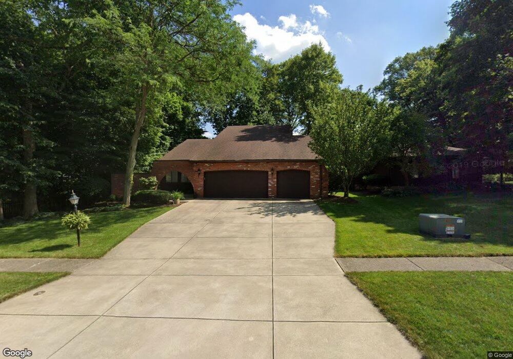
16573 S White Oaks Dr Strongsville, OH 44136
Estimated Value: $385,000 - $412,000
4
Beds
3
Baths
2,814
Sq Ft
$143/Sq Ft
Est. Value
About This Home
This home is located at 16573 S White Oaks Dr, Strongsville, OH 44136 and is currently estimated at $402,090, approximately $142 per square foot. 16573 S White Oaks Dr is a home located in Cuyahoga County with nearby schools including Strongsville High School and Saint Ambrose Catholic School.
Ownership History
Date
Name
Owned For
Owner Type
Purchase Details
Closed on
Jul 25, 2001
Sold by
Pace Rose L
Bought by
Williams Donald M and Williams Barbara A
Current Estimated Value
Home Financials for this Owner
Home Financials are based on the most recent Mortgage that was taken out on this home.
Original Mortgage
$185,200
Outstanding Balance
$72,296
Interest Rate
7.16%
Estimated Equity
$329,794
Purchase Details
Closed on
Mar 15, 1988
Sold by
Pace Charles A
Bought by
Pace Rose L
Purchase Details
Closed on
Mar 18, 1985
Sold by
Pace Charles A
Bought by
Pace Charles A
Purchase Details
Closed on
Mar 2, 1978
Bought by
Pace Charles A
Purchase Details
Closed on
Aug 15, 1977
Bought by
Production Homes Inc
Purchase Details
Closed on
Jan 1, 1977
Bought by
North East Land Co
Create a Home Valuation Report for This Property
The Home Valuation Report is an in-depth analysis detailing your home's value as well as a comparison with similar homes in the area
Home Values in the Area
Average Home Value in this Area
Purchase History
| Date | Buyer | Sale Price | Title Company |
|---|---|---|---|
| Williams Donald M | $231,500 | -- | |
| Pace Rose L | -- | -- | |
| Pace Charles A | -- | -- | |
| Pace Charles A | $92,200 | -- | |
| Production Homes Inc | $23,000 | -- | |
| North East Land Co | -- | -- |
Source: Public Records
Mortgage History
| Date | Status | Borrower | Loan Amount |
|---|---|---|---|
| Open | Williams Donald M | $185,200 |
Source: Public Records
Tax History Compared to Growth
Tax History
| Year | Tax Paid | Tax Assessment Tax Assessment Total Assessment is a certain percentage of the fair market value that is determined by local assessors to be the total taxable value of land and additions on the property. | Land | Improvement |
|---|---|---|---|---|
| 2024 | $5,670 | $120,750 | $19,425 | $101,325 |
| 2023 | $6,216 | $99,270 | $19,570 | $79,700 |
| 2022 | $6,171 | $99,260 | $19,570 | $79,700 |
| 2021 | $6,122 | $99,260 | $19,570 | $79,700 |
| 2020 | $5,670 | $81,340 | $16,030 | $65,310 |
| 2019 | $5,504 | $232,400 | $45,800 | $186,600 |
| 2018 | $4,958 | $81,340 | $16,030 | $65,310 |
| 2017 | $5,013 | $75,570 | $12,710 | $62,860 |
| 2016 | $4,972 | $75,570 | $12,710 | $62,860 |
| 2015 | $5,043 | $75,570 | $12,710 | $62,860 |
| 2014 | $5,043 | $75,570 | $12,710 | $62,860 |
Source: Public Records
Map
Nearby Homes
- 16711 Beech Cir
- 16486 S Red Rock Dr
- 17130 Golden Star Dr
- 18229 Howe Rd
- 17159 Turkey Meadow Ln
- 3550 Boston Rd
- 17682 Drake Rd
- 18411 Yorktown Oval
- 17024 Bear Creek Ln
- 15604-REAR Boston Rd
- 17934 Cambridge Oval
- 19694 Benbow Rd
- 97 Weathervane Ln
- 18294 Drake Rd
- 19740 Benbow Rd
- 16650 Lanier Ave
- 14985 Camden Cir
- 15188 Trails Landing
- 18848 Pearl Rd
- 18987 Laurell Cir
- 16577 S White Oaks Dr
- 17216 Misty Lake Dr
- 17212 Misty Lake Dr
- 16581 S White Oaks Dr
- 16802 Falmouth Dr
- 16768 Falmouth Dr
- 16836 Falmouth Dr
- 16734 Falmouth Dr
- 16550 S White Oaks Dr
- 16554 S White Oaks Dr
- 17208 Misty Lake Dr
- 16558 S White Oaks Dr
- 16904 Falmouth Dr
- 16562 S White Oaks Dr
- 16589 S White Oaks Dr
- 17219 Misty Lake Dr
- 17223 Misty Lake Dr
- 16676 Falmouth Dr
- 17204 Misty Lake Dr
- 16566 S White Oaks Dr