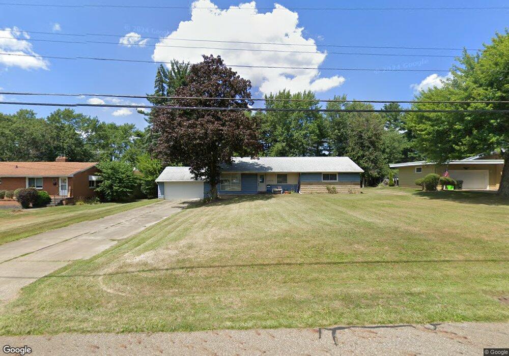
1659 Charl Ann Dr Alliance, OH 44601
Estimated Value: $227,630 - $250,000
3
Beds
2
Baths
1,864
Sq Ft
$127/Sq Ft
Est. Value
About This Home
This home is located at 1659 Charl Ann Dr, Alliance, OH 44601 and is currently estimated at $236,210, approximately $126 per square foot. 1659 Charl Ann Dr is a home located in Stark County with nearby schools including Alliance Early Learning School, Alliance Intermediate School at Northside, and Alliance Middle School.
Ownership History
Date
Name
Owned For
Owner Type
Purchase Details
Closed on
Apr 5, 2017
Sold by
Vogus Janet L
Bought by
Vogus Janet L and Groves Ronald L
Current Estimated Value
Purchase Details
Closed on
Sep 15, 2006
Sold by
Cross Edward P and Cross Helen J
Bought by
Vogus Janet L
Home Financials for this Owner
Home Financials are based on the most recent Mortgage that was taken out on this home.
Original Mortgage
$108,000
Outstanding Balance
$74,353
Interest Rate
9.55%
Mortgage Type
Purchase Money Mortgage
Estimated Equity
$161,857
Purchase Details
Closed on
Nov 4, 2004
Sold by
Cross Edward P and Cross Helen J
Bought by
Cross Edward P and Cross Helen J
Create a Home Valuation Report for This Property
The Home Valuation Report is an in-depth analysis detailing your home's value as well as a comparison with similar homes in the area
Home Values in the Area
Average Home Value in this Area
Purchase History
| Date | Buyer | Sale Price | Title Company |
|---|---|---|---|
| Vogus Janet L | -- | None Available | |
| Vogus Janet L | $108,000 | None Available | |
| Cross Edward P | -- | -- |
Source: Public Records
Mortgage History
| Date | Status | Borrower | Loan Amount |
|---|---|---|---|
| Open | Vogus Janet L | $108,000 |
Source: Public Records
Tax History Compared to Growth
Tax History
| Year | Tax Paid | Tax Assessment Tax Assessment Total Assessment is a certain percentage of the fair market value that is determined by local assessors to be the total taxable value of land and additions on the property. | Land | Improvement |
|---|---|---|---|---|
| 2022 | $1,416 | $43,760 | $15,720 | $28,040 |
| 2021 | $1,418 | $43,760 | $15,720 | $28,040 |
| 2020 | $1,279 | $38,260 | $13,650 | $24,610 |
| 2019 | $1,261 | $38,260 | $13,650 | $24,610 |
| 2018 | $1,267 | $38,260 | $13,650 | $24,610 |
| 2017 | $1,114 | $34,270 | $11,450 | $22,820 |
| 2016 | $1,123 | $34,270 | $11,450 | $22,820 |
| 2015 | $1,133 | $34,270 | $11,450 | $22,820 |
| 2014 | $1,094 | $32,210 | $10,750 | $21,460 |
| 2013 | $546 | $32,210 | $10,750 | $21,460 |
Source: Public Records
Map
Nearby Homes
- 1201 Overlook Dr
- 2050 Federal Ave
- 2112 Blenheim Ave
- 0 S Sawburg Ave Unit 5113457
- 2220 Western Ave
- 1321 Parkway Blvd
- 884 W College Rd
- 970 Kingsway St
- 1515 S Rockhill Ave
- 738 Kingsway St
- 896 Parkway Blvd
- 1059 Oakwood Dr
- 8630 Schubert Ave NE
- 0 W Main St Unit 5090123
- 734 Parkway Blvd
- 725 W Summit St
- 680 Mcgrath St
- 2371 Ansley St Unit 2371
- 2377 Ansley St Unit 2377
- 2839 S Rockhill Ave
- 1647 Charl Ann Dr
- 1671 Charl Ann Dr
- 1664 Denwood St
- 1637 Charl Ann Dr
- 1691 Charl Ann Dr
- 1656 Denwood St
- 1672 Denwood St
- 1648 Denwood St
- 1660 Charl Ann Dr
- 1680 Denwood St
- 1650 Charl Ann Dr
- 1670 Charl Ann Dr
- 1632 Denwood St
- 1642 Charl Ann Dr
- 1690 Charl Ann Dr
- 1623 Charl Ann Dr
- 1021 Northview Ave
- 1632 Charl Ann Dr
- 1657 Denwood St
- 1624 Denwood St