Estimated Value: $192,000 - $198,012
4
Beds
2
Baths
1,287
Sq Ft
$151/Sq Ft
Est. Value
About This Home
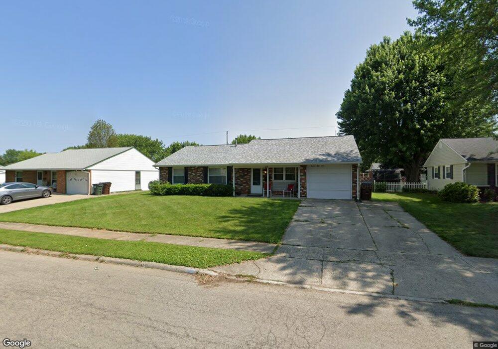
This home is located at 1659 Commonwealth Dr, Xenia, OH 45385 and is currently estimated at $194,253, approximately $150 per square foot. 1659 Commonwealth Dr is a home located in Greene County with nearby schools including Xenia High School, Summit Academy Community School for Alternative Learners - Xenia, and Legacy Christian Academy.
Ownership History
Date
Name
Owned For
Owner Type
Purchase Details
Closed on
Jul 18, 2012
Sold by
Price Bonnie B
Bought by
Adams Ii Richard A and Adams Merita
Current Estimated Value
Home Financials for this Owner
Home Financials are based on the most recent Mortgage that was taken out on this home.
Original Mortgage
$36,000
Interest Rate
3.73%
Mortgage Type
New Conventional
Create a Home Valuation Report for This Property
The Home Valuation Report is an in-depth analysis detailing your home's value as well as a comparison with similar homes in the area
Home Values in the Area
Average Home Value in this Area
Purchase History
| Date | Buyer | Sale Price | Title Company |
|---|---|---|---|
| Adams Ii Richard A | $48,000 | None Available |
Source: Public Records
Mortgage History
| Date | Status | Borrower | Loan Amount |
|---|---|---|---|
| Previous Owner | Adams Ii Richard A | $36,000 |
Source: Public Records
Tax History Compared to Growth
Tax History
| Year | Tax Paid | Tax Assessment Tax Assessment Total Assessment is a certain percentage of the fair market value that is determined by local assessors to be the total taxable value of land and additions on the property. | Land | Improvement |
|---|---|---|---|---|
| 2024 | $2,078 | $48,560 | $11,210 | $37,350 |
| 2023 | $2,078 | $48,560 | $11,210 | $37,350 |
| 2022 | $1,728 | $34,450 | $6,590 | $27,860 |
| 2021 | $1,752 | $34,450 | $6,590 | $27,860 |
| 2020 | $1,537 | $34,450 | $6,590 | $27,860 |
| 2019 | $1,537 | $29,710 | $6,440 | $23,270 |
| 2018 | $1,543 | $29,710 | $6,440 | $23,270 |
| 2017 | $1,499 | $29,710 | $6,440 | $23,270 |
| 2016 | $1,419 | $26,800 | $6,440 | $20,360 |
| 2015 | $1,423 | $26,800 | $6,440 | $20,360 |
| 2014 | $1,362 | $26,800 | $6,440 | $20,360 |
Source: Public Records
Map
Nearby Homes
- 1403 Texas Dr
- 1866 Roxbury Dr
- 1778 Arapaho Dr
- 1829 Gayhart Dr
- 1769 Gayhart Dr
- 1908 Whitt St
- 1255 Colorado Dr
- 1107 Arkansas Dr
- 1653 Seneca Dr
- 1618 Navajo Dr
- 1272 Bellbrook Ave
- 2499 Jenny Marie Dr
- 1208 Bellbrook Ave
- 2257 Maryland Dr
- 2142 Michigan Dr
- 2345 Tennessee Dr
- 2540 Jenny Marie Dr
- 2421 Louisiana Dr
- 2540 Cornwall Dr
- 1568 Cheyenne Dr
- 1673 Commonwealth Dr
- 1645 Commonwealth Dr
- 1313 Texas Dr
- 1299 Texas Dr
- 1327 Texas Dr
- 1683 Commonwealth Dr
- 1684 Commonwealth Dr
- 1700 Commonwealth Dr
- 1670 Commonwealth Dr
- 1621 Commonwealth Dr
- 1710 Commonwealth Dr
- 1697 Commonwealth Dr
- 1347 Texas Dr
- 1277 Texas Dr
- 1743 Roxbury Dr
- 1306 Texas Dr
- 1646 Commonwealth Dr
- 1728 Commonwealth Dr
- 1607 Commonwealth Dr
- 1361 Texas Dr