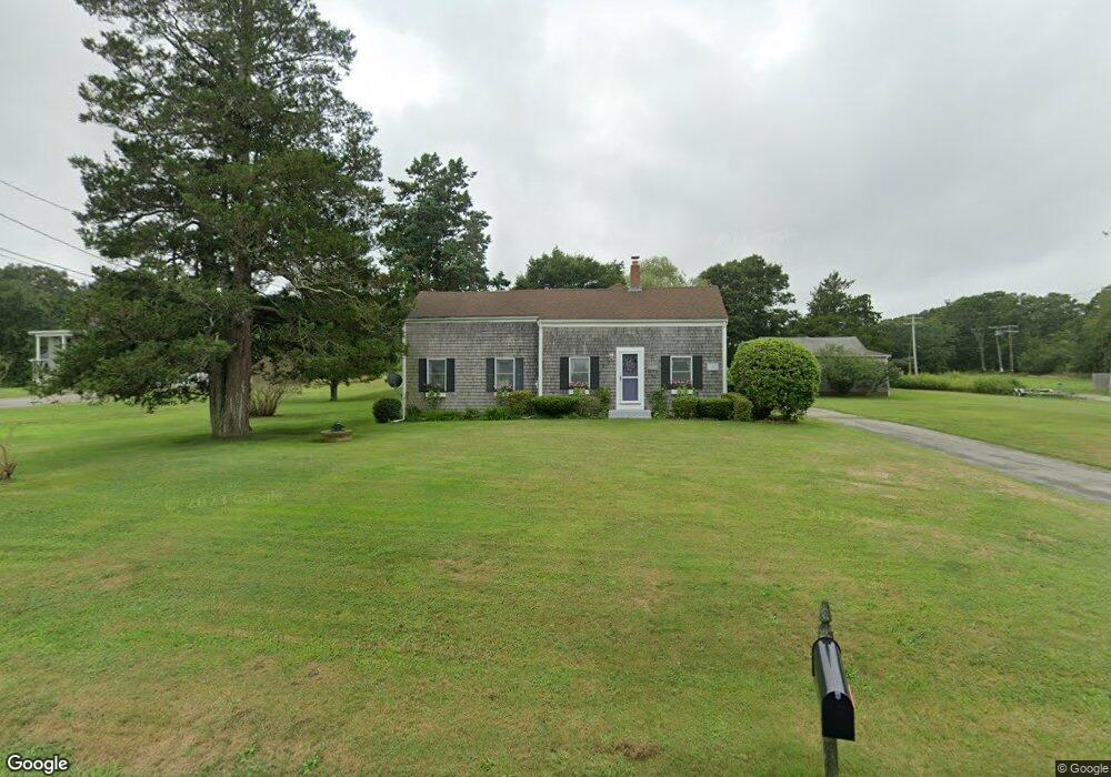
1659 Drift Rd Westport, MA 02790
Westport Point NeighborhoodEstimated Value: $627,000 - $978,000
4
Beds
--
Bath
2,207
Sq Ft
$362/Sq Ft
Est. Value
About This Home
This home is located at 1659 Drift Rd, Westport, MA 02790 and is currently estimated at $797,934, approximately $361 per square foot. 1659 Drift Rd is a home located in Bristol County with nearby schools including Alice A. Macomber Primary School, Westport Elementary School, and Westport Middle-High School.
Ownership History
Date
Name
Owned For
Owner Type
Purchase Details
Closed on
Mar 1, 2019
Sold by
Brown Debra E and Thompson Steven R
Bought by
Thompson Brown Nt
Current Estimated Value
Purchase Details
Closed on
Dec 4, 2001
Sold by
Nady Dahim
Bought by
Brown Debra E
Purchase Details
Closed on
Sep 24, 1997
Sold by
Brown Walter A
Bought by
Citizens Union Sb
Purchase Details
Closed on
Sep 23, 1993
Sold by
25 Bedford Corp
Bought by
Nady Fahim
Purchase Details
Closed on
Mar 9, 1993
Sold by
Brown Walter A and Citizens Sav Bk
Bought by
Citizens Sb
Create a Home Valuation Report for This Property
The Home Valuation Report is an in-depth analysis detailing your home's value as well as a comparison with similar homes in the area
Home Values in the Area
Average Home Value in this Area
Purchase History
| Date | Buyer | Sale Price | Title Company |
|---|---|---|---|
| Thompson Brown Nt | -- | -- | |
| Brown Debra E | $15,500 | -- | |
| Citizens Union Sb | $24,000 | -- | |
| Nady Fahim | $155,000 | -- | |
| 25 Bedford Corp | $126,097 | -- | |
| Citizens Sb | $140,000 | -- |
Source: Public Records
Mortgage History
| Date | Status | Borrower | Loan Amount |
|---|---|---|---|
| Previous Owner | Citizens Sb | $160,000 | |
| Previous Owner | Citizens Sb | $20,000 |
Source: Public Records
Tax History Compared to Growth
Tax History
| Year | Tax Paid | Tax Assessment Tax Assessment Total Assessment is a certain percentage of the fair market value that is determined by local assessors to be the total taxable value of land and additions on the property. | Land | Improvement |
|---|---|---|---|---|
| 2025 | $4,371 | $586,700 | $395,300 | $191,400 |
| 2024 | $4,291 | $555,100 | $366,300 | $188,800 |
| 2023 | $4,285 | $525,100 | $348,800 | $176,300 |
| 2022 | $4,278 | $504,500 | $348,800 | $155,700 |
| 2021 | $3,612 | $419,000 | $263,300 | $155,700 |
| 2020 | $3,443 | $408,400 | $252,700 | $155,700 |
| 2019 | $3,696 | $446,900 | $298,700 | $148,200 |
| 2018 | $2,908 | $355,900 | $223,000 | $132,900 |
| 2017 | $2,998 | $376,200 | $241,300 | $134,900 |
| 2016 | $3,066 | $387,600 | $262,000 | $125,600 |
| 2015 | $2,906 | $366,400 | $243,700 | $122,700 |
Source: Public Records
Map
Nearby Homes
- 1702J Drift Rd
- 1702 Drift Rd
- 1580 Main Rd
- 1881 Main Rd
- 99 Sylvia Ln
- 1346 Main Rd Unit B
- 0 Reed Rd (Ss)
- 225 Hixbridge Rd
- 920 Drift Rd
- Lot 2 Horseneck Rd
- 19 Seabury Ln
- 101 Adamsville Rd
- 2 Slades Farm Ln
- 837 Main Rd
- 238-242 E Beach Rd
- 17 Quail Trail
- Lot 2E Horseneck Rd
- 8 Village Way
- 7 Village Way
- 255 John Dyer Rd
- 1651 Drift Rd
- 1665 Drift Rd
- 1645 Drift Rd
- 1681 Drift Rd
- 1660 Drift Rd
- 1642 Drift Rd
- 5 Julius Way
- 1670 Drift Rd
- 1635 Drift Rd
- 1676 Drift Rd
- 1625 Drift Rd
- 1687 Drift Rd
- 63 Julius Way
- 1614 Drift Rd Unit A
- 1614 Drift Rd
- 1614 Drift Rd Unit 1614A
- 1614A Drift Rd Unit 1614A
- 10 Julius Way
- 1617 Drift Rd
- 1680 Drift Rd Unit L