Estimated Value: $714,022 - $799,000
4
Beds
3
Baths
1,825
Sq Ft
$405/Sq Ft
Est. Value
About This Home
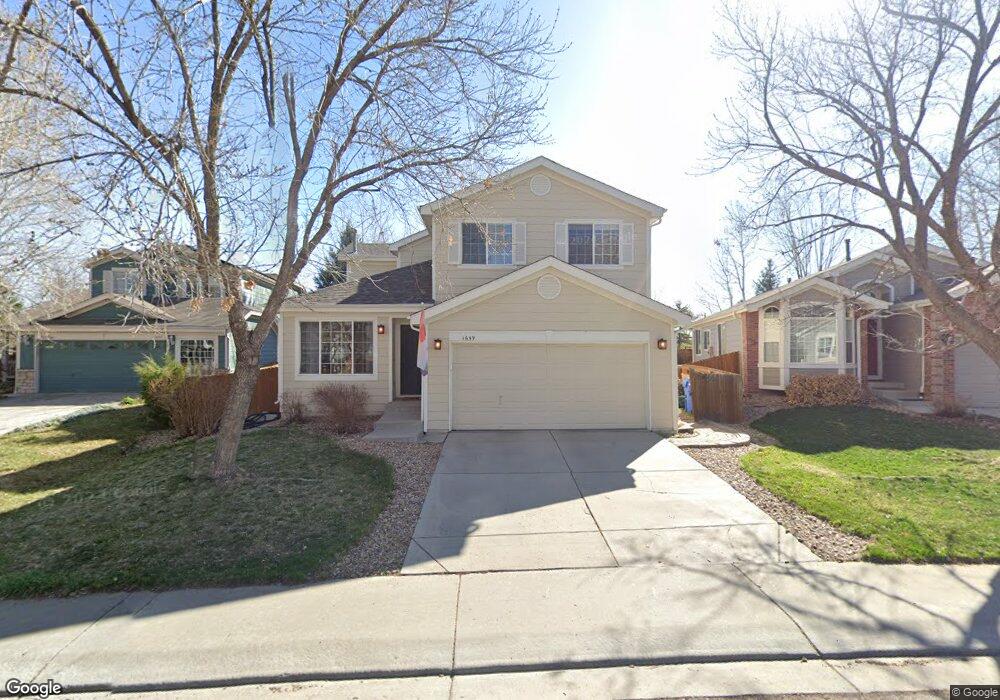
This home is located at 1659 Holeman Dr, Erie, CO 80516 and is currently estimated at $739,006, approximately $404 per square foot. 1659 Holeman Dr is a home located in Boulder County with nearby schools including Meadowlark School, Centaurus High School, and Peak to Peak Charter School.
Ownership History
Date
Name
Owned For
Owner Type
Purchase Details
Closed on
Aug 23, 2002
Sold by
Baxley William B
Bought by
Lemley Bradford J
Current Estimated Value
Home Financials for this Owner
Home Financials are based on the most recent Mortgage that was taken out on this home.
Original Mortgage
$212,400
Outstanding Balance
$79,868
Interest Rate
5%
Estimated Equity
$659,138
Purchase Details
Closed on
Jun 9, 2000
Sold by
Long Gary W and Long Susan M
Bought by
Baxley William B
Home Financials for this Owner
Home Financials are based on the most recent Mortgage that was taken out on this home.
Original Mortgage
$173,500
Interest Rate
8.13%
Purchase Details
Closed on
May 8, 1998
Sold by
Kdb Homes Inc
Bought by
Long Gary W and Long Susan M
Home Financials for this Owner
Home Financials are based on the most recent Mortgage that was taken out on this home.
Original Mortgage
$170,000
Interest Rate
7.18%
Create a Home Valuation Report for This Property
The Home Valuation Report is an in-depth analysis detailing your home's value as well as a comparison with similar homes in the area
Home Values in the Area
Average Home Value in this Area
Purchase History
| Date | Buyer | Sale Price | Title Company |
|---|---|---|---|
| Lemley Bradford J | $265,500 | -- | |
| Baxley William B | $273,500 | -- | |
| Long Gary W | $164,092 | First American Heritage Titl |
Source: Public Records
Mortgage History
| Date | Status | Borrower | Loan Amount |
|---|---|---|---|
| Open | Lemley Bradford J | $212,400 | |
| Previous Owner | Baxley William B | $173,500 | |
| Previous Owner | Long Gary W | $170,000 |
Source: Public Records
Tax History Compared to Growth
Tax History
| Year | Tax Paid | Tax Assessment Tax Assessment Total Assessment is a certain percentage of the fair market value that is determined by local assessors to be the total taxable value of land and additions on the property. | Land | Improvement |
|---|---|---|---|---|
| 2025 | $4,704 | $44,206 | $13,750 | $30,456 |
| 2024 | $4,704 | $44,206 | $13,750 | $30,456 |
| 2023 | $4,637 | $44,568 | $18,284 | $29,969 |
| 2022 | $3,964 | $35,695 | $11,551 | $24,144 |
| 2021 | $3,954 | $36,722 | $11,883 | $24,839 |
| 2020 | $3,714 | $34,177 | $7,436 | $26,741 |
| 2019 | $3,668 | $34,177 | $7,436 | $26,741 |
| 2018 | $3,428 | $31,363 | $10,440 | $20,923 |
| 2017 | $3,435 | $34,674 | $11,542 | $23,132 |
| 2016 | $3,057 | $28,799 | $14,726 | $14,073 |
| 2015 | $2,922 | $24,143 | $10,826 | $13,317 |
| 2014 | $3,106 | $24,143 | $10,826 | $13,317 |
Source: Public Records
Map
Nearby Homes
- 1842 Southard St
- 1331 Fountain Ln
- 848 Sandstone Cir
- 1381 Siltstone St
- 1321 Alexandria St
- 1195 Fox Hills Ct
- 1920 Marfell St
- 1305 Inverness Dr
- 1305 Balmora St
- 1063 Sandstone Cir
- 2326 Carbonate Cir
- 1182 Red Iron Ct
- 1205 Red Iron Ct
- 309 Baron Ave
- 972 Carbonate Ln
- 2268 Front Range Rd
- 908 Dinosaur Dr
- 1451 Loraine Cir N
- 1441 Loraine Cir N
- 1441 Loraine Cir N
- 1667 Holeman Dr
- 1653 Holeman Dr
- 1673 Holeman Dr
- 2553 Betts Cir
- 2559 Betts Cir
- 1679 Holeman Dr
- 2563 Betts Cir
- 1660 Holeman Dr
- 1652 Holeman Dr
- 1685 Holeman Dr
- 2569 Betts Cir
- 1676 Holeman Dr
- 1644 Holeman Dr
- 1691 Holeman Dr
- 2558 Betts Cir
- 1636 Holeman Dr
- 2573 Betts Cir
- 2566 Betts Cir
- 2593 Payne Ct
- 1692 Holeman Dr