Estimated Value: $285,000 - $335,000
3
Beds
1
Bath
1,657
Sq Ft
$183/Sq Ft
Est. Value
About This Home
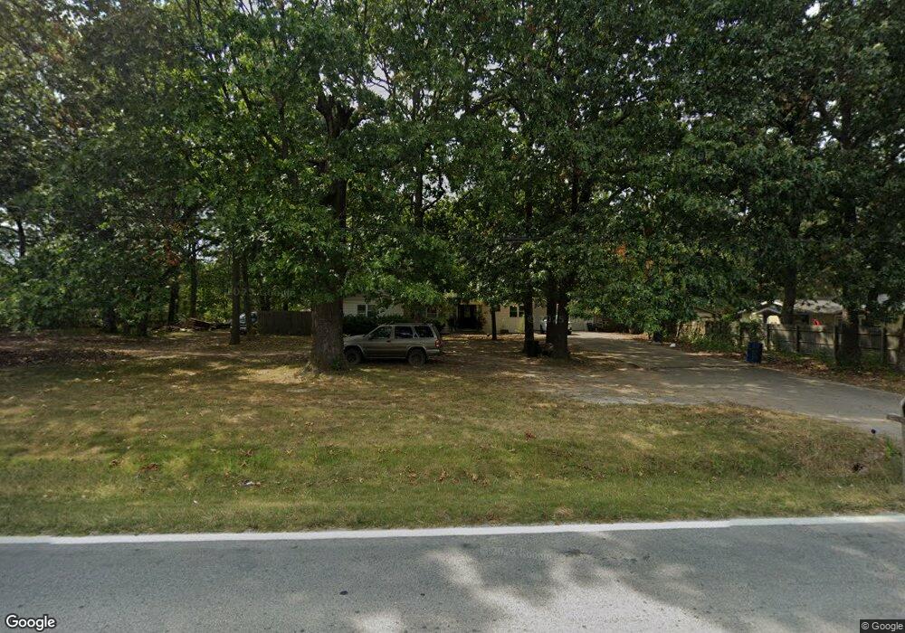
This home is located at 1659 N State Highway Cc, Nixa, MO 65714 and is currently estimated at $302,786, approximately $182 per square foot. 1659 N State Highway Cc is a home with nearby schools including High Pointe Elementary School, Summit Intermediate School, and Nixa Junior High School.
Ownership History
Date
Name
Owned For
Owner Type
Purchase Details
Closed on
Jul 28, 2025
Sold by
Abney Breanna
Bought by
Norris Margaret and Norris John
Current Estimated Value
Purchase Details
Closed on
May 9, 2025
Sold by
Eoff Brinda
Bought by
Abney Breanna
Purchase Details
Closed on
Feb 21, 2024
Sold by
Eoff Brinda
Bought by
Missouri Highways And Transportation Commissi
Purchase Details
Closed on
Sep 19, 2017
Sold by
Eoff Brinda and Eoff Jimmie Dale
Bought by
Abney Brenden
Create a Home Valuation Report for This Property
The Home Valuation Report is an in-depth analysis detailing your home's value as well as a comparison with similar homes in the area
Home Values in the Area
Average Home Value in this Area
Purchase History
| Date | Buyer | Sale Price | Title Company |
|---|---|---|---|
| Norris Margaret | -- | Meridian Title | |
| Norris Margaret | -- | Meridian Title | |
| Abney Breanna | -- | Ozark Abstract & Title | |
| Missouri Highways And Transportation Commissi | $1,750 | None Listed On Document | |
| Abney Brenden | -- | None Available |
Source: Public Records
Tax History Compared to Growth
Tax History
| Year | Tax Paid | Tax Assessment Tax Assessment Total Assessment is a certain percentage of the fair market value that is determined by local assessors to be the total taxable value of land and additions on the property. | Land | Improvement |
|---|---|---|---|---|
| 2024 | $1,461 | $24,620 | -- | -- |
| 2023 | $1,461 | $24,620 | $0 | $0 |
| 2022 | $1,351 | $22,740 | $0 | $0 |
| 2021 | $1,352 | $22,740 | $0 | $0 |
| 2020 | $1,301 | $20,920 | $0 | $0 |
| 2019 | $1,301 | $20,920 | $0 | $0 |
| 2018 | $1,066 | $18,490 | $0 | $0 |
| 2017 | $1,066 | $18,490 | $0 | $0 |
| 2016 | $1,048 | $18,490 | $0 | $0 |
| 2015 | $1,050 | $18,490 | $18,490 | $0 |
| 2014 | $1,021 | $18,470 | $0 | $0 |
| 2013 | $10 | $18,470 | $0 | $0 |
| 2011 | $10 | $36,940 | $0 | $0 |
Source: Public Records
Map
Nearby Homes
- 1677 N State Highway Cc
- 000 N Pine St
- 110 W Maple St
- 1719 N Pine St
- 000 W Bentwater Dr
- Lot 24 Bentwater Phase 3
- 000 N Gregory Dr
- 703 W Laverne Dr
- 709 W Jackson Ave
- 610 N Cheyenne Valley Rd
- 000 N Massey Blvd
- 1363 N Maxine Ave
- 1327 N Maxine Ave
- 1313 N Maxine Ave
- 1301 N Maxine Ave
- Obsidian B Plan at Walker Estates
- 1383 N Maxine Ave
- Diamond Plan at Walker Estates
- Amber Plan at Walker Estates
- Amethyst Plan at Walker Estates
- 1663 N State Highway Cc
- Tbd N State Highway Cc
- 1641 N State Highway Cc
- 1640 Lakeshore Dr
- 1676 N State Highway Cc
- 1661 Lakeshore Dr
- 1643 Lakeshore Dr
- 1613 N State Highway Cc
- 1635 Lakeshore Dr
- 1609 N State Highway Cc
- 1609 N State Highway Cc
- 1675 Lakeshore Dr
- 1701 N Highway Cc
- 104 W Herndon St
- 106 W Herndon St
- 108 W Herndon Rd
- 108 Herndon St
- 110 W Herndon Rd
- 1606 N Pine St
- 110 Herndon St