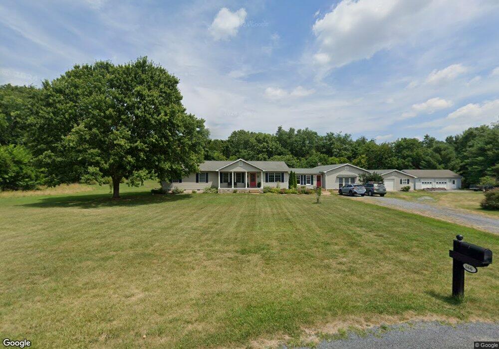
166 Cortland Cir Clear Brook, VA 22624
Estimated Value: $483,000 - $616,000
4
Beds
3
Baths
3,267
Sq Ft
$175/Sq Ft
Est. Value
About This Home
This home is located at 166 Cortland Cir, Clear Brook, VA 22624 and is currently estimated at $570,283, approximately $174 per square foot. 166 Cortland Cir is a home located in Frederick County with nearby schools including Stonewall Elementary School and James Wood Middle School.
Ownership History
Date
Name
Owned For
Owner Type
Purchase Details
Closed on
Jul 29, 2016
Sold by
Dean Robert S and Crites Vickie L
Bought by
The Robert S Dean Revocable Trust Under and The Vickie L Crites Revocable Trust Unde
Current Estimated Value
Purchase Details
Closed on
Jun 25, 2015
Sold by
Crites Vickie L
Bought by
Crites Vickie L and Dean Robert S
Home Financials for this Owner
Home Financials are based on the most recent Mortgage that was taken out on this home.
Original Mortgage
$140,000
Interest Rate
3.87%
Mortgage Type
Credit Line Revolving
Create a Home Valuation Report for This Property
The Home Valuation Report is an in-depth analysis detailing your home's value as well as a comparison with similar homes in the area
Home Values in the Area
Average Home Value in this Area
Purchase History
| Date | Buyer | Sale Price | Title Company |
|---|---|---|---|
| The Robert S Dean Revocable Trust Under | -- | None Available | |
| Crites Vickie L | -- | -- |
Source: Public Records
Mortgage History
| Date | Status | Borrower | Loan Amount |
|---|---|---|---|
| Previous Owner | Crites Vickie L | $140,000 | |
| Previous Owner | Crites Vickie L | $92,000 |
Source: Public Records
Tax History Compared to Growth
Tax History
| Year | Tax Paid | Tax Assessment Tax Assessment Total Assessment is a certain percentage of the fair market value that is determined by local assessors to be the total taxable value of land and additions on the property. | Land | Improvement |
|---|---|---|---|---|
| 2025 | $2,286 | $476,180 | $136,400 | $339,780 |
| 2024 | $1,032 | $404,800 | $117,900 | $286,900 |
| 2023 | $2,064 | $404,800 | $117,900 | $286,900 |
| 2022 | $2,106 | $345,300 | $109,300 | $236,000 |
| 2021 | $2,106 | $345,300 | $109,300 | $236,000 |
| 2020 | $2,008 | $332,500 | $109,300 | $223,200 |
| 2019 | $2,008 | $329,100 | $109,300 | $219,800 |
| 2018 | $1,987 | $325,700 | $110,300 | $215,400 |
| 2017 | $1,954 | $325,700 | $110,300 | $215,400 |
| 2016 | $1,644 | $274,000 | $97,500 | $176,500 |
| 2015 | $1,534 | $274,000 | $97,500 | $176,500 |
| 2014 | $746 | $266,100 | $97,500 | $168,600 |
Source: Public Records
Map
Nearby Homes
- 371 Ruebuck Rd
- 571 Rest Church Rd
- 411 Rest Church Rd
- 2718 Welltown Rd
- 277 Specks Run Rd
- 4231 Martinsburg Pike
- 421 Switchgrass Ct
- 44 Beaulah Ct
- 159 Larian Dr
- 229 Charming Ln
- 93 Switchgrass Ct
- 382 Fegan Rd
- 148 Cedar Hill Ln
- Lot 1 Glebe Dr
- Lot 3 Glebe Dr
- Lot 2 Glebe Dr
- 672 Montmorency Dr
- 284 Wigeon Ct
- 379 Eurasian Dr
- 0 Martinsburg Pike Unit VAFV2012476
- 560 Orchard Dale Dr
- 630 Orchard Dale Dr
- 149 Cortland Cir
- 574 Orchard Dale Dr
- 381 Ruebuck Rd
- 197 Cortland Cir
- 355 Ruebuck Rd
- 389 Ruebuck Rd
- 409 Ruebuck Rd
- 179 Cortland Cir
- 401 Ruebuck Rd
- 345 Ruebuck Rd
- 405 Ruebuck Rd
- 421 Ruebuck Rd
- 335 Ruebuck Rd
- 617 Orchard Dale Dr
- 303 Ruebuck Rd
- 431 Ruebuck Rd
- 510 Orchard Dale Dr
- 378 Ruebuck Rd