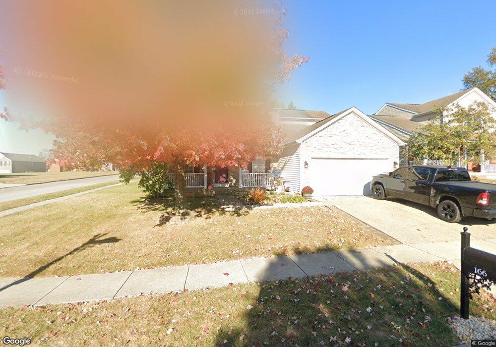
166 Dunn Cir Georgetown, KY 40324
Southeast Scott County NeighborhoodEstimated Value: $342,059 - $370,000
4
Beds
3
Baths
1,966
Sq Ft
$182/Sq Ft
Est. Value
About This Home
This home is located at 166 Dunn Cir, Georgetown, KY 40324 and is currently estimated at $357,015, approximately $181 per square foot. 166 Dunn Cir is a home located in Scott County with nearby schools including Eastern Elementary School, Scott County Middle School, and Scott County High School.
Ownership History
Date
Name
Owned For
Owner Type
Purchase Details
Closed on
Sep 15, 2005
Sold by
Dominion Homes Of Kentucky Ltd
Bought by
Bolte David L and Bolte Teresa G
Current Estimated Value
Home Financials for this Owner
Home Financials are based on the most recent Mortgage that was taken out on this home.
Original Mortgage
$83,625
Outstanding Balance
$39,077
Interest Rate
4.25%
Mortgage Type
New Conventional
Estimated Equity
$317,938
Create a Home Valuation Report for This Property
The Home Valuation Report is an in-depth analysis detailing your home's value as well as a comparison with similar homes in the area
Home Values in the Area
Average Home Value in this Area
Purchase History
| Date | Buyer | Sale Price | Title Company |
|---|---|---|---|
| Bolte David L | $179,575 | None Available |
Source: Public Records
Mortgage History
| Date | Status | Borrower | Loan Amount |
|---|---|---|---|
| Open | Bolte David L | $83,625 |
Source: Public Records
Tax History
| Year | Tax Paid | Tax Assessment Tax Assessment Total Assessment is a certain percentage of the fair market value that is determined by local assessors to be the total taxable value of land and additions on the property. | Land | Improvement |
|---|---|---|---|---|
| 2025 | $2,644 | $296,900 | $0 | $0 |
| 2024 | $2,545 | $283,000 | $0 | $0 |
| 2023 | $2,459 | $271,200 | $48,000 | $223,200 |
| 2022 | $1,954 | $229,800 | $40,000 | $189,800 |
| 2021 | $2,017 | $214,100 | $40,000 | $174,100 |
| 2020 | $1,772 | $206,200 | $40,000 | $166,200 |
| 2019 | $1,730 | $198,200 | $0 | $0 |
| 2018 | $1,669 | $192,300 | $0 | $0 |
| 2017 | $1,591 | $182,480 | $0 | $0 |
| 2016 | $1,438 | $178,547 | $0 | $0 |
| 2015 | $1,419 | $177,300 | $0 | $0 |
| 2014 | $1,454 | $175,400 | $0 | $0 |
| 2011 | $110 | $177,300 | $0 | $0 |
Source: Public Records
Map
Nearby Homes
- 191 Johnstone Trail
- 208 Johnstone Trail
- 206 Johnstone Trail
- 204 Johnstone Trail
- 3140 Paris Pike
- 136 Wilderness Cove Ln
- 117 River Run Ct
- 105 Oxford Landing Dr
- 101 Rocky Creek Rd
- 144 Limestone Ln
- 116 Whitman Way Unit 7
- 139 Limestone Ln
- 115 Oxford Landing Dr
- 117 Oxford Landing Dr
- 118 Oxford Landing Dr
- 176 Oxford Landing Dr
- 120 Oxford Landing Dr
- 201 Whitman Way
- 5365 Paris Rd
- The Sutton Bay Plan at Oxford Landing - Trend Collection
- 164 Dunn Cir
- 202 Falmouth Dr
- 162 Dunn Cir
- 124 Brookford Way Unit 1C
- 126 Brookford Way
- 204 Falmouth Dr
- 167 Dunn Cir
- 165 Dunn Cir
- 128 Brookford Way
- 160 Dunn Cir
- 206 Falmouth Dr
- 163 Dunn Cir
- 130 Brookford Way
- 208 Falmouth Dr
- 161 Dunn Cir
- 105 Falmouth Ridge Ct
- 158 Dunn Cir
- 103 Falmouth Ridge Ct
- 117 Brookford Way
- 132 Brookford Way