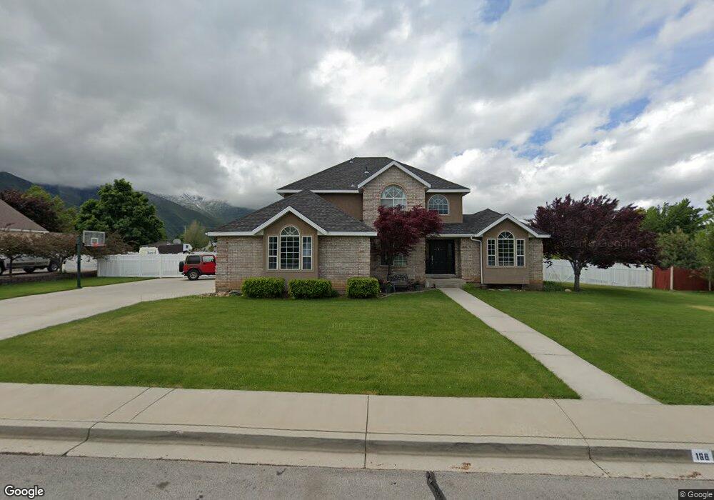
166 E 1700 N Mapleton, UT 84664
Estimated Value: $753,000 - $847,000
5
Beds
4
Baths
2,539
Sq Ft
$321/Sq Ft
Est. Value
About This Home
This home is located at 166 E 1700 N, Mapleton, UT 84664 and is currently estimated at $815,267, approximately $321 per square foot. 166 E 1700 N is a home located in Utah County with nearby schools including Hobble Creek School, Mapleton Junior High School, and Maple Mountain High School.
Ownership History
Date
Name
Owned For
Owner Type
Purchase Details
Closed on
Jul 30, 2018
Sold by
Swanson Ryan W and Swanson Terryl R
Bought by
Swanson Ryan and Swanson Terryl
Current Estimated Value
Purchase Details
Closed on
May 22, 2018
Sold by
Swanson Ryan and Swanson Terryl
Bought by
Swanson Ryan and Swanson Terryk
Purchase Details
Closed on
Aug 13, 2012
Sold by
Swanson Ryan and Swanson Terryl
Bought by
Swanson Ryan W and Swanson Terril R
Home Financials for this Owner
Home Financials are based on the most recent Mortgage that was taken out on this home.
Original Mortgage
$110,000
Outstanding Balance
$17,530
Interest Rate
3.56%
Mortgage Type
New Conventional
Estimated Equity
$797,737
Create a Home Valuation Report for This Property
The Home Valuation Report is an in-depth analysis detailing your home's value as well as a comparison with similar homes in the area
Home Values in the Area
Average Home Value in this Area
Purchase History
| Date | Buyer | Sale Price | Title Company |
|---|---|---|---|
| Swanson Ryan | -- | None Available | |
| Swanson Ryan | -- | None Available | |
| Swanson Ryan W | -- | Title West |
Source: Public Records
Mortgage History
| Date | Status | Borrower | Loan Amount |
|---|---|---|---|
| Open | Swanson Ryan W | $110,000 |
Source: Public Records
Tax History
| Year | Tax Paid | Tax Assessment Tax Assessment Total Assessment is a certain percentage of the fair market value that is determined by local assessors to be the total taxable value of land and additions on the property. | Land | Improvement |
|---|---|---|---|---|
| 2025 | $3,411 | $367,895 | -- | -- |
| 2024 | $3,411 | $334,180 | $0 | $0 |
| 2023 | $3,566 | $351,560 | $0 | $0 |
| 2022 | $3,942 | $384,230 | $0 | $0 |
| 2021 | $3,306 | $494,700 | $185,000 | $309,700 |
| 2020 | $3,270 | $473,400 | $163,700 | $309,700 |
| 2019 | $2,885 | $426,300 | $157,000 | $269,300 |
| 2018 | $2,770 | $389,700 | $132,300 | $257,400 |
| 2017 | $2,684 | $200,365 | $0 | $0 |
| 2016 | $2,599 | $192,885 | $0 | $0 |
| 2015 | -- | $186,065 | $0 | $0 |
| 2014 | $2,387 | $172,920 | $0 | $0 |
Source: Public Records
Map
Nearby Homes
- 145 W Carnesecca Ct
- 1350 N Main St
- 1567 N 600 E Unit 26
- 1096 Valley Sage Dr
- 1839 River Bottom Rd
- 1092 Valley Sage Dr
- 1697 N 500 W
- 435 E 1000 N
- 598 W 1600 N
- 1618 E 970 S
- 829 S 2200 E
- 594 E 1000 N
- 1518 E Pheasant Run Dr
- 1264 E 1150 S
- 265 E 600 N
- 1096 N 1000 E
- 1052 Cove Dr
- 59 E 775 S Unit 21
- 52 E 775 S Unit 19
- 775 N 800 E
- 208 E 1700 N
- 124 E 1700 N
- 201 E 1600 N
- 147 E 1600 N Unit 6
- 147 E 1600 N Unit 6,27
- 205 E 1600 N
- 157 E 1700 N
- 123 E 1600 N
- 250 E 1700 N
- 82 E 1700 N
- 203 E 1700 N
- 235 E 1600 N
- 95 E 1600 N
- 243 E 1600 N
- 249 E 1700 N
- 121 E 1700 N
- 75 E 1700 N
- 160 E 1600 N Unit 1
- 160 E 1600 N Unit 47-48
- 160 E 1600 N Unit 53-56
Your Personal Tour Guide
Ask me questions while you tour the home.