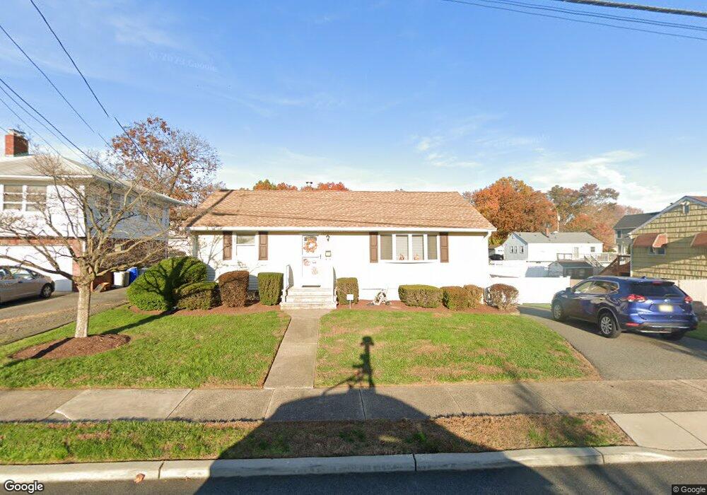
166 Gordon Ave Totowa, NJ 07512
Estimated Value: $680,000
--
Bed
--
Bath
988
Sq Ft
$688/Sq Ft
Est. Value
About This Home
This home is located at 166 Gordon Ave, Totowa, NJ 07512 and is currently estimated at $680,000, approximately $688 per square foot. 166 Gordon Ave is a home located in Passaic County with nearby schools including Washington Park Elementary School, Passaic Valley High School, and John P Holland Charter School.
Ownership History
Date
Name
Owned For
Owner Type
Purchase Details
Closed on
Nov 21, 2011
Sold by
Mulhearn Diane
Current Estimated Value
Home Financials for this Owner
Home Financials are based on the most recent Mortgage that was taken out on this home.
Original Mortgage
$90,000
Outstanding Balance
$8,748
Interest Rate
3.38%
Mortgage Type
Purchase Money Mortgage
Estimated Equity
$671,252
Purchase Details
Closed on
Oct 24, 1997
Sold by
Montagna Carlo and Montagna Mary
Bought by
Mulhearn Dennis and Mulhearn Diane
Home Financials for this Owner
Home Financials are based on the most recent Mortgage that was taken out on this home.
Original Mortgage
$167,280
Interest Rate
7.19%
Mortgage Type
VA
Create a Home Valuation Report for This Property
The Home Valuation Report is an in-depth analysis detailing your home's value as well as a comparison with similar homes in the area
Home Values in the Area
Average Home Value in this Area
Purchase History
| Date | Buyer | Sale Price | Title Company |
|---|---|---|---|
| -- | $312,500 | -- | |
| Mulhearn Dennis | $164,000 | -- |
Source: Public Records
Mortgage History
| Date | Status | Borrower | Loan Amount |
|---|---|---|---|
| Open | -- | $90,000 | |
| Previous Owner | Mulhearn Dennis | $167,280 |
Source: Public Records
Tax History Compared to Growth
Tax History
| Year | Tax Paid | Tax Assessment Tax Assessment Total Assessment is a certain percentage of the fair market value that is determined by local assessors to be the total taxable value of land and additions on the property. | Land | Improvement |
|---|---|---|---|---|
| 2025 | $7,737 | $285,400 | $155,400 | $130,000 |
| 2024 | $7,400 | $285,400 | $155,400 | $130,000 |
| 2022 | $6,958 | $285,400 | $155,400 | $130,000 |
| 2021 | $6,790 | $285,400 | $155,400 | $130,000 |
| 2020 | $6,912 | $285,400 | $155,400 | $130,000 |
| 2019 | $6,815 | $285,400 | $155,400 | $130,000 |
| 2018 | $6,801 | $285,400 | $155,400 | $130,000 |
| 2017 | $6,733 | $285,400 | $155,400 | $130,000 |
| 2016 | $6,704 | $285,400 | $155,400 | $130,000 |
| 2015 | $6,519 | $285,400 | $155,400 | $130,000 |
| 2014 | $6,056 | $285,400 | $155,400 | $130,000 |
Source: Public Records
Map
Nearby Homes
- 160 Gordon Ave
- 172 Gordon Ave
- 165 Gordon Ave
- 169 Gordon Ave
- 157 Gordon Ave
- 101 Hudson Ave
- 180 Gordon Ave
- 105 Hudson Ave
- 175 Gordon Ave
- 153 Gordon Ave
- 93 Hudson Ave
- 181 Gordon Ave
- 107 Hudson Ave
- 148 Gordon Ave
- 87 Hudson Ave
- 96 Hobart Place
- 100 Hobart Place
- 92 Hobart Place
- 135 Gordon Ave
- 100 Hudson Ave