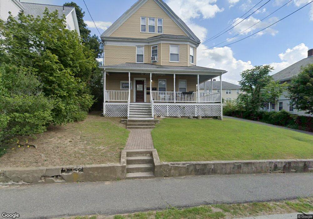
166 Kendrick Ave Quincy, MA 02169
South Quincy NeighborhoodEstimated Value: $941,539 - $1,099,000
7
Beds
3
Baths
3,342
Sq Ft
$303/Sq Ft
Est. Value
About This Home
This home is located at 166 Kendrick Ave, Quincy, MA 02169 and is currently estimated at $1,013,135, approximately $303 per square foot. 166 Kendrick Ave is a home located in Norfolk County with nearby schools including Lincoln-Hancock Community School, South West Middle School, and Quincy High School.
Ownership History
Date
Name
Owned For
Owner Type
Purchase Details
Closed on
Jan 5, 2004
Sold by
Channing Edward T
Bought by
Decouto Anthony W and Dcecouto Kelly A
Current Estimated Value
Home Financials for this Owner
Home Financials are based on the most recent Mortgage that was taken out on this home.
Original Mortgage
$360,000
Outstanding Balance
$167,891
Interest Rate
5.86%
Mortgage Type
Purchase Money Mortgage
Estimated Equity
$845,244
Purchase Details
Closed on
Sep 3, 1999
Sold by
Quincy Res Rlty Llc
Bought by
Channing Edward T
Purchase Details
Closed on
Nov 18, 1996
Sold by
Walsh Thomas A and Walsh Barbara K
Bought by
Quincy Residnal Rt Llc
Create a Home Valuation Report for This Property
The Home Valuation Report is an in-depth analysis detailing your home's value as well as a comparison with similar homes in the area
Home Values in the Area
Average Home Value in this Area
Purchase History
| Date | Buyer | Sale Price | Title Company |
|---|---|---|---|
| Decouto Anthony W | $450,000 | -- | |
| Channing Edward T | $315,000 | -- | |
| Quincy Residnal Rt Llc | $189,637 | -- |
Source: Public Records
Mortgage History
| Date | Status | Borrower | Loan Amount |
|---|---|---|---|
| Open | Quincy Residnal Rt Llc | $360,000 | |
| Closed | Quincy Residnal Rt Llc | $45,000 |
Source: Public Records
Tax History Compared to Growth
Tax History
| Year | Tax Paid | Tax Assessment Tax Assessment Total Assessment is a certain percentage of the fair market value that is determined by local assessors to be the total taxable value of land and additions on the property. | Land | Improvement |
|---|---|---|---|---|
| 2025 | $11,226 | $973,600 | $312,900 | $660,700 |
| 2024 | $10,668 | $946,600 | $298,100 | $648,500 |
| 2023 | $9,722 | $873,500 | $271,300 | $602,200 |
| 2022 | $9,431 | $787,200 | $226,500 | $560,700 |
| 2021 | $9,342 | $769,500 | $226,500 | $543,000 |
| 2020 | $9,370 | $753,800 | $226,500 | $527,300 |
| 2019 | $9,302 | $741,200 | $213,900 | $527,300 |
| 2018 | $7,935 | $594,800 | $198,300 | $396,500 |
| 2017 | $8,056 | $568,500 | $188,900 | $379,600 |
| 2016 | $7,107 | $494,900 | $164,700 | $330,200 |
| 2015 | $7,087 | $485,400 | $164,700 | $320,700 |
| 2014 | $6,540 | $440,100 | $164,700 | $275,400 |
Source: Public Records
Map
Nearby Homes
- 155 Kendrick Ave Unit T7
- 83 Madison Ave
- 166 Phipps St
- 72 Federal Ave
- 10 Hughes St
- 5 Pearl St
- 102 Conrad St
- 218 Independence Ave Unit B
- 195 Independence Ave Unit 137
- 106 Home Park Rd
- 8 Jackson St Unit B2
- 57 Summer St
- 9 Independence Ave Unit 212
- 25 John Paul Cir
- 11 Rogers Cir
- 161 Cedar St
- 94 Brook Rd Unit 3
- 54 Elmlawn Rd
- 33 Brook Rd
- 347 Centre St
- 166 Kendrick Ave Unit 2
- 166 Kendrick Ave Unit 1
- 162 Kendrick Ave
- 174 Kendrick Ave Unit 1
- 172 Kendrick Ave
- 174 Kendrick Ave
- 172 Kendrick Ave Unit 1
- 7 Alton Rd
- 172 - 174 Kendrick Ave
- 15 Alton Rd Unit 2
- 15 Alton Rd Unit 1
- 13 Alton Rd Unit 2
- 13 Alton Rd Unit 1
- 169 Kendrick Ave Unit 2
- 169 Kendrick Ave
- 163 Kendrick Ave
- 163 Kendrick Ave Unit 163
- 19 Alton Rd
- 134 Madison Ave
- 171 Kendrick Ave