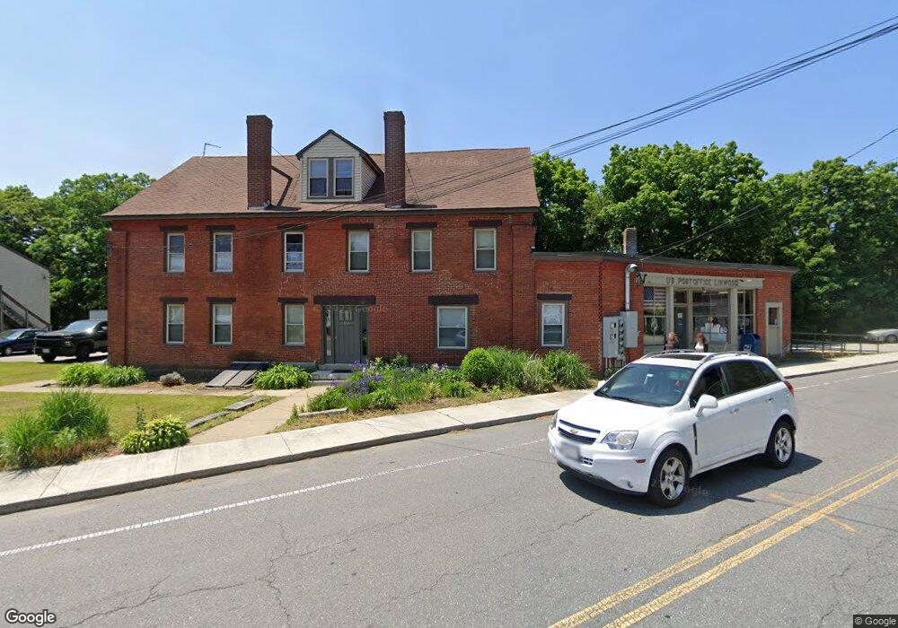
166 Linwood St Uxbridge, MA 01569
Estimated Value: $756,344
Studio
--
Bath
5,346
Sq Ft
$141/Sq Ft
Est. Value
About This Home
This home is located at 166 Linwood St, Uxbridge, MA 01569 and is currently estimated at $756,344, approximately $141 per square foot. 166 Linwood St is a home located in Worcester County with nearby schools including Uxbridge High School, Whitinsville Christian School, and Our Lady of the Valley Regional School.
Ownership History
Date
Name
Owned For
Owner Type
Purchase Details
Closed on
Jul 9, 2001
Sold by
Themeli Patricia R
Bought by
Schotanus Peter B and Schotanus Judith A
Current Estimated Value
Home Financials for this Owner
Home Financials are based on the most recent Mortgage that was taken out on this home.
Original Mortgage
$219,000
Outstanding Balance
$82,873
Interest Rate
7.05%
Mortgage Type
Commercial
Estimated Equity
$673,471
Purchase Details
Closed on
May 29, 2001
Sold by
Themeli Patricia R
Bought by
Shotanus Peter B and Shotanus Judith A
Home Financials for this Owner
Home Financials are based on the most recent Mortgage that was taken out on this home.
Original Mortgage
$219,000
Outstanding Balance
$82,873
Interest Rate
7.05%
Mortgage Type
Commercial
Estimated Equity
$673,471
Create a Home Valuation Report for This Property
The Home Valuation Report is an in-depth analysis detailing your home's value as well as a comparison with similar homes in the area
Home Values in the Area
Average Home Value in this Area
Purchase History
| Date | Buyer | Sale Price | Title Company |
|---|---|---|---|
| Schotanus Peter B | $273,000 | -- | |
| Shotanus Peter B | $273,000 | -- |
Source: Public Records
Mortgage History
| Date | Status | Borrower | Loan Amount |
|---|---|---|---|
| Open | Shotanus Peter B | $219,000 |
Source: Public Records
Tax History
| Year | Tax Paid | Tax Assessment Tax Assessment Total Assessment is a certain percentage of the fair market value that is determined by local assessors to be the total taxable value of land and additions on the property. | Land | Improvement |
|---|---|---|---|---|
| 2025 | $0 | $538,800 | $153,600 | $385,200 |
| 2024 | $6,999 | $521,400 | $145,700 | $375,700 |
| 2023 | $6,999 | $501,700 | $126,000 | $375,700 |
| 2022 | $6,563 | $432,900 | $110,300 | $322,600 |
| 2021 | $6,811 | $430,500 | $107,900 | $322,600 |
| 2020 | $7,121 | $425,400 | $106,300 | $319,100 |
| 2019 | $7,381 | $425,400 | $106,300 | $319,100 |
| 2018 | $7,304 | $425,400 | $106,300 | $319,100 |
| 2017 | $6,872 | $405,200 | $103,400 | $301,800 |
| 2016 | $7,068 | $402,300 | $154,000 | $248,300 |
| 2015 | $6,871 | $394,900 | $154,000 | $240,900 |
Source: Public Records
Map
Nearby Homes
- 164 Heritage Dr Unit 164
- 138 Elm St
- 125 Heritage Dr
- 12 Hartford Ave E
- 237 Heritage Dr Unit 237
- 240 Heritage Dr
- 0 Homestead Ave
- 3 Strathmore Shire Unit A
- 235 Rivulet St
- 288-290 Providence Rd
- 71 Rivulet St Unit B
- 26 Rivulet St
- 79 Country Club Dr
- 218 E Hartford Ave Unit 218
- 128 Linwood Ave
- 208-210 Church St
- 21 Granite St
- 831 Providence Rd Unit 837
- 39 Crestwood Cir Unit 42
- 37 Crestwood Cir Unit 43
- 167 Linwood St
- 165 Linwood St
- 165 Linwood St Unit 165
- 161 Linwood St
- 161 Linwood St Unit 1
- 154 Linwood St
- 159 Linwood St
- 157 Linwood St
- 175 Linwood St
- 175 Linwood St Unit A
- 175 Linwood St Unit B
- 432 N Main St
- 432 N Main St Unit 2
- 155 Linwood St Unit B
- 155 Linwood St Unit A
- 155 Linwood St Unit 1
- 155 Linwood St Unit 2
- 999 Linwood Ave
- 428 N Main St
- 148 Linwood St
Your Personal Tour Guide
Ask me questions while you tour the home.