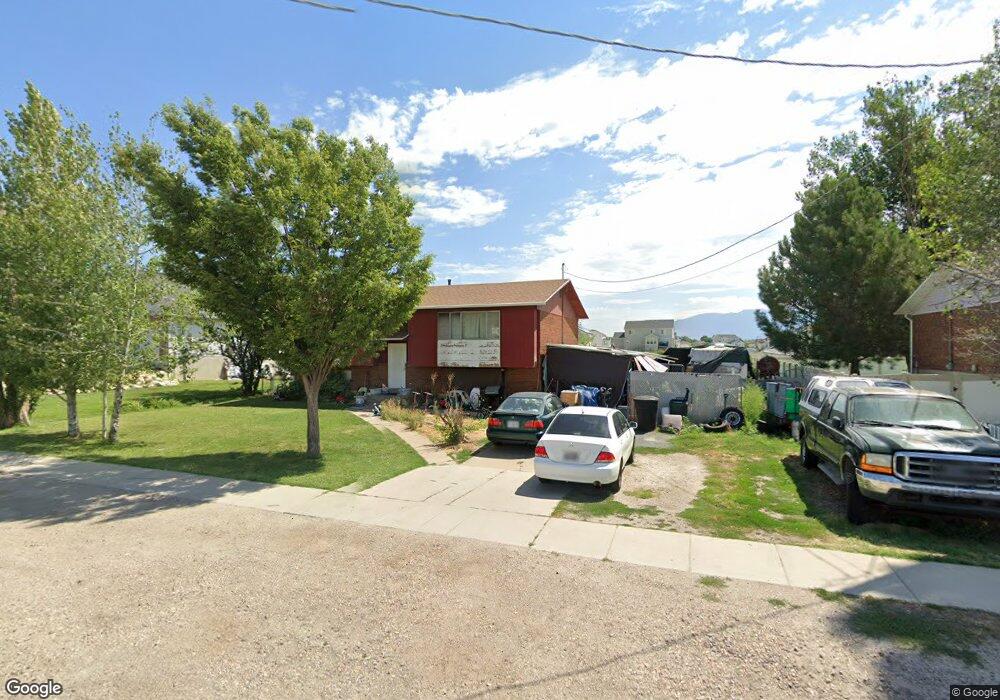
166 N 4500 W Clearfield, UT 84015
Estimated Value: $418,000 - $495,000
4
Beds
2
Baths
2,008
Sq Ft
$228/Sq Ft
Est. Value
About This Home
This home is located at 166 N 4500 W, Clearfield, UT 84015 and is currently estimated at $458,036, approximately $228 per square foot. 166 N 4500 W is a home located in Davis County with nearby schools including West Point School, West Point Junior High School, and Syracuse High School.
Ownership History
Date
Name
Owned For
Owner Type
Purchase Details
Closed on
Oct 1, 2003
Sold by
Pyles Charles T and Pyles Silvia R
Bought by
Anderson Carolyn
Current Estimated Value
Home Financials for this Owner
Home Financials are based on the most recent Mortgage that was taken out on this home.
Original Mortgage
$94,400
Outstanding Balance
$48,969
Interest Rate
7.99%
Mortgage Type
Purchase Money Mortgage
Estimated Equity
$409,067
Purchase Details
Closed on
Nov 26, 1996
Sold by
Pyles Charles T
Bought by
Pyles Charles T and Pyles Silvia R
Create a Home Valuation Report for This Property
The Home Valuation Report is an in-depth analysis detailing your home's value as well as a comparison with similar homes in the area
Home Values in the Area
Average Home Value in this Area
Purchase History
| Date | Buyer | Sale Price | Title Company |
|---|---|---|---|
| Anderson Carolyn | -- | Founders Title Co | |
| Pyles Charles T | -- | -- |
Source: Public Records
Mortgage History
| Date | Status | Borrower | Loan Amount |
|---|---|---|---|
| Open | Anderson Carolyn | $94,400 | |
| Closed | Anderson Carolyn | $23,600 |
Source: Public Records
Tax History Compared to Growth
Tax History
| Year | Tax Paid | Tax Assessment Tax Assessment Total Assessment is a certain percentage of the fair market value that is determined by local assessors to be the total taxable value of land and additions on the property. | Land | Improvement |
|---|---|---|---|---|
| 2025 | $2,199 | $202,400 | $112,687 | $89,713 |
| 2024 | $2,125 | $196,350 | $101,452 | $94,898 |
| 2023 | $1,960 | $333,000 | $126,380 | $206,620 |
| 2022 | $2,087 | $194,150 | $65,716 | $128,434 |
| 2021 | $1,890 | $263,000 | $102,765 | $160,235 |
| 2020 | $1,657 | $227,000 | $86,316 | $140,684 |
| 2019 | $1,623 | $219,000 | $83,748 | $135,252 |
| 2018 | $1,475 | $196,000 | $83,784 | $112,216 |
| 2016 | $1,316 | $91,740 | $32,416 | $59,324 |
| 2015 | $1,278 | $84,425 | $32,416 | $52,009 |
| 2014 | $1,263 | $84,444 | $32,416 | $52,028 |
| 2013 | -- | $70,890 | $27,569 | $43,321 |
Source: Public Records
Map
Nearby Homes
- 128 N 4500 W
- 4594 W 75 N Unit 405
- 4366 W 200 N
- 4325 W 75 N
- 4362 West St Unit 106
- 4358 West St Unit 105
- 120 N 4325 W
- 4669 W 75 N
- 4352 W 300 N
- 477 N 4500 W
- 357 N 4000 W
- 356 S 4300 W Unit 611
- 364 S 4300 W Unit 610
- 3949 W 250 N
- 4719 W 650 N
- 3851 W 50 S Unit 425
- 3849 W 50 S Unit 426
- 3847 W 50 S Unit 428
- Charleston Plan at Bluff View
- 114 3830 W
- 176 N 4500 W
- 148 N 4500 W
- 144 N 4500 W
- 190 N 4500 W
- 153 N 4450 W Unit 110
- 157 N 4500 W
- 147 N 4500 W
- 181 N 4500 W
- 127 N 4450 W
- 127 N 4450 W Unit 111
- 131 N 4500 W
- 4541 W 200 N Unit 215
- 105 N 4450 W Unit 112
- 97 N 4500 W
- 4563 W 200 N
- 4421 W 150 N Unit 117
- 4563 Jean Cir Unit 216
- 4563 Jean Cir
- 102 N 4450 W
- 102 N 4450 W Unit 116