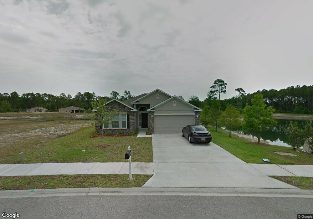
166 Osprey Marsh Ln Saint Augustine, FL 32086
Moultrie NeighborhoodEstimated Value: $348,393 - $419,000
3
Beds
2
Baths
1,800
Sq Ft
$213/Sq Ft
Est. Value
About This Home
This home is located at 166 Osprey Marsh Ln, Saint Augustine, FL 32086 and is currently estimated at $383,098, approximately $212 per square foot. 166 Osprey Marsh Ln is a home located in St. Johns County with nearby schools including Otis A. Mason Elementary School, Gamble Rogers Middle School, and Pedro Menendez High School.
Ownership History
Date
Name
Owned For
Owner Type
Purchase Details
Closed on
Jun 30, 2010
Sold by
Maronda Homes Inc Of Florida
Bought by
Wuenschel Betty L
Current Estimated Value
Home Financials for this Owner
Home Financials are based on the most recent Mortgage that was taken out on this home.
Original Mortgage
$156,000
Outstanding Balance
$103,768
Interest Rate
4.74%
Mortgage Type
New Conventional
Estimated Equity
$279,330
Create a Home Valuation Report for This Property
The Home Valuation Report is an in-depth analysis detailing your home's value as well as a comparison with similar homes in the area
Home Values in the Area
Average Home Value in this Area
Purchase History
| Date | Buyer | Sale Price | Title Company |
|---|---|---|---|
| Wuenschel Betty L | $195,000 | Steel City Title Inc |
Source: Public Records
Mortgage History
| Date | Status | Borrower | Loan Amount |
|---|---|---|---|
| Open | Wuenschel Betty L | $156,000 |
Source: Public Records
Tax History
| Year | Tax Paid | Tax Assessment Tax Assessment Total Assessment is a certain percentage of the fair market value that is determined by local assessors to be the total taxable value of land and additions on the property. | Land | Improvement |
|---|---|---|---|---|
| 2025 | $4,022 | $300,354 | $75,600 | $224,754 |
| 2024 | $4,022 | $318,882 | $75,600 | $243,282 |
| 2023 | $4,022 | $321,526 | $75,600 | $245,926 |
| 2022 | $3,527 | $262,510 | $75,600 | $186,910 |
| 2021 | $3,272 | $232,480 | $0 | $0 |
| 2020 | $3,016 | $209,236 | $0 | $0 |
| 2019 | $2,940 | $194,149 | $0 | $0 |
| 2018 | $2,718 | $176,698 | $0 | $0 |
| 2017 | $2,810 | $179,754 | $42,000 | $137,754 |
| 2016 | $2,727 | $168,569 | $0 | $0 |
| 2015 | $2,608 | $159,640 | $0 | $0 |
| 2014 | $2,402 | $141,543 | $0 | $0 |
Source: Public Records
Map
Nearby Homes
- 4849 Winton Cir
- 4909 Winton Cir
- 245 Wildwood Dr Unit 163
- 245 Wildwood Dr Unit 99
- 245 Wildwood Dr Unit 131
- 245 Wildwood Dr Unit 181
- 245 Wildwood Dr
- 93 Adalyn Ave
- 4233 Oak Ln
- 16 Meadow Crossing Dr
- 4420 Carter Rd Unit 36
- 4420 Carter Rd Unit 19
- 4420 Carter Rd
- 4900-B US 1 S
- 227 Deerfield Glen Dr
- 617 Knollwood Ln
- 163 Adalyn Ave
- 501 Hayley Rd
- 561 Boxwood Place
- 112 Laurel Wood Way Unit 202
- 170 Osprey Marsh Ln
- 174 Osprey Marsh Ln
- 167 Osprey Marsh Ln
- 171 Osprey Marsh Ln
- 186 Osprey Marsh Ln
- 175 Osprey Marsh Ln
- 158 Osprey Marsh Ln
- 179 Osprey Marsh Ln
- 190 Osprey Marsh Ln
- 183 Osprey Marsh Ln
- 146 Osprey Marsh Ln
- 159 Osprey Marsh Ln
- 194 Osprey Marsh Ln
- 155 Osprey Marsh Ln
- 187 Osprey Marsh Ln
- 191 Osprey Marsh Ln
- 142 Osprey Marsh Ln
- 0 Datil Pepper Rd
- 198 Osprey Marsh Ln
- 151 Osprey Marsh Ln
Your Personal Tour Guide
Ask me questions while you tour the home.