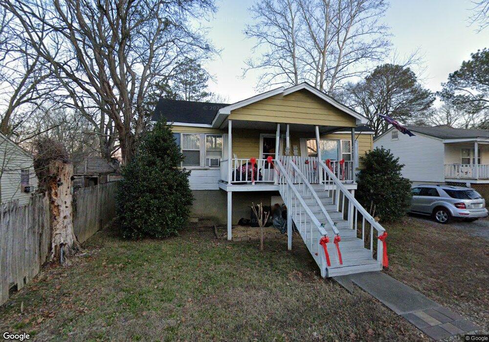
166 T E McKinney Cir Owens Cross Roads, AL 35763
Estimated Value: $159,135 - $244,000
2
Beds
2
Baths
1,000
Sq Ft
$184/Sq Ft
Est. Value
About This Home
This home is located at 166 T E McKinney Cir, Owens Cross Roads, AL 35763 and is currently estimated at $183,784, approximately $183 per square foot. 166 T E McKinney Cir is a home located in Madison County with nearby schools including Owens Cross Roads Elementary School and New Hope High School.
Ownership History
Date
Name
Owned For
Owner Type
Purchase Details
Closed on
Mar 29, 2019
Sold by
Swann Robert K
Bought by
Swann Leslie Thompson
Current Estimated Value
Home Financials for this Owner
Home Financials are based on the most recent Mortgage that was taken out on this home.
Original Mortgage
$45,750
Outstanding Balance
$40,222
Interest Rate
4.3%
Mortgage Type
Purchase Money Mortgage
Estimated Equity
$143,562
Purchase Details
Closed on
Nov 10, 2006
Sold by
Pennington Ann Ledbetter
Bought by
Swann Robert K
Home Financials for this Owner
Home Financials are based on the most recent Mortgage that was taken out on this home.
Original Mortgage
$38,000
Interest Rate
6.27%
Mortgage Type
Future Advance Clause Open End Mortgage
Create a Home Valuation Report for This Property
The Home Valuation Report is an in-depth analysis detailing your home's value as well as a comparison with similar homes in the area
Home Values in the Area
Average Home Value in this Area
Purchase History
| Date | Buyer | Sale Price | Title Company |
|---|---|---|---|
| Swann Leslie Thompson | $41,500 | None Available | |
| Swann Robert K | -- | -- |
Source: Public Records
Mortgage History
| Date | Status | Borrower | Loan Amount |
|---|---|---|---|
| Open | Swann Leslie Thompson | $45,750 | |
| Previous Owner | Swann Robert K | $38,000 |
Source: Public Records
Tax History Compared to Growth
Tax History
| Year | Tax Paid | Tax Assessment Tax Assessment Total Assessment is a certain percentage of the fair market value that is determined by local assessors to be the total taxable value of land and additions on the property. | Land | Improvement |
|---|---|---|---|---|
| 2024 | $191 | $5,900 | $880 | $5,020 |
| 2023 | $191 | $5,760 | $880 | $4,880 |
| 2022 | $151 | $4,920 | $460 | $4,460 |
| 2021 | $136 | $4,540 | $460 | $4,080 |
| 2020 | $127 | $4,320 | $460 | $3,860 |
| 2019 | $338 | $4,170 | $460 | $3,710 |
| 2018 | $336 | $8,300 | $0 | $0 |
| 2017 | $336 | $8,300 | $0 | $0 |
| 2016 | $336 | $8,300 | $0 | $0 |
| 2015 | $336 | $8,300 | $0 | $0 |
| 2014 | $326 | $8,060 | $0 | $0 |
Source: Public Records
Map
Nearby Homes
- 16 Old 431 Hwy
- 5 U S 431
- 24 Acres U S 431
- 102 Vulcan St
- 104 Vulcan St
- 106 Vulcan St
- 108 Vulcan St
- 110 Vulcan St
- 114 Vulcan St
- 116 Vulcan St
- 124 Vulcan St
- 126 Vulcan St
- 128 Vulcan St
- The Butler Plan at Ramsay Cove
- The Franklin Plan at Ramsay Cove
- The Shelby A Plan at Ramsay Cove
- The Chelsea A Plan at Ramsay Cove
- The Daphne Plan at Ramsay Cove
- The Everett Plan at Ramsay Cove
- DUPONT Plan at Ramsay Cove
- 172 T E McKinney Cir
- 120 Brockway Ave
- 120 Brockway Ave
- 120 Brockway Ave
- 164 T E McKinney Cir
- 118 Brockway Ave
- 158 T E McKinney Cir
- 167 T E McKinney Cir
- 0000 County Road 1410
- 001 County Road 1605
- 173 T E McKinney Cir
- 161 T E McKinney Cir
- 154 T E McKinney Cir
- 109 Wall St
- 153 T E McKinney Cir
- 188 T E McKinney Cir
- 103 Wall St
- 2980 Old Highway 431
- 146 T E McKinney Cir
- 2982 Old Highway 431